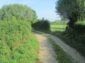
The heart of Mormal

Covering just over 9,000 hectares, the ‘green giant’ of the Nord Mormal is as intriguing as it is majestic thanks to its flora and fauna, but do you know its heart?
Whilst the famous saying goes that all roads lead to Rome, here, all roads lead to Locquignol. A charming little village steeped in history, which was originally a simple hunting meeting point for the counties of Hainaut.
On this route, which is suitable for everyone, I invite you to take a short pilgrimage through the Mormal Forest to discover its heart.
There are no signposts as this walk was created by a local (myself). It is not aGR® route. You will therefore need to follow the map shown on your phone in real time.

Details

53339500
Creation:
Last update:
Last review:
  • Walking
    Activity: Walking
  • ↔
    Distance: 6.58 mi
  • ◔
    Average duration: 3h 05 
  • ▲
    Difficulty: Moderate

  • ⚐
    Back to start: Yes
  • ↗
    Ascent: + 66 ft
  • ↘
    Descent: - 69 ft

  • ▲
    Highest point: 554 ft
  • ▼
    Lowest point: 466 ft

Photos

Description of the walk

Park in the Étang David car park. It doesn’t matter which side of the road you’re coming from, as it’s a cul-de-sac; the arboretum has two car parks, one on each side of the cul-de-sac.

(S/E) Facing the arboretum with the pond behind you, head left at the start of the route. Take the
first forest path on the right, just after the end of the arboretum’s fence. You’ll soon reach an X-shaped junction.

(1) Turn right and continue in a straight line until you reach a crossroads with four almost perpendicular paths.

(2) Take the path on the left – this is the GE122, marked in white and red – which is also completely straight. You’ll reach the D233.

(3) Cross it with great care, turn left, and reach the Carrefour de la Touraille. Take the Route d’Hecq on the right, leaving theGR® briefly before rejoining it at the next junction. Turn left back onto theGR® to reach the edge of the forest.

(4) Leave theGR® again to turn right and walk alongside the edge of the forest on one side and pastures on the other. After a left-hand bend, you’ll reach the entrance to the village of Locquignol.

(5) Turn left to cross the village. Pass the town hall and the church, then arrive at the car park next to the cemetery.

(6) Turn left, walk past the sports ground and continue into the Haisnes pasture. Walk alongside the pond until you reach the junction at Laie de la Pâture d’Haisne on the edge of the forest.

(7) Turn left, then immediately right, to take this track. Continue straight on until you reach the junction with the Route de Raucourt.

(8) Turn left here, then further on cross the Route d’Hecq and the Laie des Brûlés. A few steps further on, you’ll come to the crossroads with a small wooden sign pointing to the arboretum.

(9) Take this path to the right and, following another straight stretch, return to the initial junction you passed on the way out.

(11) Continue straight ahead in the opposite direction to the way there to return to the Étang David car park (S/E).

Waypoints

  1. S/E : mi 0 - alt. 505 ft - David Pond / Arboretum.
  2. 1 : mi 0.26 - alt. 492 ft - Junction of the circular loop
  3. 2 : mi 0.79 - alt. 472 ft - GR122
  4. 3 : mi 2.03 - alt. 535 ft - La Touraille crossroads.
  5. 4 : mi 2.54 - alt. 515 ft - Edge of the woodland pasture
  6. 5 : mi 3.18 - alt. 512 ft - Entrance to Locquignol
  7. 6 : mi 3.61 - alt. 515 ft - Cemetery car park
  8. 7 : mi 3.92 - alt. 525 ft - Laie Pâture d’Haisne
  9. 8 : mi 4.64 - alt. 528 ft - Raucourt Path
  10. 9 : mi 5.45 - alt. 505 ft - Arboretum sign
  11. S/E : mi 6.58 - alt. 509 ft - David Pond / Arboretum.

Notes

Several sections of the route are frequently used by wild boars; it’s not uncommon to come across them, so be as careful of them as you are of yourselves. Some parts of the route may be muddy where they have passed, depending on the season.
There are sections with tall grass – watch out for ticks.
You can take breaks and sit down several times along the way if needed; fallen tree trunks are a common sight.
Between (6) and (7), there are plenty of benches for a picnic, as the park has rubbish bins.
Throughout the walk: make the most of the educational displays for the younger ones.
This is a family route: learn about squirrel behaviour, revisit the legend of Gargantua and share it with the little ones!

Worth a visit

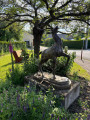
(S/E) Mormal Arboretum and Forest: do pop round the Arboretum to see how Gargantua is getting on.
(3) La Touraille de Mormal guesthouse
Between (5) and (7) the ponds.
(6) A plant maze for those with a keen sense of direction – let yourself be drawn into the plant maze and good luck finding your way out.

Always be cautious and plan ahead when you're outdoors. Visorando and the author of this route cannot be held responsible for any accidents occurring on this route.

The GR® and PR® markings are the intellectual property of the Fédération Française de Randonnée Pédestre.

Reviews and comments

3.7 / 5
Based on 6 reviews

Reliability of the description
3.7 / 5
Ease of following the route
3.3 / 5
Route interest
4 / 5
Clovis5793
Clovis5793

Overall rating : 4.7 / 5

Date of your route : Jun 20, 2026
Reliability of the description : ★★★★★ Very good
Ease of following the route : ★★★★★ Very good
Route interest : ★★★★☆ Good
Very busy route : No

A pleasant walk, especially in hot weather. The route must indeed be muddy, as some sections were still muddy despite the scorching heat.

At the car park, the starting point is a bit tricky to find, but after that it’s fine.

However, there are mosquitoes and, above all, ticks: we brought two back with us, which we only spotted once we got home.

There are picnic tables on the way out of Locquignol.

Machine-translated

User 2215452

Overall rating : 3 / 5

Date of your route : May 20, 2026
Reliability of the description : ★★★☆☆ Average
Ease of following the route : ★★★☆☆ Average
Route interest : ★★★☆☆ Average
Very busy route : No

I went on this hike in May 2026.
Half the route was nothing but mud, or even large puddles that you could cross by balancing on pieces of wood, wading through tall vegetation, or simply wading through with water up to your ankles. Given this, I didn’t find this route suitable for families at all.
The GR markings are not visible.
I also got lost a few times, particularly between points 1 and 2.

Machine-translated

User 4029040

Overall rating : 3.7 / 5

Date of your route : Nov 10, 2025
Reliability of the description : ★★★☆☆ Average
Ease of following the route : ★★★☆☆ Average
Route interest : ★★★★★ Very good
Very busy route : No

A very beautiful route that is completely lacking in signposting.
The PDF map is not sufficient as numerous tree felling operations have altered the paths.
A GPS device is recommended
This walk is well worth it because the forest is superb and you will be alone in the world

Machine-translated

naya59!
naya59!

Thank you for the clarification. I will try again as soon as possible.

Machine-translated

Pyou
Pyou

Hi Naya,
Opposite the arboretum (i.e. the small pond behind you) turn left and take the 1st forest path on the right. I'm confused because I don't understand how you could have taken 30 minutes without finding it when there's only one footpath. In fact, there's a continuation of it just opposite to go in the other direction. It's impossible to go on the wrong way as the second turning on the right is a road. The path starts a few metres along the fence that surrounds the arboretum, as indicated in the description. I did this walk myself a month ago and the path is visible and well maintained!
A great day out!

Machine-translated

naya59!
naya59!

Overall rating : 2.7 / 5

Date of your route : Jun 02, 2025
Reliability of the description : ★★★☆☆ Average
Ease of following the route : ★☆☆☆☆ Very disappointing
Route interest : ★★★★☆ Good
Very busy route : No

We couldn’t find the starting point of the walk, so we gave up after searching for 30 minutes, as per the description

Machine-translated

Les fous de la rando

Overall rating : 4.7 / 5

Date of your route : Nov 25, 2024
Reliability of the description : ★★★★☆ Good
Ease of following the route : ★★★★★ Very good
Route interest : ★★★★★ Very good
Very busy route : No

A very scenic walk, but muddy, and actually 13 km long. Watch out for the abundance of wildlife

Machine-translated

Lili86
Lili86

Overall rating : 3.3 / 5

Date of your route : Oct 15, 2024
Reliability of the description : ★★★★☆ Good
Ease of following the route : ★★★☆☆ Average
Route interest : ★★★☆☆ Average
Very busy route : No

A walk with a car park where you can leave your car.
Quite varied scenery from point 3 onwards
I completed the route around midday in autumn following frequent rain; there were mountain bikers in the morning and horse riders, which I found made it quite technical at times due to the muddy ground.
It’s best to wear proper, suitable footwear all the same.
In some places, nature had already reclaimed the area, so the paths are a bit harder to follow.
You’ll find wooden benches and tables along the way, which can make the walk even more enjoyable
It’s not my favourite, but it’s still enjoyable overall.

Machine-translated

Pyou
Pyou

Hello,
I’m sorry to hear that you didn’t enjoy my walk, Fanny. There are no signposts because this walk was created by a local (myself). It isn’t a GR route. You’ll therefore need to follow the map shown on your phone in real time. However, the directions have been approved by a site moderator and are entirely reliable, especially as there aren’t 36 different paths at the start of the walk – there’s just one path that crosses the road. I’m rather puzzled by your scepticism. As for the points of interest, I did make it clear that this is a family-friendly route. I realise that, as an adult, understanding squirrel behaviour and revisiting the myth of Gargantua might not interest you, but sharing this with younger children is actually great fun!
Have a lovely day!

Machine-translated

MissFanny
MissFanny
• Edited:

The start of the trail is poorly signposted and there are no markings along the route.

Machine-translated

naya59!
naya59!

I’ll be doing this hike sometime in July – I can’t wait to find out what it’s like

Machine-translated

Other walks in the area

For more walks, use our search engine .

The GPS track and description are the property of this route's author. Please do not copy them without permission.