The Dame Marguerite route in Maroilles

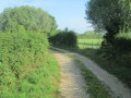
This route through the Maroilles countryside is accessible all year round. A succession of small country roads and dirt tracks
lead you past the remarkable farms of the Helpe Mineure valley.

Details

1559594
Creation:
Last update:
Last review:
  • Walking
    Activity: Walking
  • ↔
    Distance: 7.77 mi
  • ◔
    Average duration: 3h 40 
  • ▲
    Difficulty: Moderate

  • ⚐
    Back to start: Yes
  • ↗
    Ascent: + 151 ft
  • ↘
    Descent: - 151 ft

  • ▲
    Highest point: 610 ft
  • ▼
    Lowest point: 433 ft

Photos

Description of the walk

Car park: Maison du Parc, Maroilles.

(S/E) Leave the abbey courtyard and head towards the town hall. Cross at the pedestrian crossing, then turn left onto Rue du Lieutenant towards the Moulin des Prés.

(1) Just before the Croix-Robosse bridge and the mill, turn right into Rue Dame Marguerite. This narrow street, which you’ll follow for about 3 km, was an ancient road that was redeveloped and maintained in the 15th and 16th centuries under Margaret of Austria, Governor of the Netherlands. It forms part of the old strategic road linking Avesnes-sur-Helpe to Le-Cateau-Cambrésis. To your left flows the channelled River Sambre, with the Mormal National Forest in the background.

(2) First turn right then left onto the RD32 (take care) and continue along the road, which turns into a track.

(3) At the junction, carry on straight ahead. After the Bois Brun farm and a bend to the right, leave the straight road to the left heading towards Renaud Folie – the abbey’s former farm and birthplace of the painter Marcel Gromaire – and carry on straight ahead.

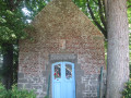
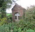
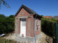
(4) At Les Basses Noyelles, turn right onto the RD959 for 200 metres (take care), then turn right into Rue des Haies. Note the blue stone chapels characteristic of the Avesnois region.

(5) After the campsite, turn left onto Ruelle du Breton. From this high vantage point, look back to enjoy a panoramic view of the Mormal Forest. First turn right then left onto the RD959 (drive carefully) and join the RD962 via the track.

(6) Walk along the left-hand side of the RD962 for 200 metres (take care), then head down the lane to the right.

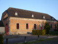
(7) Turn right and, at the next junction, continue left onto Rue du Faux. You’ll pass a few traditional L-shaped farmhouses with gables facing the street. On some of the older houses, note the beautiful carved stones above the front door, usually inscribed with the three letters IHS (Iesus Hominum Salvator: Jesus, Saviour of Mankind).

(8) Turn right onto Rue du Marais. Immediately on your left is the building of a former tannery which operated until the last war. From the street, there is a view over the Helpe Mineure valley.
At the crossroads (on your right is the Place Verte – with its triumphal arch and bandstand), turn left onto Chemin de la Petite Marlière to head down towards the Helpe, cross the pasture (don’t forget to close the small gates for the animals) then head back up to the left towards the church.

(9) Head down to the left and make your way to the Maison du Parc (S/E).

Waypoints

  1. S/E : mi 0 - alt. 459 ft - Abbey Courtyard
  2. 1 : mi 1.13 - alt. 433 ft - Pont de la Croix Robosse
  3. 2 : mi 1.87 - alt. 459 ft - D32 road
  4. 3 : mi 2.61 - alt. 443 ft - Junction
  5. 4 : mi 3.89 - alt. 459 ft - Les Basses Noyelles
  6. 5 : mi 5.09 - alt. 535 ft - Ruelle du Breton
  7. 6 : mi 5.8 - alt. 607 ft - D962 road
  8. 7 : mi 6.09 - alt. 587 ft - Crossroads – Rue du Faux
  9. 8 : mi 6.87 - alt. 512 ft - Junction – Rue du Marais
  10. 9 : mi 7.62 - alt. 486 ft - Église Saint-Humbert (Maroilles)
  11. S/E : mi 7.77 - alt. 459 ft - Abbey courtyard

Notes

This route is listed in the PDIPR (Departmental Plan for Walking and Hiking Routes).

Follow the yellow markings.

Short alternative route (8.5 km): follow the start of the main route description
When you reach point (3), turn right. After the farm buildings, turn left onto the path. At the next junction, you will have reached point (5). Take the Ruelle du Breton straight ahead.
From this high vantage point, look back to enjoy a panoramic view of the Mormal State Forest.
Continue your walk by following the instructions for the main route until you reach (S/E).

Worth a visit

(6) In the pasture on the left, next to the RD 962, stands the Vieux Chêne, undoubtedly the oldest oak in the Avesnois region. Due to its great age – estimated at 700 years – it was pruned back in July 1995. It stands 15 metres tall with a circumference of 5.32 metres – private property, no trespassing.

Reviews and comments

5 / 5
Based on 2 reviews

Reliability of the description
5 / 5
Ease of following the route
5 / 5
Route interest
5 / 5
Audion Marrey
Audion Marrey

Thank you for your help with this minor issue. I'm planning to do this lovely walk again soon.
Beatrice

Machine-translated

PNR de l'Avesnois
PNR de l'Avesnois

Hello
The park reported the problem to the mayor of the municipality last year, who is responsible for dealing with it.
I am forwarding the comments left by users on Visorando to him once again.
Kind regards

Machine-translated

Mitch59
Mitch59

I had the same problem at the end of a hike last year.
I reported it to the park
Apparently nothing has changed!

Machine-translated

Audion Marrey
Audion Marrey

Overall rating : 5 / 5

Date of your route : Jun 16, 2025
Reliability of the description : ★★★★★ Very good
Ease of following the route : ★★★★★ Very good
Route interest : ★★★★★ Very good
Very busy route : No

A superb, uncomplicated and well-marked route through the countryside. The only slight hiccup at the end of the route is the section around the small pond. The gates are closed with strong wire but there are no signs indicating that the area is private or off limits. Can you open the gates without doing anything wrong? Or should you turn back a little and go into the town directly?

Machine-translated

Mitch59
Mitch59

Overall rating : 5 / 5

Date of your route : Oct 04, 2022
Reliability of the description : ★★★★★ Very good
Ease of following the route : ★★★★★ Very good
Route interest : ★★★★★ Very good
Very busy route : No

A very pleasant walk, starting in the village of Maroilles and then through the bocage
A route along very quiet country roads and footpaths.
Right at the very end of the route, the path was blocked (barbed wire), which meant we had to head back via the village

Machine-translated

Other walks in the area

For more walks, use our search engine .

The GPS track and description are the property of this route's author. Please do not copy them without permission.