


 Country:

 City:


Starting point and access: Mantes-la-Jolie railway station.
- Transilien – Line J, on the section between Paris-Saint-Lazare and Vernon.
- Transilien – Line N, terminus of a section coming from Paris-Montparnasse via Plaisir-Grignon.
Take the footbridge and exit at Place du 8 Mai 1945.
No signposting
(S) With your back to the station, head diagonally to the right onto Avenue du Président Roosevelt. Continue straight on until you reach a roundabout. Then take thesecond left, into Rue Castor. Next, take thefirst right, into Passage Castor. At the end, first turn right then left to follow Rue du Vieux Pilori. Carry on straight ahead and, after passing under an archway, turn left into Rue Chanzy.
(1) At the end, veer right to cross the Place du Marché au Blé and pass by the foot of the Tour Saint-Maclou. Then cross a square diagonally to the right. Join a street (Rue Nationale or Rue Auguste Goust, depending on the exact location) and follow it to the left. Continue straight on and cross a junction (note the Notre-Dame collegiate church on the right).
Red and white markings
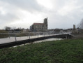
(2) Take the bridge over a branch of the Seine, walking on the left-hand pavement. Continue straight on and cross the second branch of the Seine (note the old bridge on the right).
(3) As you come off the bridge, turn left and walk down a gravel path. Continue along a tarmac quay, keeping the Seine on your left. Take a footbridge near a boat garage, pass a bend in the road and continue along a shaded path. Walk between the Seine on your left and garden fences or meadows on your right.
Yellow signposting (rare)
(4) At a sign for “Circular Trail of the Wolves”, carry on straight ahead along the banks of the Seine (ignore theGR®2which branches off to the right). Further on, the path becomes gravel. Continue along a tarmac road.
(5) At the fork in the road just past a car repair garage, take the left-hand turn onto Rue Jules Guesdes. Pass an old municipal washhouse. Join the main road, carry on straight ahead and pass a football stadium on your left.
No signposting
(6) At the roundabout, turn right towards the chapel and the cemetery. At the Stop sign, carry on straight ahead along the street. After the school, take a shortcut by following a concrete path that runs between a market hall (on the left) and a chapel (on the right). Walk alongside the cemetery and carry on straight ahead along the street. At the Stop sign, carry on straight ahead again.
(7) At the roundabout, take thesecond right, towards Follainville (be very careful, as there is no pedestrian crossing). Follow the road for about 150 m.
(8) Shortly after a road sign on the left-hand side, turn left onto a grassy track between the fields. At the junction, go straight on. The track turns right and then, after about a hundred metres, left, slightly uphill.
Red and white markings
(9) You’ll come out onto a gravel track; follow it to the left and downhill to rejoin theGR®2. At the junction, turn right. Follow a good path that climbs gently and reach a riding centre. At the end of the path, follow a road to the left, immediately ignore another road to the right and continue uphill.
Red and White + Yellow Markings
(10) As you come out of the bend, level with an electricity pole, take a path on the right. Ignore a path branching off to the right and climb gently, keeping to the left-hand side of a hedge. At the next junction, veer left and stay alongside the hedge.
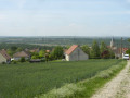
(11) Ignore a path branching off to the right, pass a reservoir and head downhill along a stony track (beautiful view over the Seine valley). Return to the tarmac road, ignore a small lane on the right and continue downhill along a street.
Red and white markings
(12) At the T-junction (wash house, former priory), turn right and head slightly uphill.
No markings
(13) Opposite No. 250, take a gravel path on the left which runs between houses Nos. 279 (on the left) and 281 (on the right). Note the white patches opposite, which are the chalky slopes on the right bank of the Seine. After passing the gate of a detached house on the right, continue through the woodland along a dirt track, descending slightly.
(14) You’ll come out onto a small road; follow it to the right. You’ll cross the Chemin du Colin Hou on your right; carry on straight ahead, enter Vétheuil and head downhill.
Red and white markings
Rejoin theGR®2and continue down the street. At the bottom, follow a wider road to the right.
(15) When you reach the Ruelle des Moulins on your right, take a sharp left and head down a winding path. At the bottom, turn right. At the next junction, turn left and follow the Ruelle du Talus between two walls. At the end, turn right and walk alongside the Seine on your left, cross a lawn and ignore the paths branching off to the right.
No signposts
After about 350 m, veer left towards the clearly visible Vétheuil jetty.
(16) Take the ferry across the Seine (see the ‘Practical Information’ section for timetables).
(17) On the opposite bank, climb a few steps then cross the lawn opposite. Just before a road, turn right onto a gravel path. Follow the garden fences and houses on your left and the River Seine on your right. You will then alternate between sections through woodland and along the edge of a meadow on your left; ignore all turn-offs to the left. When you reach the first houses, the path gives way to a tarmac road. Cross the Chemin des Ajous on your left and continue straight on for a further hundred metres or so.
(18) Then turn left onto Rue de l’Abreuvoir. Cross Rue des Mares on your left, then Rue de l’Eau on your right. At the junction immediately ahead, carry on straight ahead along Rue de la Ballonnière.
Yellow markings
(19) Take thefirst right onto Allée du Jamboree. You will then come to four forks in the road in succession over a distance of about 150 m: at thefirst, near No. 7, veer left; at thesecond, follow the path on the right, the Chemin des Rêles; at thethird, take the path on the left, the narrower one; at thefourth, turn left onto the clearest path. Continue straight on for about 1.5 km through the forest, heading west-south-west then west. You’ll come to a T-junction (information sign).
Unmarked
Two parallel paths, which join further on, are then available. It is recommended that you follow the unmarked path, which is better maintained and, above all, closer to the heathland landscape characteristic of the nature reserve.
(20) Turn left and go through a forest gate. You’ll cross a path on the left; ignore a Yellow Cross and carry on straight ahead, due south, along the edge of the heath. Further on, the path turns right. As you approach a slope, you’ll come to two steep inclines: take the one on the left.
(21) At the top, turn left and follow a path with the heathland below on your left. The path moves away from the heathland and veers to the right, then joins the signposted path.
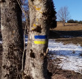
Yellow markings
Follow the path to the left and immediately turn right with it (low railings on the left-hand side). After about 300 m, at a Fork in the road, take the path on the right, lined with tall fir trees.
(22) At the end (forest gate, information board), follow a compacted track to the left and walk alongside a fence on your right. When you reach the houses on the right, continue straight on along the track, which has widened. At the next junction (signpost, information board on the left), carry on straight ahead (two PR® trails cross here; ignore the yellow arrow indicating a left turn).
Unmarked
(23) You’ll come out onto the D124; follow it to the right (let thePR® trail continue straight ahead).
Yellow markings
At the next junction, you’ll see the markings again; carry on straight ahead on the D124. At the next junction, turn right. At the crossroads immediately after, carry on straight ahead (west-north-west) and immediately ignore a turn-off to the left. Then take thefirst track on the right. Carry on straight ahead (north-west) for about 700 m.
(24) Then turn left. Ignore a track coming from the left and continue until you reach a road. Follow this road to the right. Walk past a football ground on your left, then the cemetery on your right. At the corner of the cemetery, cross the D37 and first turn right then left to follow a stony track.
(25) At the end, turn left and rejoin the banks of the Seine. Ignore a path on the left and return to the tarmac. When you reach the first house, leave the road to go round a picnic area on the right. Then pass a concrete chicane, leave a tennis court on your left and follow the fitness trail alongside a lawn on your left.
Unmarked
(26) At the junction, carry straight on along the path by the banks of the Seine, keeping a field on your left. Pass a sign saying ‘Arrivée’ and walk briefly through a copse. You’ll come out onto a track; follow it to the left.
Yellow markings
Ignore a path on the left, then a small bridge over a ditch on the right, and you’ll come back to the markings.
Yellow markings with a cross through
(27) At the next junction, turn right. You’ll briefly be back on tarmac; cross the ditch and continue along a track. At the end, first turn left then right to follow a road towards the station. At the Stop sign, carry straight on and you’ll soon find the entrance to the underpass leading to Bonnières station (E).
To get back home:
- Transilien – Line J, towards Mantes-la-Jolie and Paris-Saint-Lazare (1st entrance) or Vernon (2nd entrance).




 Visorando Member
 Moderate
 Easy

