Hauts de Limay Forest

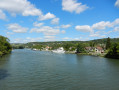
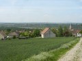
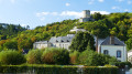
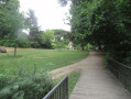
An easy, shaded walk through the forest, ending with a beautiful panoramic view of the Mantois region. Children can follow along on their bikes.

Details

n°21983037
Creation:
Last update:
Last review:
  • Walking
    Activity: Walking
  • ↔
    Distance: 4.39 mi
  • ◔
    Average duration: 2h 05 
  • ▲
    Difficulty: Easy

  • ⚐
    Back to start: Yes
  • ↗
    Ascent: + 62 ft
  • ↘
    Descent: - 69 ft

  • ▲
    Highest point: 466 ft
  • ▼
    Lowest point: 364 ft
  • ⚐ Country: France
  • ⚐
    Area: Vexin
  • ⚐ City: Limay (78520)
  • ⚑
    Start/End: N 49.007173° / E 1.729539°
  • ❏
    IGN map(s): Ref. 2113ET
  • Hour-by-hour weather

Description of the walk

Car park just past the Hauts de Limay housing estate, on Rue Édouard Fosse. The entrance is opposite the care home. To find the car park:
- Coming from the centre of Mantes-la-Jolie, after crossing the two bridges, enter Limay, drive straight up Rue Nationale and then along Boulevard Aristide Briand. At the roundabout with a windmill in the centre, take the3rd exit onto Avenue Édouard Fosse, towards Follainville. The car park is 830 m further on, on your left.
- Coming from Mantes via the RD983, atthe third roundabout, take thethird exit towards Limay-les-Hauts and Follainville. You will immediately come to another roundabout with a windmill in the centre; take the first exit towards Follainville. The car park is 830 m on your left.

(S/E) Cross the road and follow theGR®11path northwards until you come to a road, which you cross. Continue along theGR®11until you reach a crossroads, known as the Rond-Point.

(1) Take theGR®2on your left and follow it straight on until you reach a junction of wider paths, near a memorial stone.

(2) Turn onto the path at the edge of the forest on your left and follow it until you reach the road; follow this for 50 metres to the left before immediately taking the path that climbs slightly to the right.

(3) You’ll come to a sports ground and, once again, a road; turn left onto this road and follow it for a few dozen metres.

(4) Take the path slightly to the right until you reach a car park, which you cross to the right to join the path at the far end. This path leads straight on to an orientation board and a viewpoint overlooking the Seine valley and Mantes.

(5) Continue to the left.

(6) Take the path on the left. You’ll pass an outdoor fitness circuit. Stay on the main path which branches off to the left, then, at the start of a small clearing, take the path on the right. Follow it until you reach a wider track, which you’ll take back to the car park where you started (S/E), ignoring the four small paths branching off to the right.

Waypoints

  1. S/E : mi 0 - alt. 404 ft - Car park on Rue Édouard Fosse
  2. 1 : mi 1.58 - alt. 443 ft - Le Roud-Point, GR11 GR2
  3. 2 : mi 2.29 - alt. 436 ft - Marker stone
  4. 3 : mi 3.15 - alt. 449 ft - Sports ground
  5. 4 : mi 3.21 - alt. 453 ft - Junction on the track
  6. 5 : mi 3.7 - alt. 377 ft - Panoramic view over the valley of the - Seine [la]
  7. 6 : mi 3.78 - alt. 364 ft - Path on the left
  8. S/E : mi 4.39 - alt. 397 ft - Car park on Rue Édouard Fosse

Worth a visit

Don’t miss the view!!

Always be cautious and plan ahead when you're outdoors. Visorando and the author of this route cannot be held responsible for any accidents occurring on this route.

The GR® and PR® markings are the intellectual property of the Fédération Française de Randonnée Pédestre.

Reviews and comments

3.7 / 5
Based on 3 reviews

Reliability of the description
3 / 5
Ease of following the route
4 / 5
Route interest
4 / 5
User 31439057

Overall rating : 4.7 / 5

Date of your route : Oct 04, 2026
Reliability of the description : ★★★★☆ Good
Ease of following the route : ★★★★★ Very good
Route interest : ★★★★★ Very good
Very busy route : No

Hello, we did this route with two young children. It’s easy, with not much of a climb, but not suitable for young children on bikes (including balance bikes or bikes with training wheels). Much of it is shaded, but there are a few sunny stretches on roads open to cars. The GPS waypoint was spot on; we did a circular route and ended up right back in front of our car. I’d recommend it for a peaceful, flat walk with a short (very old) fitness trail and a lovely view of the Mantois region.

Machine-translated

cdfalkoff
cdfalkoff

Overall rating : 3 / 5

Date of your route : Apr 25, 2025
Reliability of the description : ★★★☆☆ Average
Ease of following the route : ★★★☆☆ Average
Route interest : ★★★☆☆ Average
Very busy route : No

An easy walk with no hills. There isn’t much to see. You’ll need the GPS coordinates at the end to avoid getting lost.

Machine-translated

leo stephen torgoff
leo stephen torgoff

Overall rating : 3.3 / 5

Date of your route : Jun 12, 2022
Reliability of the description : ★★☆☆☆ Disappointing
Ease of following the route : ★★★★☆ Good
Route interest : ★★★★☆ Good
Very busy route : No

The route is impossible to follow using the directions in the description – a GPS track is absolutely essential

Machine-translated

Other walks in the area

For more walks, use our search engine .

The GPS track and description are the property of this route's author. Please do not copy them without permission.