


 Country:

 City:
City:


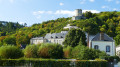
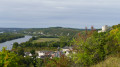
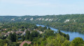
Starting point: Mantes-Station railway station, Transilien line J.
GR® (red and white markings)
(S) On leaving the station, cross Boulevard Calmette (at the pedestrian crossing), turn right, then cross Boulevard Victor Duhamel coming from the left. Follow this boulevard, then ignore the first three streets branching off to the right. Just past number 3 on the street, turn right onto Rue du Chapeau Rouge. Atthe first junction, carry on straight ahead until you reach Rue des Martraits. Turn right, then left onto Rue d’Arnouville, then right onto Rue Sousseuse, and right again onto Rue de Maurepas until you reach a Fork in the road.
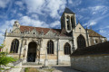
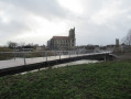
(1) Turn left until you reach Rue de la Sangle. Turn left, then right onto Rue du Cloître Notre-Dame. At the next junction, turn left, then left again onto Rue du Château. Walk past the collegiate church, then turn right onto Place Jean XXIII (in front of the collegiate church), which runs alongside Rue Thiers. Walk down this street towards the Seine. Take the footbridge to reach the Île de Limay.
Off the marked route
(2) Stay on the path which, after curving to the right, runs alongside the car parks to reach the Vieux Pont de Limay. Cross the Seine again via the new footbridge inaugurated on 20 July 2026. On the other bank, walk past the houses on the left along Quai Albert Ier until you reach Rue Nationale. Cross the street, then head down the road opposite to reach a Fork in the road.
GRP® (red and yellow markings)
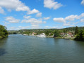
(3) Keep left, then join the Quai aux Vins. Follow it, then continue along the river via the towpath for approximately 2.6 km, until you reach the entrance to the village of Dennemont on Rue Jean-Jaurès. Carry on straight ahead to the roundabout.
Unmarked section
(4) Take the first exit on the right (the continuation of Rue Jean-Jaurès). At the fourth junction, turn right onto Rue de la Pleigne, which continues straight ahead at the next junction. Go through the pedestrian tunnel, climb the stairs, and follow the D147 until you reach the staircase on the left. Climb the steps, then cross the junction to join Chemin de la Pleigne, which is slightly to the left and leads up the hillside. Follow this road up to a junction and the end of the tarmac section.
GR® (red and white markings)
(5) Turn left onto Chemin de Maloret, heading towards the forest. Continue straight on along the GR®, ignoring all paths coming from the left, until you reach the village of Follainville-Dennemont.
(6) After the first few houses, turn onto the first path leading down to the left. Cross Rue des Lavoirs (there’s a pedestrian crossing about thirty metres to the right) and head up Rue Wilson on the opposite side.
(7) Carry on to the left along Rue Pasteur. Ignore a path coming from the right and continue to a crossroads at the edge of the village.
(8) Turn right onto Chemin du Coudray, heading due north (please note: the GR® route shown on the map is out of date). At the following junctions, carry on straight ahead until you reach the hamlet of Coudray. Turn right in the hamlet, then left onto Chemin de la Croix Maurice for about a hundred metres.
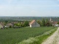
(9) Keep straight ahead on the tarmac road that runs alongside the riding centre, then curves to the left. As you come out of the bend, turn right onto a wide track that climbs across the fields before running alongside a copse (on your left). At the junction, turn left along the copse, then continue straight ahead, ignoring the paths branching off on either side, until you reach the entrance to the village of Saint-Martin-La-Garenne at the junction near a wash house.
(10) Turn right onto Chemin de la Désirée, which, after running alongside some built-up properties, continues as a track at the edge of the woodland (dead-end sign). Stay on the GR® until you reach the entrance to Vétheuil, continuing straight ahead at all times (ignore all paths coming from or leading off to the sides). You’ll arrive at the junction (signposted ‘La Forêt’).
(11) Turn right onto Chemin des Noues, then right again onto Route de Saint-Martin. After about a hundred metres (low stone wall on the left), at a traffic mirror, turn left onto the path which descends steeply in a zigzag to join Rue des Fraiches Femmes.
(12) Turn right onto this street, then turn left between two stone walls onto Ruelle du Talus, until you reach the banks of the Seine. Turn right, cross the Ru de Chaudry via the footbridge (new; maps not yet updated), then turn right onto Rue de la Seine. Continue until you reach Avenue Claude Monnet. Cross the road (take care) and turn left onto the steps leading to the Church of Vétheuil, painted by Monnet. Walk round the church on the left, then head up Rue du Cimetière to the Fork in the road (marked by a ‘pattée’ cross).
PR® (yellow markings)
(13) Turn right, then continue northwards up the partly shaded path (please note: thefirst path on the left shown on the IGN map is no longer accessible). After a more open area, at the junction, take the wide path branching off to the left (sign for ‘Réserve Naturelle Coteaux de la Seine’ on the left). Join the GR®.
GR® (red and white markings)
(14) Turn right onto the GR®, walking alongside the glider airfield. At the junction with the path coming from the village of Chérence, carry on straight ahead, then continue in the same direction, gradually approaching the Route des Crêtes.
(15) As you get closer to the road, the path runs up against a property bordered by a concrete fence (with a wooden gate on the right). Turn left onto the path that descends alongside the property, then down a small rocky outcrop. At the end of the outcrop, turn immediately right onto the path that climbs steeply towards the top of the hill. Ignore the path branching off to the right and continue along the GR®, which, after numerous bends, leads onto a tarmac road, Rue de la Charrière des bois. Walk down this road to the left for about thirty metres until you come to a path that cuts diagonally uphill to the right.
(16) Take this path, which winds its way along the hillside, ignoring all the paths branching off to the right. At the end of the path, go down the steps and continue straight on to the Place de l’Église Saint-Samson. Turn right onto Rue des Frères Rousse, then left in front of the castle entrance onto Rue de l’Audience. At the junction, cross the road (at the pedestrian crossing) then turn left onto Rue du Général Leclerc. Walk to the town hall, in front of which is the stop for bus 1119, which takes you back to Mantes-la-Jolie station (E).
 Visorando Member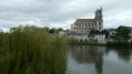
 Moderate
 Easy
Easy 
