Country:
 City:
City:





Starting point and access: Lardy station.
- RER – Line C, on the section between Paris and Étampes.
Take Exit 1, Place de la Gare, on the side of platform 1B, the one heading from Paris to Étampes (if arriving from the opposite direction, use the underpass).
No signposting
(S) As you leave the station, turn left. At the corner by a café, carry on straight ahead (ignore the red and white arrow pointing down to the right into Rue de la Gare). Take the next right onto Rue Myrtille Beer. Carry on straight ahead to the end of the street. Then turn left and, after about twenty metres, just before No. 26, turn right onto a footpath. Further on, cross a small tarmac area and carry on straight ahead along the footpath, which first turns right then left. You’ll come out onto a street; follow it to the left.
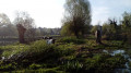
(1) Take thefirst right, which is a dead end, then go through a metal gate to enter the Town Hall Park. On a compacted track, walk alongside a pond on your left, ignore a footbridge on the right and walk alongside the River Juine on your right. Cross a stream via a small bridge, walk past a clump of bamboo and ignore the paths branching off to the left. Cross another stream via a footbridge and, at the T-junction (not shown on the map), turn left. At the next T-junction, turn right, leave the park and come out onto a road.
(2) Follow the road to the right on the right-hand pavement (the left-hand one becomes too narrow further on) and cross the River Juine via the Pont de l’Hêtre. Go round a roundabout on the right and cross Rue de Bouray (D17) at the pedestrian crossing.
Red and yellow + yellow signposting
Then follow the D17 to the left towards La Ferté-Alais. Stay on the right-hand pavement (the left-hand verge is too narrow). Where the carriageway narrows, move onto the left-hand verge, which becomes wider (take care when crossing). You will soon reach the entrance to the Château du Mesnil Voisin. Continue along the grassy verge of the road and enter Le Petit Mesnil.
Red and yellow + yellow + blue signposting
(3) Take thefirst left, Rue des Tilleuls. At the end, turn right into Rue de la Fontaine. At the three-way junction, veer left. Pass between nos. 23 and 16 and join a footpath. Go straight on between fences and gardens, ignoring a footpath leading off at right angles to the right. At the end, cross the road at the pedestrian crossing and first turn left then right onto Rue du Gué. Walk through a residential area. Towards the end, the street narrows and gives way to a short footpath.
Yellow markings
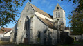
(4) At the end of the footpath, first turn right then left onto Rue Basse. Cross Rue du Garage on the right-hand side and continue straight on. At the end of the street, turn right onto the D17 towards Étampes and walk past Bouray church.
Yellow and Blue Signposting
(5) When the main road turns right, carry on straight ahead along Rue des Champs. Walk slightly uphill and follow the path alongside the cemetery.
Yellow + Red and Yellow signposting
At the corner by the cemetery, turn left. Opposite No. 21, turn right into a tarmac-surfaced lane. Continue along a narrow lane.
Red and yellow markings
Take thefirst left (Rue de Bretagne). At the end, cross a small square, go past a chicane and carry on straight ahead along a tarmac lane.
(6) At the Stop sign, turn right and take a tarmac path running parallel to the D449. At the end of this path, continue straight ahead along the grass verge of the road and pass the road signs. Just before a roundabout, level with a gate on the other side, cross the road (caution: busy road, no pedestrian crossing). Then walk along the wall of the castle grounds on your left and follow the D449 towards Itteville (the verge is relatively wide).
(7) At the corner of the wall, turn left onto a path that leads into a small wood. Leave the wood, walk along a field on your right until you reach a fence. Then turn right and walk along the fence on your left along a shaded path. Further on, in open country, continue straight ahead between the fence and a field (note the Menhir de la Roche à Gentil in the distance to the right). Ignore a path on the left leading to a pond, then pass a fenced-off building on the right.
Signposting: Red and Yellow + Yellow + Blue
(8) At a junction (signpost), carry straight on along a farm track and walk past a small house on your right. At the end of the track (information boards on the right), turn left, pass a hairpin bend and enter the Marais d’Itteville area. Walk alongside a wetland on your left and you’ll soon reach a crossroads (fenced pasture on the left).
Unmarked
(9) Continue straight on, pass a few small rocks lying across the path, walk alongside the pasture fence and arrive at the Fauvettes observatory. Retrace your steps.
Red and yellow + yellow + blue signposts
(9) On returning from the observatory, turn sharply left onto a grassy path. Go round a pond on the left and follow a pasture fence on your right. Pass another chicane and, at the T-junction that appears immediately, turn left.
No markings
(10) At the next junction (gate on the right-hand side), turn left towards the Blongios observatory (forest gate). Follow a path between the pond and the reed bed to reach the observatory (no entry beyond this point). Retrace your steps.
Red and Yellow + Yellow + Blue markings
(10) On your return from the observatory, follow the previous path to the left.
Yellow markings
At the next junction (signpost), go straight on (ignore the yellow arrow indicating a right turn; twoPR® routes split here). Continue straight on (a few damp patches) until you reach a road (D8).
(11) Cross the road (be careful – there is no pedestrian crossing) and follow it to the left on the right-hand pavement (there is no route on the left-hand side). Pass the Impasse des Acacias on the right-hand side.
No signposting
Cross Impasse des Charmilles on the right-hand side (ignore the yellow arrow) then Impasse du Moulin (still on the right-hand side), and follow Route de Saint-Vrain. At the traffic lights, cross the D8 again (at a pedestrian crossing) and follow it to the right for a few metres.
Yellow markings
(12) Turn immediately left onto the Chemin du Moulin de la Brière. At the end of the tarmac, continue along a path running alongside the field (ignore a path further to the left which leads into the woodland). At the corner of the field, carry straight on and enter the woodland. Immediately ignore a path on the left, turn right and carry straight on along the main path, a short distance from the field on the right. Leave the woodland: the path becomes a track, which soon turns into a tarmac lane. Join the D8, cross it and follow it to the left for about thirty metres.
(13) Just before the entrance to Saint-Vrain, turn right (do not cross the Juine).
No signposting
At the next junction (with a dovecote opposite), turn right onto Avenue du Général Leclerc. Then take thefirst left, onto Avenue du Château. At the Stop sign, go straight on. Further on, the avenue bends to the right and then to the left.
(14) At the junction, carry on straight ahead onto Avenue de la Gare. Continue straight ahead along a long, straight stretch which may seem monotonous, keeping to the left-hand side of the fenced-off grounds of a well-known aerospace company. Finally, pass the Étang des Hirondelles on your left, then cross the Essonne.
(15) At the T-junction that appears immediately, turn left onto Rue Eugène Pereire. At the Stop sign, turn right, then immediately right again to reach Ballancourt station (E).
To get back home:
- RER – Line D, towards Corbeil, Juvisy and Paris (direct access, platform 2) or Malesherbes (use the underpass).


 Visorando Member
 Very difficult



 Difficult