Country:
 City:
City:


Starting point and access: Étréchy station.
- RER - Line C, on the section between Paris and Étampes.
Take Exit 1, Boulevard Pasteur, on the side of platform 2B, the platform for trains from Étampes to Paris (if arriving from the opposite direction, use the underpass).
Blue signposting (sparse)
(S) On leaving the station, take Rue du Chemin de Fer opposite and walk past the Conservatoire on your left. At the junction, turn left into Grande Rue. At the next junction, turn right into Rue de l'Amandier.
No markings
Take thefirst left, Rue du 11 Novembre 1918. After about thirty metres, turn right and pass between the church (on the left) and the town hall (on the right).
(1) At the T-junction, turn right and walk past the war memorial. At the end of the street, turn left.
Blue signposting (sparse)
At the junction immediately ahead, follow Rue Saint-Vincent to the right. Continue straight ahead and ignore all turn-offs to the left.
(2) At the junction (with the cemetery opposite), turn right. After about fifty metres, turn left into Rue de l'Égalité (dead end). Walk along the cemetery wall on your left and, at the end, continue up a shaded path. Continue along a path bordering a field (on the left) and a hedge (on the right).
(3) At the junction (signpost), turn sharply left and take a grassy path between the fields. Further on, cross a copse. Then turn right between a vineyard plot (on the left) and a wayside cross (on the right). Pass through a wooden gate, continue along a small uphill road and pass by the foot of a reservoir.
(4) At the next crossroads, two paths lie ahead: take the one on the left (no arrow or marker here). Climb slightly and continue on level ground heading north-west between the fields. Pass under a medium-voltage power line and continue along a track.
No markings
At the junction, turn right onto a small tarmac road (let the signposted path continue straight ahead).
(5) At the next junction (isolated tree on the right), continue straight ahead (Camino de Santiago marker). Go straight on, heading north-east, along a small road with very little traffic as it is a dead end. Ignore the path branches, first to the left (elevation 152) then to the right (elevation 150). Pass under a medium-voltage power line and continue along a track. Ignore a path branching off to the right (elevation 152) and continue along a grassy path until you reach a T-junction.
Yellow markings
(6) Turn right towards the village of Mauchamps. At the crossroads, turn left into Rue des Templiers. Ignore the side streets on the right and, at Place Saint-Jean, veer right to pass in front of the church.
(7) Turn right at the corner of the church and follow Rue de la Croix. When the street becomes a dead end, turn left into Rue de la Mare du Bois. At the stop sign, go straight on and walk alongside a sports ground on your right. When the street turns left, continue straight on along a tarmac path. Join a road and follow it to the right for about thirty metres.
(8) At the foot of a road sign (recycling bins), turn right onto a path. At the junction (elevation 147), continue straight ahead and walk alongside a wood on your left. Further on, walk alongside a wood on your right and then enter it. Go straight ahead (north-west) and ignore any vague paths branching off to the sides.
Red and white + yellow markings
(9) At the junction (barely marked), turn right towards an old sandstone marker (ignore an arrow pointing left; twoPR® routes cross here; see further details in the practical information). At the T-junction (elevation 147), turn right.
(10) After about a hundred metres, turn left and head downhill. Further on, at a junction not shown on the IGN map, go straight ahead, on fairly level ground. Ignore a path on the left (not shown on the IGN map) and walk along the right-hand side of fenced-off meadows and gardens.
Red and white markings
(11) At the end of the path, turn right. At the next junction, go straight on and pass under a metal archway. At a junction, go straight on. Pass through a second metal gate and turn immediately left (elevation 100). Walk along the right-hand side of a field, rejoin the tarmac and go straight on until you reach a Stop sign. Then turn right towards the N20 and go straight on until the next Stop sign.
(12) Then turn left and walk alongside the N20 (the pavement is narrow but adequate). After a few dozen metres, take the pedestrian underpass beneath the N20. On the other side, walk a few dozen metres and turn left onto Chemin de la Maison Blanche. Walk past some sheds on your right. At the end, continue straight ahead, pass a chicane and follow a tarmac path (no entry). Pass under a power line and arrive at a T-junction.
(13) Turn right towards a wood. Enter the wood and immediately ignore a path on the left. Climb a slope that becomes steeper as you go.
(14) At the top, at a junction, turn sharply left at the edge of the woods, then right between the fields. At the end (houses), turn right and follow Rue Notre-Dame straight ahead. At the fork, veer right towards the church and temporarily leave the signposted route.
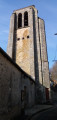
(15) At the foot of the church bell tower, take a narrow lane on the left. At the end, cross a road carefully, follow the D99 opposite towards Lardy and rejoin the signposting. When the road turns left, take a track on the right between nos. 28 and 26B. Note an old farmhouse some distance away on the left. At the junction (small EDF substation), go straight on. Head downhill, passing a sewage treatment plant on your left, and you will soon reach a junction (a signpost whose markers have been torn off...).
(16) Turn right here and walk between a wood on the left and a field on the right. Cross the wood briefly, then wind your way between the fields. At a T-junction at the edge of another woodland (La Grande Beauce), follow a path to the right that stays along the edge. At a three-way junction, turn left and climb steeply into the woodland. Join another path (a wide track visible a few metres further on).
(17) Follow the path to the left.
Red and white + blue markings
At the T-junction, follow theGR®1to the left. Ignore a path on the right. Pass through a forest gate, behind which there is a junction.
Blue markings
(18) Continue straight ahead (let theGR® head off to the right).
No markings
At the next junction, turn right. Ignore a path on the left and follow a fence on the left-hand side. Pass through a forest gate and go past the large gate of an isolated house.
Red and White + Blue Markings
Go straight on and descend steeply along a concrete path that turns into a tarmac road. At the bottom, turn immediately right to reach Lardy station (E).
To get back home:
- RER - Line C, towards Paris (direct access) or Étampes (take the underpass).



 Visorando Member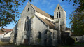
 Difficult

 Easy
Easy