


Refine your search for walks in Gare de Ballancourt
Gare de Ballancourt walks


 From La Ferté-Alais to Mennecy via the ponds
 Visorando Member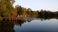
 10.80 mi
 +66 ft
 -135 ft
 5h 00
5h 00
 Moderate
 Departure from La Ferté-Alais (Essonne)
This hike is certainly the most "aquatic" of those that can be undertaken along the Essonne. Indeed, numerous ponds punctuate the route: ponds for fishing or other forms of leisure; ponds and marshes that make up a protected natural area, a source of biodiversity and a place to observe wildlife.
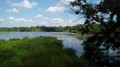
From Corbeil to Ballancourt via Villeroy Park and the Fontenay Marshes
 12.46 mi
+354 ft
-302 ft
6h 00
12.46 mi
+354 ft
-302 ft
6h 00
 Difficult
Departure from Corbeil-Essonnes (Essonne)
Difficult
Departure from Corbeil-Essonnes (Essonne)
A walk from station to station starting in Vieux Corbeil (large mills, cathedral). After following the Seine, the route climbs before descending to Moulin Galant, then follows the Essonne. The walk concludes with a stroll through Villeroy Park, set in a wooded landscape, followed by an exploration of the Fonteanay Marshes and their birdwatching hides.
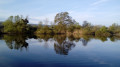
From Ballancourt to La Ferté-Alais, the Itteville marshes and the Sanglier rock
 8.20 mi
+381 ft
-354 ft
4h 05
Moderate
Departure from Ballancourt-sur-Essonne (Essonne)
8.20 mi
+381 ft
-354 ft
4h 05
Moderate
Departure from Ballancourt-sur-Essonne (Essonne)
A walk from station to station that starts gently along the Essonne. Further on, the crossing of the Itteville marshes allows you to discover ponds and reed beds and admire the birds from the observation points provided. After passing an imposing menhir, you climb the Butte d’Itteville. You then reach the rocky outcrops of Le Sanglier. The walk ends with a stroll through the narrow streets of La Ferté-Alais.
Following the Essonne
 97.78 mi
+3,153 ft
-3,136 ft
10 days
Moderate
Departure from Corbeil-Essonnes (Essonne)
97.78 mi
+3,153 ft
-3,136 ft
10 days
Moderate
Departure from Corbeil-Essonnes (Essonne)
Named after Acionna, the Gallo-Roman goddess of rivers, the Essonne flows through the north of the Loiret department and the south of the Île-de-France region. The first five stages follow its course downstream, while the last four follow it upstream. These nine stages are accessible by train. One stage, which is not accessible by train, forms a circular route upstream. The route alternates between paths along the river, passages through woods and those across cultivated plateaus.
From Ballancourt-sur-Essonne to La Ferté-Alais via Mondeville
 12.27 mi
+663 ft
-630 ft
6h 15
Difficult
Departure from Ballancourt-sur-Essonne (Essonne)
12.27 mi
+663 ft
-630 ft
6h 15
Difficult
Departure from Ballancourt-sur-Essonne (Essonne)
Twenty-ninth stage of the Grand Tour of Île-de-France via the GR®11, linking Ballancourt-sur-Essonne to La Ferté-Alais. Although both towns are located in the Essonne valley, the proposed route passes through the plateau overlooking the valley on the east side, in the Gâtinais Français Regional Nature Park, to the charming village of Mondeville. The GR® then winds its way between valleys, forests dotted with sandstone boulders and agricultural plateaus. This stage is shorter than the previous ones but is not without its difficulties as it still covers steep sections of terrain similar to the Fontainebleau forest, particularly around Mondeville. The route also allows you to discover some unusual sights, such as the Roches du Père La Musique in Ballancourt.
From Milly-la-Forêt to Ballancourt-sur-Essonne through the Gâtinais region.
 20.81 mi
+758 ft
-781 ft
10h 15
20.81 mi
+758 ft
-781 ft
10h 15
 Very difficult
Departure from Milly-la-Forêt (Essonne)
Very difficult
Departure from Milly-la-Forêt (Essonne)
This is the twenty-eighth stage of the Grand Tour of Île-de-France via the GR®11, connecting Milly-la-Forêt to the Ballancourt-sur-Essonne train station after crossing the French Gâtinais region. It is designed to follow on fromthe previous stage coming from Fontainebleau, after a night's stay there.This stage begins in the École valley, which boasts a rich heritage: Milly-la-Forêt, Moigny-sur-École, Courances and its château, and Dannemois, dear to Claude François. It continues through the fields of the Gâtinais, then the ridges and sandstone plateaus of the Grands Avaux forest, ending at Ballancourt-sur-Essonne in the valley of the same name.The stage is very beautiful but very long, and undoubtedly the most physically demanding of all those on the GR®11, especially in its second part. However, it is possible to split it in two by staying overnight and/or shorten it in several places by simplifying it.
Following the Petit Morin
 55.69 mi
+2,769 ft
-2,772 ft
7 days
Moderate
Departure from Jouarre (Seine-et-Marne)
55.69 mi
+2,769 ft
-2,772 ft
7 days
Moderate
Departure from Jouarre (Seine-et-Marne)
Within the Ile-de-France region, the Petit Morin valley is a preserved area with a strong rural and agricultural character. This is not a multi-stage hike per se, but rather a collection of seven routes lasting between 3 and 4 hours, covering the small roads of this charming valley and communal paths where motorised vehicles such as quads and 4x4s are prohibited.