Country:
 City:


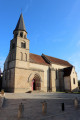
Park near the church; the easiest option is a car park situated behind it, near the D19f on Rue Jean Viard, heading towards Fougerolles.
(S/E) From the car park, take a small lane towards the church, heading south-southeast. You’ll arrive at the village square by the town hall and the church. Follow the yellow markings for the FFRandonnée route: Gourdon Valley, Chêne des Pendus (trail sign near the war memorial). Join Rue Jean Traversat and follow it to the right, towards Cluis.
(1) At the junction between the D54 and the D72, follow the D72 to the left, towards La Buxerette, until you reach the junction between the D19 and the D72.
(2) Follow the D72 straight ahead, still heading towards La Buxerette (Croix des Pousserattes). You’ll come to a fork 100 metres after the Pousserattes turn-off.
(3) Turn right onto a farm track lined with hedges (White Cross 30 m from the roadside) until you reach a junction with a road.
(4) Turn left onto this road, heading down into a small valley, then climb back up to the Pilorgets farm. Continue along the grassy track which descends to Le Gourdon (Caution: slippery rocky outcrops in wet weather). Cross the stream via a footbridge, then climb back up to a junction.
(5) Take the path on the right until you reach a small road. Turn right onto this road to reach Les Gerbauds at a Fork in the road (well).
(6) Follow the road down to the right to Moulin Dumont at a junction.
(7) Cross the D54 (cross) and head up the road opposite, towards Les Roulets, for about 300 m.
(8) At a fork in the road, take a narrow track on the right which descends into a small valley. Ignore two paths on the left, follow a stream and reach a leat from a former mill at Bord l’Épée.
(9) Follow the small road, leaving a sunken track on your right. Join the D19f and follow it uphill to the left as far as Les Coutants.
(10) At the cross, turn right towards La Claire at the road junction.
(11) At the Stop sign, turn right and head down to Le Gourdon, then onto the D19.
(12) Take this road carefully to the right for 150 m and, after the bridge, turn left onto a shaded dirt track overlooking the Gourdon. You’ll come to a road.
(13) Follow it to the left, ignoring a path leading down to the left towards a ford; walk past a house, then turn right towards the Rochefolle farm.
(14) At the end of the climb, turn left onto a lane which then enters the Bois de Villemort. Ignore the various private paths on either side until you reach the first houses of Les Granges at a crossroads.
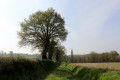
(15) Follow the road on the right, ignoring a path on the left running alongside the woodland, until you reach a lane on the right with an information board explaining the legend of the Chêne des Pendus. Enter the woodland and you’ll reach the Chêne des Pendus at a crossroads.
(16) Continue along the lane opposite, heading south-west; pass a path on the right and turn 90° to the left, continuing for 150 metres until you reach the edge of the woodland.
(17) Take the lane on the right which leads onto a small road; follow this straight on until you reach the embankment of the old railway line.
(18) As you come out of a left-hand bend, take the steps on the right which climb the embankment of the old railway line (signpost). Head back down a farm track, opposite a pond. Follow the track to the left until you reach the end.
(19) You can take a 50-metre detour to the left to the Croix de Mission, then follow the D72 westwards to return to Saint-Denis-de-Jouhet. Leave the D54 on your left, reach the site of the old chimney, then take an optional detour to the left to the fountain. Then head to the church square and on to the car park (S/E).

 Visorando Member
 Easy