


Circular route via the Puerto de Canal Roya


This is a circular route that follows existing paths. The descent follows a track that sometimes disappears, but is never far away. Just look out for the cairns. There are also herds of cows and sheep (watch out for the Ppatous).
Details
Creation:
Last update:
Last review:
–
–
-
 Activity: Walking
 -
 Distance: 4.58 mi
 -
 Average duration: 3h 25
 -
 Difficulty: Moderate
 -
-
 Back to start: Yes
 -
 Ascent: + 1,516 ft
 -
 Descent: - 1,493 ft
 -
-
 Highest point: 7,244 ft
 -
 Lowest point: 5,709 ft
-
 Country:
Spain
Country:
Spain
-
 Area: Pyrenees
 -
 City:
Sallent de Gállego
City:
Sallent de Gállego -
 Start/End: N 42.802948° / W 0.416821°
 -
 IGN map(s): Ref. 1547OT, 1547OTR, 1647OT, 1647OTR
 -


 Hour-by-hour weather


Waypoints
- S/E : mi 0 - alt. 5,830 ft
- S/E : mi 4.58 - alt. 5,830 ft
This route passes through a protected area, which may be subject to special regulations:
Other walks in the area
Pic du Pourtalet and Pic d’Estremère from the Col du Pourtalet
 Visorando Member
 3.15 mi
+1,204 ft
-1,207 ft
2h 30
Moderate
3.15 mi
+1,204 ft
-1,207 ft
2h 30
Moderate
 Departure from Laruns (Pyrénées-Atlantiques)
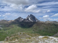
A short hike to the summits of two very close peaks. Superb views and a 360° panorama, particularly towards theCirque d’Anéou, the Pic du Midi d’Ossau and the Lurien Massif. You’re likely to spot marmots and chamois along the way.Please note that whilst these peaks are in France, the majority of the route takes place in Spain and along the border ridge.
The GPX track may prove useful.
From the Cabane de l’Araille to Lac de Roumassot
8.25 mi
+2,595 ft
-2,162 ft
6h 05
 Difficult
Departure from Laruns (Pyrénées-Atlantiques)
Difficult
Departure from Laruns (Pyrénées-Atlantiques)
The first stage of this beautiful hike. Not particularly demanding, with no specific difficulties apart from the distance. Featuring magnificent scenery, views of the south face of the Pic du Midi d’Ossau and the lakes. The route includes a bivouac at Lac de Roumassot with a breathtaking view of the Ossau! The path is well signposted from start to finish, with quite varied scenery: mountain pastures, rocky outcrops and lakes.
Pombie Refuge
 5.84 mi
+1,581 ft
-1,578 ft
4h 05
Moderate
Departure from Laruns (Pyrénées-Atlantiques)
5.84 mi
+1,581 ft
-1,578 ft
4h 05
Moderate
Departure from Laruns (Pyrénées-Atlantiques)
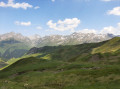
With only 8 km and 470 m of elevation gain, this hike is accessible to almost everyone. The paths are wide and easy to follow. The views are magnificent. A change of scenery without too much difficulty. From the refuge, the more adventurous can climb to the Col de Peyreget or the Col de Suzon. To do so, you will need to be very well equipped.
Houer Lake
 5.84 mi
+1,736 ft
-1,745 ft
4h 10
Moderate
Departure from Laruns (Pyrénées-Atlantiques)
5.84 mi
+1,736 ft
-1,745 ft
4h 10
Moderate
Departure from Laruns (Pyrénées-Atlantiques)
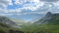
Lac de Houer is very quiet, as hikers prefer to head towards Lac de la Pombie from Cabane d'Araille.
In summer, this walk allows you to admire the equally beautiful landscapes far from the crowds, surrounded by pastures and herds of cattle.
The circuit around Pic de Peyreget near Pic du Midi d'Ossau
 7.28 mi
+2,539 ft
-2,543 ft
5h 35
Difficult
Departure from Laruns (Pyrénées-Atlantiques)
7.28 mi
+2,539 ft
-2,543 ft
5h 35
Difficult
Departure from Laruns (Pyrénées-Atlantiques)
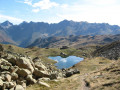
A circular walk starting from the Anéou basin, to pay a visit to Jean-Pierre, the giant of Béarn, and enjoy the beauty of a few small mountain lakes. A walk we have done several times in late summer or autumn, always with the same pleasure.
Circular in the Cirque d'Anéou
 4.30 mi
+965 ft
-951 ft
2h 50
Moderate
Departure from Laruns (Pyrénées-Atlantiques)
4.30 mi
+965 ft
-951 ft
2h 50
Moderate
Departure from Laruns (Pyrénées-Atlantiques)
What better season than spring to discover (or rediscover) the mountains? Snow still adorns the landscape, streams flow merrily down the slopes, and a profusion of flowers carpets the already thick grass of the mountain pastures. The Cirque d'Anéou, in the upper Ossau valley, offers us the added bonus of its magnificent setting and geological curiosities.
Lake Anayet
6.80 mi
+2,087 ft
-2,113 ft
4h 55
Moderate
Departure from Sallent de Gállego (Huesca)
Hike from the car park at the Fomigal Zona Anayet resort towards Lake Anayet.
Follow the GR®11 trail. Pass through La Garganta and then continue at a leisurely pace to Lake Anayet. Once at the lake, the view of the Pic du Midi d'Ossau is magnificent, as are the surroundings, colours and reflections.
You can also hike to the Cuello de Anayet pass (2,414 m) and then Punta del Garmo (2,555 m), which are off the beaten track.
Pombie – Astún
 6.75 mi
+2,838 ft
-2,490 ft
5h 35
Difficult
Departure from Laruns (Pyrénées-Atlantiques)
6.75 mi
+2,838 ft
-2,490 ft
5h 35
Difficult
Departure from Laruns (Pyrénées-Atlantiques)
Day two: return to Astún from the Pombie Refuge, via the Col and the Peyreget hut, then Lake Castérau and the Col des Moines. Compared to the first day, the elevation gains are a little steeper, with the final ascent covering nearly 520 m. The atmosphere is different: no ridges, but lakes and valleys!
For more walks, use our search engine .
The GPS track and description are the property of this route's author. Please do not copy them without permission.

