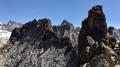
From La Bérarde to Les Étages

A short, half-day fitness walk along the Vénéon, with a detour at the start of the Vallon des Étages for a bit of elevation gain

Details

n°724773
Creation:
Last update:
Last review:
  • Walking
    Activity: Walking
  • ↔
    Distance: 4.93 mi
  • ◔
    Average duration: 3h 15 
  • ▲
    Difficulty: Easy

  • ⚐
    Back to start: Yes
  • ↗
    Ascent: + 1,112 ft
  • ↘
    Descent: - 1,102 ft

  • ▲
    Highest point: 5,955 ft
  • ▼
    Lowest point: 5,213 ft

Photos

Description of the walk

Park in the Bérarde car park, which is situated on the banks of the Vénéon.

(S/E) Head north-west for about 150 metres, then turn left to reach the small bridge over the Vénéon.

(1) Cross the stream and head downstream to the right. The path climbs, moving slightly away from the stream bed, then descends again to the Camping de la Bérarde.

(2) Cross the campsite towards the reception, following the Vénéon.

(3) Do not cross the stream but carry on straight ahead. You will then easily reach a junction.

(4) A sign points towards the Vallon des Étages along the right bank via a path starting on the left. Ignore this and carry on towards the hamlet of Les Étages.

(5) You can cross the small bridge if you wish to stop off at Les Étages. Otherwise, head straight up to the left towards the Vallon des Étages on the left bank, unless you prefer to turn back to avoid the climb. Please note, the climb is quite steep, but the path is good.

(6) At the junction, head left to cross the stream towards the right bank. Then turn right to head back down.

(4) Turn right to follow the same path as on the way there, along the Vénéon.

(2) For a bit of a change, turn left as you leave the campsite and cross the Vénéon before La Bérarde. Join the small road leading to it, which you follow to the right. This allows you to visit the village … The car park is easy to find, at the bottom of the village (S/E).

Waypoints

  1. S/E : mi 0 - alt. 5,594 ft - La Bérarde car park
  2. 1 : mi 0.1 - alt. 5,577 ft - Bridge over the Vénéon
  3. 2 : mi 0.39 - alt. 5,518 ft - Entrance to the Bérarde campsite
  4. 3 : mi 0.67 - alt. 5,482 ft - Campsite reception - Camping de La Bérarde
  5. 4 : mi 1.93 - alt. 5,226 ft - Les Étages junction – right bank of the valley
  6. 5 : mi 2.03 - alt. 5,213 ft - Pont des Étages
  7. 6 : mi 2.44 - alt. 5,906 ft - Junction: turn left towards the right bank
  8. S/E : mi 4.93 - alt. 5,597 ft - La Bérarde car park

Notes

Hiking boots and walking poles are recommended if you’re walking up the valley.
The elevation gain measured by the altimeter is greater than that calculated by the Visorando software: 430 metres.

Worth a visit

In season, you can pick blackberries.
If you have more time, it is possible to climb further up the Vallon des Étages. This additional section has not been tested by the author.

Reviews and comments

4.7 / 5
Based on 1 review

Reliability of the description
5 / 5
Ease of following the route
5 / 5
Route interest
4 / 5
Bea.lebrun13
Bea.lebrun13

Overall rating : 4.7 / 5

Date of your route : Aug 12, 2018
Reliability of the description : ★★★★★ Very good
Ease of following the route : ★★★★★ Very good
Route interest : ★★★★☆ Good

Personally, I set off from the Hameau des Étages and decided to head further into the valley. I’m glad I did, as the scenery there is absolutely stunning! I chose to start on the right bank. It turns out that it’s easier and better marked with cairns than the left bank.

Machine-translated

Other walks in the area

For more walks, use our search engine .

The GPS track and description are the property of this route's author. Please do not copy them without permission.