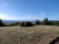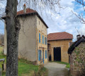
From west of Primarette to north of Moissieu-sur-Dolon

A walk worth doing even after rain as there are no streams to cross.
TO ALL HIKERS (SES) WHO FOLLOW MY ROUTES: you can post photos, indicating their location along the route.

Details

n°15661795
Creation:
Last update:
Last review:
  • Walking
    Activity: Walking
  • ↔
    Distance: 6.10 mi
  • ◔
    Average duration: 3h 10 
  • ▲
    Difficulty: Moderate

  • ⚐
    Back to start: Yes
  • ↗
    Ascent: + 440 ft
  • ↘
    Descent: - 433 ft

  • ▲
    Highest point: 1,503 ft
  • ▼
    Lowest point: 1,161 ft

Photos

Description of the walk

To get there from the north, take the D538; after crossing the TGV bridge, it’s thefirst road on the right as you head down towards Beaurepaire. Coming from the south, from Beaurepaire on the D538, takethe first road on the left as you head uphill past the Château du Louvier.
100 metres from the D538, park your car near the junction where the path branches off to the left towards the south (there’s usually a pile of logs there).

(S/E) Carry on straight ahead. After a wide bend to the right, at the junction, turn right, then immediately – after about 50 m – turn left to go round the houses. Carry on until you reach the Y-junction.

(1) Take the right-hand branch. Continue downhill.

(2) Further on, after two houses on the left, ignore the first path branching off to the left and carry on until you reach the bend in the road.

(3) Turn right and walk past the house. Follow the TGV line.

(4) Go under the TGV line bridge. Cross the junction heading towards the hamlet of Le Pinet. Turn right, then carry on straight ahead. Pass between the first houses in Moissieu-sur-Dolon.

(5) Carry on straight ahead, following the road to the right. Turn right onto Route des Peupliers, which curves to the left. At the next junction, carry on straight ahead.

(6) After 100 m, turn right, heading north, then, after about 200 m, take the first path leading uphill on the left. You’ll come to a junction.

(7) Turn right and continue along the track, which is also theGR®65, until you reach the inverted Y-junction.

(8) Walk past the water tower. Carry on straight ahead, skirting the edge of the forest. Just before the last field before the woodland opposite, a path branches off to the right.

(9) Take this path and turn left 100 metres further on. Carry on, crossing the bridge over the TGV line. Continue until you reach the starting point (S/E).


Waypoints

  1. S/E : mi 0 - alt. 1,490 ft - Car park by the roadside
  2. 1 : mi 0.72 - alt. 1,453 ft - Fork
  3. 2 : mi 1.27 - alt. 1,293 ft - Fork
  4. 3 : mi 1.52 - alt. 1,243 ft - Passage between the two houses
  5. 4 : mi 2.13 - alt. 1,276 ft - TGV bridge
  6. 5 : mi 2.94 - alt. 1,240 ft - First houses in Moissieu-sur-Dolon
  7. 6 : mi 3.36 - alt. 1,316 ft - Junction
  8. 7 : mi 3.94 - alt. 1,424 ft - Junction
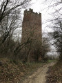
  9. 8 : mi 4.59 - alt. 1,470 ft - Water tower
  10. 9 : mi 5.51 - alt. 1,499 ft - Path on the right
  11. S/E : mi 6.1 - alt. 1,493 ft - Car park by the roadside

Notes

No special equipment required.
It’s a shame there’s hardly any path left – or so little that you can no longer do a route without having to use tarmac roads in this area.

Always be cautious and plan ahead when you're outdoors. Visorando and the author of this route cannot be held responsible for any accidents occurring on this route.

The GR® and PR® markings are the intellectual property of the Fédération Française de Randonnée Pédestre.

Reviews and comments

4 / 5
Based on 2 reviews

Reliability of the description
4 / 5
Ease of following the route
4.5 / 5
Route interest
3.5 / 5
User 3980208

Overall rating : 4 / 5

Date of your route : Apr 11, 2026
Reliability of the description : ★★★★☆ Good
Ease of following the route : ★★★★☆ Good
Route interest : ★★★★☆ Good
Very busy route : No

Quite a few spots in direct sunlight. Take care in summer

Machine-translated

Klaudius33
Klaudius33

Hello,
thank you for your feedback and comments; I’m always very keen to hear from walkers as this sometimes enables me to make changes to either the route in question or the description.
You’ll find around thirty routes that I’ve created within a radius of about twenty km of Beaurepaire 38270
Kind regards.
Klaudius33

Machine-translated

hiker38
hiker38

Overall rating : 4 / 5

Date of your route : Jan 26, 2025
Reliability of the description : Not used / Not applicable
Ease of following the route : ★★★★★ Very good
Route interest : ★★★☆☆ Average
Very busy route : No

Fine weather and panoramic views of the Alps. 17°C this Saturday, 25 January 2025! A route near the TGV line. Trains pass frequently but are not too disruptive. Flax fields on the plateau.
Very scattered settlements with a few notable houses.
Thanks to Klaudius33 for this walk, which we’ll remember fondly.

Machine-translated

Other walks in the area

For more walks, use our search engine .

The GPS track and description are the property of this route's author. Please do not copy them without permission.