La Salette Chapel and the Font du Loup valley

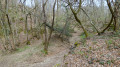
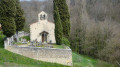
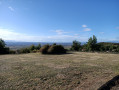
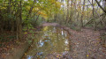
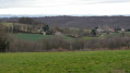
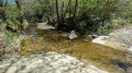
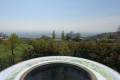
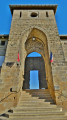
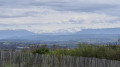
Discover three very different sites: the orientation point towards Bellegarde-Poussieu, the Chapelle de la Salette and the strange little valley known as La Font du Loup. From the orientation point, you can see the entire Alpine range, and under the tall trees you can park and make use of the picnic tables. From the chapel, you can see the very pleasant Combe Rival. La Font du Loup is a strange little valley in the forest, criss-crossed by several streams. 

Details

n°65868389
Creation:
Last update:
Last review:
  • Walking
    Activity: Walking
  • ↔
    Distance: 6.29 mi
  • ◔
    Average duration: 3h 25 
  • ▲
    Difficulty: Moderate

  • ⚐
    Back to start: Yes
  • ↗
    Ascent: + 600 ft
  • ↘
    Descent: - 577 ft

  • ▲
    Highest point: 1,480 ft
  • ▼
    Lowest point: 1,089 ft

Photos

Description of the walk

Park under the trees by the orientation table, accessible via the unpaved Chemin des Crêtes. 

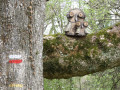
(S/E) Take this path north-east, following the red and white GR® markings. Cross the main roadwith care andcontinue straight ahead along the small road called Chemin du Château until you reach the goat farm.

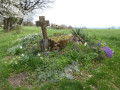
(1) Carry on straight ahead (GR®) along the unpaved track called Chemin de la Salette. This track curves round and reveals the chapel and its cemetery. After the chapel, the track narrows as it descends towards Bellegarde and joins a small road, which you take to the left.

(2) About 150 m further on, turn left onto the Chemin du Roc (GR®65), which leads uphill. At the junction with the Chemin des Masures, continue uphill to the left until you reach the small road known as the Grandes Bruyères. Follow it to the left and continue uphill until you reach a crossroads.

(3) Turn right and follow the Chemin de Taravas. Once you reach the junction with the Chemin de la Combe d’Orge, the tarmac ends and the track continues on almost level ground.

(4) Leave the track heading towards Moissieu-sur-Dolon on your right and carry on straight ahead until you reach the forest keeper’s house.

(5) Turn left onto the forest track, leaving the GR® markings behind. Follow this main track to a junction where there is a signpost indicating ‘Font du Loup’. Turn left onto the path – which can be very wet – which descends towards the south and reaches a fork approximately 500 m further on.

(6) Turn right when you come to a small, narrow path ahead: a yellow marker confirms this turn. Follow the forest path down to reach the Font du Loup. Follow the yellow markings carefully, as the path is difficult to see, being hidden amongst the trees, streams and the numerous tracks left by cyclists who come here for off-road cycling. After several very easy fords, emerge from this valley and continue along the path to ford the stream one last time. 

(7) Follow the main forest track, which climbs steeply. You’ll rejoin the tarmac road near the Ayats’ house. When the road turns right at a right angle, head straight on along the grassy path running alongside a field. You’ll come to the main road; follow it to the left for about fifty metres. 

(8) Turn left onto the road and then immediately turn right. Follow this small road downhill until you reach the goat farm. 

(1) Turn right and retrace your steps in the opposite direction to return to the grove where you started and the car park (S/E). 

Waypoints

  1. S/E : mi 0 - alt. 1,280 ft - Chemin des Crêtes Viewpoint
  2. 1 : mi 0.28 - alt. 1,283 ft - Goat farm
  3. 2 : mi 1.18 - alt. 1,099 ft - Chemin du Roc
  4. 3 : mi 2.03 - alt. 1,411 ft - Crossroads
  5. 4 : mi 2.47 - alt. 1,430 ft - Junction, straight ahead
  6. 5 : mi 3.18 - alt. 1,463 ft - Forest warden’s house, GR® route abandoned
  7. 6 : mi 3.9 - alt. 1,447 ft - Turn right at the fork, yellow marker
  8. 7 : mi 4.81 - alt. 1,243 ft - Final ford across the stream
  9. 8 : mi 5.62 - alt. 1,385 ft - Crossroads
  10. S/E : mi 6.29 - alt. 1,280 ft - Chemin des Crêtes Viewpoint

Always be cautious and plan ahead when you're outdoors. Visorando and the author of this route cannot be held responsible for any accidents occurring on this route.

The GR® and PR® markings are the intellectual property of the Fédération Française de Randonnée Pédestre.

Reviews and comments

4.1 / 5
Based on 3 reviews

Reliability of the description
4 / 5
Ease of following the route
3.3 / 5
Route interest
5 / 5
sisaso
sisaso

Overall rating : 4 / 5

Date of your route : Sep 27, 2026
Reliability of the description : ★★★★☆ Good
Ease of following the route : ★★★☆☆ Average
Route interest : ★★★★★ Very good
Very busy route : No

There’s an instruction missing at the end of point 6. You’re tempted to follow the first direction in point 7, which says to take the path leading uphill, when in fact you need to turn left. Otherwise, everything’s perfect. A lovely walk. The Font du Loup is impressive. It’s a shame we were disturbed by about ten very noisy motorcyclists.
Thank you for this lovely route.

Machine-translated

sisaso
sisaso

Overall rating : 4 / 5

Date of your route : Sep 27, 2026
Reliability of the description : ★★★★☆ Good
Ease of following the route : ★★★☆☆ Average
Route interest : ★★★★★ Very good
Very busy route : No

There’s an instruction missing at the end of point 6. It’s tempting to follow the first direction in point 7, which says to take the path leading uphill, when in fact you need to turn left. Otherwise, everything’s perfect. A lovely walk. The Font du Loup is impressive. It’s a shame we were disturbed by about ten very noisy motorcyclists.

Machine-translated

MEUNIER Chantal
MEUNIER Chantal

Overall rating : 4.3 / 5

Date of your route : May 17, 2025
Reliability of the description : ★★★★☆ Good
Ease of following the route : ★★★★☆ Good
Route interest : ★★★★★ Very good
Very busy route : No

A magnificent walk in the hills above Bellegarde, undertaken in 22°C weather, with bright sunshine and a light breeze. The path at the start is accessible by car, and it’s very nice to be able to park in the shade. Throughout the route (except in the La Font du Loup valley), your gaze is drawn to the horizon: the Alps, the valley. Some truly beautiful views.
Between points 6 and 7, you’re advised to follow the yellow markings: this is very important to avoid zigzagging between the various streams. Currently, these yellow markings (which are sometimes hard to see) are accompanied by numbers painted in fluorescent red (from 1 to 15), which are easier to follow. The La Font du Loup valley really does leave a strange impression.
It’s important to wear good walking shoes. There are a few sections of the route with large stones.
The goat farm is open to the public, Monday to Friday 10.00–12.00, 17.00–19.00; Saturday 17.00–19.00; closed on Wednesday mornings and all day Sunday. We finished the walk at 15.00, so we were sorry we couldn’t try the cheeses
Thanks to the author for this walk.

Machine-translated

Other walks in the area

For more walks, use our search engine .

The GPS track and description are the property of this route's author. Please do not copy them without permission.