From Saint-Jean Church to Boscodon Abbey

A short walk that takes you off the beaten track (and is therefore unmarked) and passes by the superb Notre-Dame de Boscodon Abbey. This walk is not recommended with young children.
Please note: if the torrent is flowing strongly, it is better to do the walk in the opposite direction – even if it means retracing your steps – to avoid finding yourself at a dead end because you cannot cross it and missing out on the Boscodon Abbey.

Details

n°189391
Creation:
Last update:
Last review:
  • Walking
    Activity: Walking
  • ↔
    Distance: 3.64 mi
  • ◔
    Average duration: 2h 30 
  • ▲
    Difficulty: Moderate

  • ⚐
    Back to start: Yes
  • ↗
    Ascent: + 951 ft
  • ↘
    Descent: - 938 ft

  • ▲
    Highest point: 4,314 ft
  • ▼
    Lowest point: 3,671 ft

Photos

Description of the walk

(S/E) The walk starts at Saint-Jean Church in Crots (in the hamlet of Saint-Jean), where several hearses are on display.

Head up the RD90, which runs above the cemetery. 200 metres further on, after the water reservoir (on the left), leave the road and continue along the path in front of you (where the rubbish bins are), until you reach the small road to Marlès.

(1) Turn right and head down the tarmac road towards Coste-Aussel.
Go round the barn on the right without entering the farm’s private grounds (BOSCODON sign) and follow the barely visible path that branches off to the right on the descent just after the farm, then immediately turn left (BOSCODON sign). Continue down the slope almost straight on until you reach the Infernet stream. Please note that the path can be slippery.

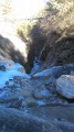
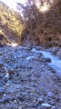
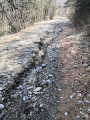
(2) Once you reach the stream, look for a suitable place to cross it (do not use the footbridge where a water pipe runs). Do not go near the waterfall as it is very dangerous, but walk up the stream bed for a few metres until you reach the tyres holding up the opposite bank. There, a small cairn marks the start of the track, which climbs steeply up to a path (marked by a forked pine tree); take this path to the right for about 70 steps to reach a small car park where there is a fire hydrant.

(3) Once you reach the small car park, take the road on the left.

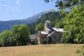
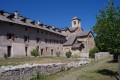
(4) Walk past the Abbey, which you can visit if you have time, and continue along the forest track that runs alongside the car park towards the Grande Cabane.

(5) 60 metres after the second hairpin bend, take the path that climbs to the left (Chemin de la Draye – Refuge and restaurant). The path climbs steeply to the upper track, where you reach the highest point of the walk.

(6) Turn left onto the path that crosses the meadow, then follow the almost level track to the hamlet of Marlès, where you’ll rejoin the path you took on the way up.

(1) Follow this path down to the car park (S/E).

Waypoints

  1. S/E : mi 0 - alt. 3,983 ft - Car park at Saint-Jean Church in Crots
  2. 1 : mi 0.53 - alt. 4,275 ft - Route de Marlès, turn right
  3. 2 : mi 1.26 - alt. 3,681 ft - Infernet torrent
  4. 3 : mi 1.29 - alt. 3,694 ft - Road to the abbey. Turn left
  5. 4 : mi 1.34 - alt. 3,740 ft - Abbaye Notre-Dame de Boscodon
  6. 5 : mi 2.08 - alt. 3,960 ft - Chemin de la Draye. Turn left
  7. 6 : mi 2.47 - alt. 4,314 ft - Upper path
  8. S/E : mi 3.64 - alt. 3,983 ft - Car park at Saint-Jean Church in Crots

Notes

I would not recommend this walk to anyone who is not confident in reading an IGN map.

Crossing the torrent (2) can prove difficult or even impossible if the water flow is too strong. Do not take unnecessary risks, especially if you are on your own. You may wish to use this route for the return journey, with or without a detour via the Abbey.

Make sure you wear waterproof walking shoes, as you’ll cross several small streams below Coste-Aussel as well as the Boscodon torrent.

A longer version of this walk, which uses slightly more roads, is suggested by hemadi:
https://www.visorando.com/randonnee-de-l...

Worth a visit

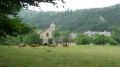
Boscodon Abbey.
St John’s Church, which is unfortunately not often open, and its outdoor shelter for hearse carriages – which were once used in the hamlet – built by volunteers from the ASPEC (Association for the Preservation of Crots’ Heritage and Environment).
Embrun and its beautiful Notre-Dame du Réal Cathedral, its ancient alleyways, the brown tower, etc.
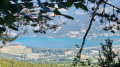
Swimming in Lake Serre-Ponçon.

Reviews and comments

2.6 / 5
Based on 7 reviews

Reliability of the description
2.5 / 5
Ease of following the route
2.8 / 5
Route interest
2.4 / 5
ddlyonnais
ddlyonnais

Overall rating : 2.7 / 5

Date of your route : Jun 21, 2025
Reliability of the description : ★★★☆☆ Average
Ease of following the route : ★★★☆☆ Average
Route interest : ★★☆☆☆ Disappointing
Very busy route : No

We wanted to do the circuit from the abbey, but the description of crossing the stream discouraged us from doing the circuit in reverse.
So we did a half loop there and back.
Not very exciting.

Machine-translated

mgm1561
mgm1561

Overall rating : 3.7 / 5

Date of your route : Aug 09, 2021
Reliability of the description : ★★★☆☆ Average
Ease of following the route : ★★★★★ Very good
Route interest : ★★★☆☆ Average
Very busy route : No

We couldn’t cross the torrent! The current was too strong.
So we had to turn back!
So, we were very disappointed!

Machine-translated

gazok54
gazok54 ★

Hello, everyone.
Today, 20 July 2020, the stream can be crossed, though you may get your feet a little wet.
I’ve reinforced the cairn on the opposite bank of the stream and repaired the path leading up to the road.
Please take care

Machine-translated

gazok54
gazok54 ★

Hello, and thank you for your reply.
There is a link in the practical information section for my walk that leads to the route you describe.
I have also added a few recommendations to my description.
Kind regards,

Machine-translated

Scipio Cornelli
Scipio Cornelli

Dear Mr Gazock
I have no intention of getting into an argument, and I apologise if I gave the impression of criticising your route.
I am familiar with it and find it unsuitable for an ‘easy’ family walk, especially during the summer when many holidaymakers set off with their noses in the air, smartphones in hand, with children wearing trainers – if not beach shoes... Or even with a baby just a few months old strapped to a strange, wobbly frame on their back. Not to mention that the baby in question isn’t wearing sunglasses at midday in August at an altitude of 1,300 metres, but that’s another matter.
That’s why I’m suggesting this really easy walk along a clearer route.
All roads lead to Rome; there are (at least) three ways to get to or from St Jean à Boscodon – it’s up to the walker to choose their own.
Kind regards.

Machine-translated

gazok54
gazok54 ★
• Edited:

Hello Scipio Cornelli
I’m sorry you found it difficult to find your way around using my description and the map of the route.
As the author of the guide and a resident of Crots, near Coste-Aussel, I find that it is, in fact, your account that is fanciful and disparaging.
In fact, the path leading down to the stream does indeed exist; you just need to look carefully. Furthermore, last autumn I built some small cairns to help people find their way. I also reopened the path on the right-hand side of the descent, which joins the Chemin des Chaulières.
Following the path, there is no greater risk of falling than anywhere else in the mountains.
As for crossing the stream, I never wrote that there was a ford; I merely drew the hiker’s attention to the fact that at certain times of the year it was impossible to cross, which is not the case at present. If you were expecting to see a bridge, you’ll be disappointed. Personally, I find it rather pleasant to have to cross this stream, even if I do sometimes get my feet wet.
As for the opposite bank, here too, you simply need to look carefully and you’ll find the cairn that I myself placed at the foot of the path leading up the slope.
The route you suggest via Marlès and Le Marquisat is another option for the return journey. It’s described elsewhere on Visorando.
My choice for the return journey is the one you describe via Marlès, taking the Chemin de la Draye.
So there’s no point in criticising a walk like this, which isn’t signposted, takes you off the beaten track and requires a bit of map-reading skill or the use of a GPS.
If you’ve just signed up to Visorando, you’ll need to get used to reading the route descriptions and using the IGN map extracts.

Machine-translated

Scipio Cornelli
Scipio Cornelli

Overall rating : 1 / 5

Date of your route : Aug 12, 2019
Reliability of the description : ★☆☆☆☆ Very disappointing
Ease of following the route : ★☆☆☆☆ Very disappointing
Route interest : ★☆☆☆☆ Very disappointing

As a resident of CROTS, near Boscodon Abbey, I would like to share the following information with you:
the route described above is completely fictitious for the Coste-Aussel / Boscodon section; the path that is supposed to run from the farm (at Coste Aussel) to the stream opposite the Abbey has not existed for decades, although for some reason it still appears on Google Maps.
Next to the farm there is a baffling signpost directing you towards the path where your troubles will begin.
You risk getting lost and having an unpleasant time in ravines overgrown with thorny bushes, on barely passable tracks left by animals or herds.
At worst, you’ll take a tumble.
In any case, don’t take the children and make sure you’re wearing sturdy footwear.
There’s no crossing point for the stream either – there’s no ford, and the opposite bank is impassable.
However, there is a comfortable route, in the shade of the fir trees, which will take you to the Abbey in complete peace and quiet. Here it is: at Marlès, head towards the Oratoire de Rambaud, pass the Oratoire and continue downwards towards the north-west along a narrow, well-marked path signposted with cairns.
Turn left at the hamlet of Les Chaulières and you’ll arrive at a place called ‘Le Marquisat’. There, cross the first stream (over the bridge), then a second stream (over another bridge); after that, a sign on the right points towards the Abbey (marked in blue).
All in all, a leisurely one-hour walk to discover this superb abbey.
To return, follow the forest track, then take the fairly steep path to the left towards “La Draye”, cross the forest heading north, and arrive at the hamlet of Marlès. Return to St Jean as indicated.
A 2-hour circular walk, ideal for families.

Machine-translated

gazok54
gazok54 ★

Hello everyone
The description and route map have been updated to reflect the right of way across the Boscodon stream (2). There is now a footpath leading to the road (3).
Don’t forget your waterproof footwear.

Machine-translated

gazok54
gazok54 ★

Good evening, jpl4983
Which bridge are you talking about? I’ve never mentioned a bridge for crossing the stream. I only mentioned a footbridge with a water pipe running over it, which you mustn’t use under any circumstances.
You simply cross the stream by stepping over it.
I can guarantee one thing: crossing the stream is no problem at all during this dry spell. I know what I’m talking about, as I walked this route a fortnight ago.

Machine-translated

jpl4983
jpl4983

Overall rating : 1.7 / 5

Date of your route : Oct 08, 2017
Reliability of the description : ★☆☆☆☆ Very disappointing
Ease of following the route : ★☆☆☆☆ Very disappointing
Route interest : ★★★☆☆ Average

Hello,
On this route, it is impossible to get from point 2 to point 3; the bridge crossing the gorge of the stream has never existed, despite the error on the map having been reported on several occasions. The return journey follows the same route as the outward journey, except that the route is extended by approximately 500 metres along the road to avoid the climb through the woods, which has a gradient of over 20 per cent.

Machine-translated

gazok54
gazok54 ★
• Edited:

Hello poeroe
Who on earth told you such nonsense? Certainly not anyone from round here, or else someone who wanted to mislead you. In fact, between Marlès and Coste-Aussel there’s a small tarmac road, used regularly by the farm’s residents.
So, as the author of this walk and someone who lives 100 metres from the starting point of this route, I’d advise you next time to read the description and look at the route map – then you won’t have any problems.

Machine-translated

poeroe
poeroe

Overall rating : 1 / 5

Date of your route : Jun 20, 2017
Reliability of the description : Not used / Not applicable
Ease of following the route : Not used / Not applicable
Route interest : ★☆☆☆☆ Very disappointing

The stretch between Marlès and Costle Aussel is inaccessible, according to local residents.

Machine-translated

gazok54
gazok54 ★

Thank you, kawibou, for going on this hike.
You’re right, the path isn’t very well marked up to the stream as not many people use it. I like to get off the beaten track
I’ve updated the description with the information you gave me.
Have a look and let me know if you think it’s better this way.

Machine-translated

kawibou
kawibou

Overall rating : 4 / 5

Date of your route : Aug 08, 2016
Reliability of the description : ★★★☆☆ Average
Ease of following the route : ★★★★☆ Good
Route interest : ★★★★★ Very good

A very enjoyable and very accessible walk (apart from the section across the stream – see below)

Two minor points to note, however:
- at point no. 2: the narrow path is rather poorly signposted. After going round the small hut, you need to take the path on the right as it goes downhill, then turn off and head towards the stream (rather than going straight on)
- at the stream crossing: either we got it wrong, or finding the Abbey path after crossing the stream proved very tricky (no obvious crossing point visible or indicated in the walk details) and the path that seemed to lead uphill was dangerous (walking along the edge of the ravine on a precariously balanced tree trunk!)

Machine-translated

gazok54
gazok54 ★

Thank you, mjmchelles77, for your comments.
So you found yourself at a dead end, and I understand your disappointment. I’m sorry, because on the three occasions I’ve been there, I’ve always managed to cross the stream by walking a little way upstream.
Indeed, the highlight of this walk is Boscodon Abbey. Your suggestion to reverse the direction of the walk is a very good idea. I’ll revise the description accordingly.

Machine-translated

Other walks in the area

For more walks, use our search engine .

The GPS track and description are the property of this route's author. Please do not copy them without permission.