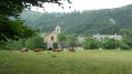
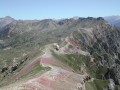
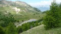
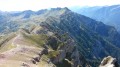
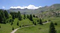
Pic de Morgon and Lac Saint-Pierre

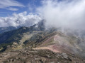
Panoramic view of Lake Serre-Ponçon from the Pic du Morgon (2,324 m).
A family hike that can really put your thighs to the test on the final stretch.

Please note:

Dogs are not permitted on the Morgon mountain pasture from 15 June to 15 September. They are allowed on a lead between 15 July and 15 August.

17 May 2023: The Grand Clos car park is only accessible via Boscodon Abbey. If travelling by car, do not attempt to reach it via any other GPS route.

There is a charge for parking during the day.

Details

77104
Creation:
Last update:
Last review:
  • Walking
    Activity: Walking
  • ↔
    Distance: 7.74 mi
  • ◔
    Average duration: 5h 55 
  • ▲
    Difficulty: Difficult

  • ⚐
    Back to start: Yes
  • ↗
    Ascent: + 2,723 ft
  • ↘
    Descent: - 2,723 ft

  • ▲
    Highest point: 7,612 ft
  • ▼
    Lowest point: 5,226 ft

Photos

Description of the walk

Access to the start of the walk:
From Embrun or Savines-le-Lac: take the N94, then the D568 (between Crots and Savines-le-Lac) towards Boscodon Abbey. At the abbey (in front of which there is a car park), you’ll see signs for the Grand Clot car park – go uphill and then turn right (as well as for La Fontaine de l’Ours, go uphill and then turn left).
Please note that the forest track leading from the abbey is unpaved, though this won’t prevent a small city car from making its way up at (very) low speed.

(S/E) This is why I chose to park before reaching the car park (see GPS track). I quickly made my way to the car park by following the forest track on foot.

(1) The path starts immediately at the far end of the car park. It’s very easy to follow as it’s clearly marked and wide enough for vehicles to pass (though these are, of course, prohibited for the general public).
On several occasions, the path splits, allowing you to take small shortcuts that quickly rejoin the main path.
The climb takes you partly through the forest and partly along sections offering increasingly unobstructed views of the lake.
A few dozen metres after passing a descending path on the right for the first time (towards the ladder), you reach the Portes de Morgon without too much difficulty, revealing all around you the magnificent Morgon cirque, bordered to the west by the Pic de Morgon and to the east by the Pic de Charance (Parpaillon massif).

(2) At the junction, where we’ll take the path opposite and follow it, keeping the bottom of the valley on our left at all times.

(3) The path turns right, then takes a wide bend to the left; after a series of small hairpin bends, we reach a fork.

(4) We turn right and begin the final ascent, which will first take us to a peak offering a stunning panoramic view of the lake and the surrounding villages, then on to the Pic de Morgon, from where the panorama widens further, offering a 360° view of both the lake and the Cirque de Morgon.

(5) After taking in the view, it’s impossible to miss the path following the ridges south-eastwards towards the Tête de la Vieille. We’ll follow this path, taking care not to slip on the first downhill section, whilst admiring the many edelweiss.
The path is very well marked.
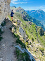
Take care on the two tricky sections – rocky ridges that can be slippery in wet weather and require you to use your hands for support (not recommended for those prone to vertigo).
We then reach the point where we descend into the Cirque de Morgon towards Lac Saint-Pierre. The descent takes us without any particular difficulty to the small lake overlooked by the Pic de Charance (Parpaillon massif).

(6) We’ll take the second path on the left heading north to rejoin the original path just before we reach the forest.

(2) We continue to the right, following the same route back down as we took on the way up, until we reach the car park (S/E).


Waypoints

  1. S/E : mi 0 - alt. 5,226 ft - Parking before the Grand Clot car park
  2. 1 : mi 0.45 - alt. 5,446 ft - Le Grand Clot car park
  3. 2 : mi 1.76 - alt. 6,214 ft - Porte de Morgon - Cirque de Morgon
  4. 3 : mi 2.64 - alt. 6,506 ft - Turn right
  5. 4 : mi 3.36 - alt. 7,277 ft - Junction
  6. 5 : mi 3.67 - alt. 7,602 ft - Pic de Morgon
  7. 6 : mi 5.48 - alt. 6,312 ft - Lac Saint-Pierre
  8. S/E : mi 7.74 - alt. 5,226 ft - Car park at the start

Notes

The path is quite busy with families with young children and groups who are unfortunately not always discreet.
For those who want to enjoy the wildlife and scenery in peace, it is best to start early to avoid the crowds that start arriving at 9 a.m.

The only water source (apart from the lake) is the drinking trough in the Morgon cirque, on the way up, near the sheepfold.

The hike to the Portes de Morgon can be done in ordinary trainers. The climb to the peak and the descent via the ridges require hiking boots for safety reasons.

Worth a visit

During the hike, you will see many marmots (despite the popularity of this hike) in the Cirque de Morgon.

If travelling by car, it would be a shame not to take the opportunity to visit Boscodon Abbey, which you will pass by on the way.

Reviews and comments

4.8 / 5
Based on 86 reviews

Reliability of the description
4.7 / 5
Ease of following the route
4.7 / 5
Route interest
4.9 / 5
Tournesol2
Tournesol2

Overall rating : 4.7 / 5

Date of your route : Jul 20, 2026
Reliability of the description : ★★★★★ Very good
Ease of following the route : ★★★★★ Very good
Route interest : ★★★★☆ Good
Very busy route : No

A lovely walk despite the intense heat.
Stunning views, with the lovely surprise of spotting a few marmots.
The view of the lake from the summit is breathtaking and is definitely worth the climb.
Apart from the steep slopes on the way up, this walk isn’t particularly difficult and is suitable for families.
A must-do in this area.

Machine-translated

User 11980278

Overall rating : 5 / 5

Date of your route : Jul 09, 2026
Reliability of the description : ★★★★★ Very good
Ease of following the route : ★★★★★ Very good
Route interest : ★★★★★ Very good
Very busy route : No

Hike undertaken on 9 July 2026 with the family, including two children aged 8 and 12, without any special equipment (no walking poles, just normal trainers for everyone).

The walk is very well described, with walking times and a difficulty level that accurately reflect the reality; the route is very easy to follow.

There is a €5 toll when driving up to the Grand Clôt car park between 7 am and 5 pm. Credit cards and cash are accepted.

The Grand Clôt car park is a little higher up than the start of the walk indicated on the route map, which adds 2 km to the distance and 100 m of elevation gain.

It was a bit busy, but nothing too bothersome. The view from the summit is incredible and well worth the effort. Along the way, we saw several marmots, edelweiss and rabbits. We thoroughly enjoyed ourselves.

By taking plenty of breaks and taking the time to admire the scenery, it took us 5 hours 53 minutes.
For reference, here are the times it took us to reach the various points along the walk from the start:

- 1 hour 45 minutes to reach point 3
- 2 hours 36 minutes to reach point 4
- 3 hours to reach point 5, the summit (compared to the 2 hours 5 minutes indicated on the yellow trail signs)
- 4 hours 40 minutes to reach point 6
- 5 hours 53 minutes to return to the start

I would definitely recommend this walk.

Machine-translated

User 27965631
• Edited:

Overall rating : 3.7 / 5

Date of your route : Oct 28, 2025
Reliability of the description : ★★★☆☆ Average
Ease of following the route : ★★★☆☆ Average
Route interest : ★★★★★ Very good
Very busy route : No

A very beautiful hike with a magnificent 360° view at the top! And sunshine as a bonus.

You can no longer pass through the sheepfold (pastoral estate), but the longer alternative is nice.

Machine-translated

Jjpjack
Jjpjack

Overall rating : 4.7 / 5

Date of your route : Oct 04, 2025
Reliability of the description : ★★★★☆ Good
Ease of following the route : ★★★★★ Very good
Route interest : ★★★★★ Very good
Very busy route : Yes

A very beautiful hike with a magnificent 360° view at the top!
I had already done this hike several times, and although the route has changed a little, I was very happy to have completed it at 76 years old and with prosthetic knees...

Machine-translated

User 23393448

Overall rating : 5 / 5

Date of your route : Sep 18, 2025
Reliability of the description : ★★★★★ Very good
Ease of following the route : ★★★★★ Very good
Route interest : ★★★★★ Very good
Very busy route : No

Very beautiful hike. Great view.

Machine-translated

Gp&Pmn
Gp&Pmn

Overall rating : 3.7 / 5

Date of your route : Sep 16, 2025
Reliability of the description : ★★★☆☆ Average
Ease of following the route : ★★★☆☆ Average
Route interest : ★★★★★ Very good
Very busy route : Yes

Change to the route by the ONF (French National Forestry Office), you no longer pass close to the sheepfold on the way up. Barrier. No problem for the looped descent.

Machine-translated

SossoMicka
SossoMicka
• Edited:

Overall rating : 5 / 5

Date of your route : Sep 11, 2025
Reliability of the description : ★★★★★ Very good
Ease of following the route : ★★★★★ Very good
Route interest : ★★★★★ Very good
Very busy route : Yes

I went on this hike again this year with a slight twinge of sadness at the sight of the number of people sitting on this magnificent orientation table, preventing me from contemplating the view.
However, this hike remains a rare gem. It offers a variety of landscapes, alternating ascents and descents to rest your legs, and a majestic peak, making it a real treat. The difficult level is undoubtedly due to a passage along the ridge that is not easy for people who suffer from vertigo, but it is doable! No particular difficulty.
I would definitely do it again, but hopefully with fewer people around...

Machine-translated

User 20561020

Overall rating : 4 / 5

Date of your route : Sep 01, 2025
Reliability of the description : ★★★★☆ Good
Ease of following the route : ★★★★☆ Good
Route interest : ★★★★☆ Good
Very busy route : No

a magnificent hike! However, you have to park in the pay car park, because we parked at Abbaye de Boscodon... we wasted three hours walking three quarters of the way along the road to get to the car park... apart from that, it was great.

Machine-translated

Tiliviou
Tiliviou

Overall rating : 5 / 5

Date of your route : Aug 18, 2025
Reliability of the description : ★★★★★ Very good
Ease of following the route : ★★★★★ Very good
Route interest : ★★★★★ Very good
Very busy route : Yes

Superb hike with magnificent views of Lake Serre Ponçon, no major difficulties, continuation of the circuit to the small lake, which was unfortunately empty, just a short technical section on the ridge, a very popular hike

Machine-translated

jonathan valoteau
jonathan valoteau

Overall rating : 5 / 5

Date of your route : Aug 11, 2025
Reliability of the description : ★★★★★ Very good
Ease of following the route : ★★★★★ Very good
Route interest : ★★★★★ Very good
Very busy route : No

Arrived at 8:30 a.m. at the car park (allow £5).
Great hike with two children aged 8 and 11.
Be aware that the climb up and down the ridge is in full sun, so make sure you bring sunscreen 😉.
Otherwise, it was magnificent.

Machine-translated

Mimine 2005
Mimine 2005

Overall rating : 4.7 / 5

Date of your route : Jul 16, 2025
Reliability of the description : ★★★★★ Very good
Ease of following the route : ★★★★☆ Good
Route interest : ★★★★★ Very good
Very busy route : No

A very beautiful walk with a wide variety of landscapes ... However, the change in route (well signposted) is a little confusing when trying to follow the original trail.
We found the route fairly quiet for the season, despite setting off late...
The section crossing the cirque is magnificent, and don't forget to take the little detour that leads to the lake, which is beautiful! Thank you!

Machine-translated

Vab007
Vab007
• Edited:

Overall rating : 5 / 5

Date of your route : Jul 22, 2025
Reliability of the description : ★★★★★ Very good
Ease of following the route : ★★★★★ Very good
Route interest : ★★★★★ Very good
Very busy route : Yes

Superb hike! Magnificent views throughout the climb to the peak, and majestic once you reach the top!
The ridge walk is also magnificent. (Of course, make sure the weather is clear to enjoy it!)
We spotted a few marmots, including one just ten metres away!
No particular difficulty, except for the length and elevation gain.
For information, we did this hike as a family with children aged 10 and 13, in 6 hours and 20 minutes, including breaks and taking our time. The "aerial" section did not pose any particular problems, either for my children or for my wife, who is a little prone to vertigo. (A short handrail is available to reassure those who need it.)
In summer, it's best to set off early, both to enjoy the cool, calm conditions (the hike is very popular in summer) and to avoid parking problems. Parking is free before 8am and paid after that.
There were no problems with the route apart from the diversion put in place for grazing, but this was very well signposted and we had no difficulty following our walk.
When we returned to the car park in the early afternoon, it was full to bursting (with cars parked along the track)

Machine-translated

User 6296456

Overall rating : 5 / 5

Date of your route : Aug 02, 2025
Reliability of the description : ★★★★★ Very good
Ease of following the route : ★★★★★ Very good
Route interest : ★★★★★ Very good
Very busy route : Yes

A very beautiful hike, arriving at the summit with an exceptional view despite a few clouds. A few exposed sections at the start of the descent, then a family picnic by the lake. Excellent!

Machine-translated

quicky2000
quicky2000

Overall rating : 5 / 5

Date of your route : Jul 27, 2025
Reliability of the description : ★★★★★ Very good
Ease of following the route : ★★★★★ Very good
Route interest : ★★★★★ Very good
Very busy route : Yes

A truly magnificent hike with superb views of the lake and the Morgon cirque.
The trail is easy to follow, and the "aerial" section posed no problems with children aged 8 and 11.
There were quite a few people but it wasn't too crowded.
The lake was quite low.

Machine-translated

Denis26
Denis26 ★

Thanks, LERCHER, for this information. I have just modified the hike using your GPX track to avoid the sheepfold.

Machine-translated

Other walks in the area

For more walks, use our search engine .

The GPS track and description are the property of this route's author. Please do not copy them without permission.