From Hell-Bourg to Bélouve

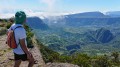
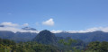
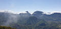
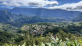
The Cirque de Salazie is renowned for its hikes. The one linking Hell-Bourg to Bélouve is a classic. It climbs along a rampart for about 500 m of elevation gain. The climb is often winding and rarely difficult, although the slope is present almost all the way. Much of the hike is in the undergrowth. However, this climb offers sumptuous views of the entire cirque, with the final viewpoint at the lodge providing a spectacular finale.

Details

2892447
Creation:
Last update:
Last review:
  • Walking
    Activity: Walking
  • ↔
    Distance: 3.32 mi
  • ◔
    Average duration: 3h 05 
  • ▲
    Difficulty: Moderate

  • ⚐
    Back to start: Yes
  • ↗
    Ascent: + 1,791 ft
  • ↘
    Descent: - 1,795 ft

  • ▲
    Highest point: 4,902 ft
  • ▼
    Lowest point: 3,150 ft

Description of the walk

Access: on arriving in Hell-Bourg town centre, take the first left onto Rue André Fontaine and walk past the town hall. Then keep left at every junction until you reach the next picnic area.

(S/E) Start the hike at the Bellevue picnic area, where tables, shelters and a water point are available. Then follow a track for about a hundred metres.

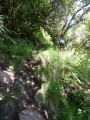
(1) At the end of the track, turn left onto the path which begins to climb gently. Rocks are everywhere along the route! The start takes you past casuarina trees and chouchou fields. The first hairpin bends soon appear amongst the tibouchinas.

There are numerous views of the cirque during this first half of the climb, and you’ll have the chance to admire Piton d’Anchaing, Piton Maillot, Hell Bourg, Mare à Poule d’Eau and its eponymous lake, Ilet à Vidot, Plaine d’Affouche, Bélier, Mare à Martin, Mare à Vielle Place, Mare à Citron, Cimendef, Roche Écrite, Piton Bé Massoune, Bécabot, Salazie and the Sisahaye Plateau at your feet. There are also numerous springs along this section of the route. The narrowest sections are secured with cables.

(2) The last spring is the largest and is situated near a wayside shrine. It is located just before a long traverse and at the end of a series of hairpin bends. A shorter stretch of hairpin bends follows: you are now halfway up the climb, both in terms of distance and elevation gain. The section that follows is flatter until the next cross.

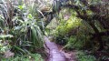
(3) This marks the start of a series of hairpin bends and the arrival at the mixed woodland. The slope is steeper and the path runs more through the undergrowth. It takes nearly thirty minutes to climb these bends and reach the remains of a cable car, which marks the arrival at the summit of the ridge.

(4) Then cross the Ravine de la Vierge and climb up the opposite slope via a few hairpin bends. You’ll reach the viewpoint at the Bélouve lodge after at least 1½ hours of climbing.

(5) Enjoy the view and follow the same route in the opposite direction to return to the car park (out and back).

Waypoints

  1. S/E : mi 0 - alt. 3,179 ft - Hell-Bourg - Bellevue
  2. 1 : mi 0.08 - alt. 3,166 ft - End of the trail
  3. 2 : mi 0.69 - alt. 3,773 ft - Source - Source du sentier reliant Hell Bourg à Bélouve
  4. 3 : mi 1.2 - alt. 4,265 ft - Croix
  5. 4 : mi 1.57 - alt. 4,810 ft - Old cable car
  6. 5 : mi 1.66 - alt. 4,902 ft - Gîte de Bélouve
  7. S/E : mi 3.32 - alt. 3,179 ft - Hell-Bourg - Bellevue

Notes

Set off early in the morning to enjoy the best views!
Several water sources available between (1) and (2).
Water point available at the lodge (5).
Accommodation available at the Bélouve lodge

Worth a visit

Places to see:
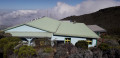
-The viewpoint at the Bélouve lodge (5) and its eco-museum.
-The old cable car (4).
-Tables and shelters available at (S/E).
-The Bébour/Bélouve primeval forest (5).

Things to do:
-Visit the village of Hell-Bourg on this route
-Option to extend the route from (5) by venturing into the primary forest or visiting the Trou de Fer
-Enjoy the various panoramic views.

Reviews and comments

4.7 / 5
Based on 9 reviews

Reliability of the description
4.6 / 5
Ease of following the route
4.7 / 5
Route interest
4.9 / 5
User 9608614

Overall rating : 5 / 5

Date of your route : Oct 27, 2025
Reliability of the description : ★★★★★ Very good
Ease of following the route : ★★★★★ Very good
Route interest : ★★★★★ Very good
Very busy route : Yes

A very beautiful hike offering views overlooking the cirque and providing access to the Trou de Fer if you extend the walk.
The slope is fairly steep but fairly even.

Machine-translated

stephwr
stephwr

Overall rating : 5 / 5

Date of your route : Aug 06, 2025
Reliability of the description : ★★★★★ Very good
Ease of following the route : ★★★★★ Very good
Route interest : ★★★★★ Very good
Very busy route : No

A very beautiful hike with no particular difficulties. We did it with our 6-year-old daughter, who had no particular difficulties. The view is very beautiful and it's a great place to have a picnic!

Machine-translated

Orando974
Orando974 ★

The trail is open again. I have adjusted the route to match the maps, as the old one was out of date. The description remains the same.

Machine-translated

Phibr
Phibr
• Edited:

Overall rating : 3.7 / 5

Date of your route : Oct 11, 2023
Reliability of the description : ★★☆☆☆ Disappointing
Ease of following the route : ★★★★☆ Good
Route interest : ★★★★★ Very good
Very busy route : Yes

This hike, described as moderate and accessible to all, seems to me to be poorly described, or else whoever wrote the description didn't actually do it. For me, accessible to all means everyone, but for people aged 60 and over, it's still a bit of a stretch. There is a 650-metre elevation gain (not 800 or 500), and the path is very narrow and rocky (which is normal, as we are in Réunion) and very slippery (luckily, it wasn't raining). None of this is mentioned in the description. Those who write the descriptions should consider that they are no longer 20 or 25 years old, but 40 years older.

Machine-translated

Gipet
Gipet
• Edited:

Overall rating : 5 / 5

Date of your route : Aug 10, 2023
Reliability of the description : ★★★★★ Very good
Ease of following the route : ★★★★★ Very good
Route interest : ★★★★★ Very good
Very busy route : No

The view of the Salazie cirque from the Bélouve lodge is simply exceptional – what a wonderful reward for the climb!

Machine-translated

danielfr40
danielfr40
• Edited:

Overall rating : 4.7 / 5

Date of your route : Mar 02, 2022
Reliability of the description : ★★★★★ Very good
Ease of following the route : ★★★★★ Very good
Route interest : ★★★★☆ Good
Very busy route : Yes

I really liked the trail, sometimes crossed by water
and the views on the way up
but the elevation gain is around 550 metres, not 800.
Thank you for this route.

Machine-translated

Tica 974
Tica 974
• Edited:

Overall rating : 5 / 5

Date of your route : Oct 16, 2021
Reliability of the description : ★★★★★ Very good
Ease of following the route : ★★★★★ Very good
Route interest : ★★★★★ Very good
Very busy route : Yes

A beautiful route that takes you to the Cirque de Salazie after about an hour's walk: it's magical!
Incredible views throughout the route, but there are some tricky sections, so you need to be careful.
Don't hesitate to give it a go!!!

Machine-translated

Dooky
Dooky
• Edited:

Overall rating : 4.3 / 5

Date of your route : Oct 12, 2020
Reliability of the description : ★★★★☆ Good
Ease of following the route : ★★★★☆ Good
Route interest : ★★★★★ Very good
Very busy route : Yes

Beautiful hike with lovely views of Salazie.
Beautiful view from the Belouve lodge.

Machine-translated

Manette974
Manette974
• Edited:

Overall rating : 5 / 5

Date of your route : Oct 11, 2020
Reliability of the description : ★★★★★ Very good
Ease of following the route : ★★★★★ Very good
Route interest : ★★★★★ Very good
Very busy route : Yes

We're glad we did this hike. We were apprehensive at first because of the climb. But we did it and continued on to the Trou de Fer viewpoint.
Even though I only walk occasionally, I did it.

Machine-translated

grave320
grave320
• Edited:

Overall rating : 4.7 / 5

Date of your route : Sep 14, 2019
Reliability of the description : ★★★★★ Very good
Ease of following the route : ★★★★☆ Good
Route interest : ★★★★★ Very good

A lovely warm-up on the heights of Hellbourg.

Machine-translated

Other walks in the area

For more walks, use our search engine .

The GPS track and description are the property of this route's author. Please do not copy them without permission.