Hell-Bourg – Caverne Dufour

A warm-up hike to the Piton des Neiges, though this is only suitable for experienced walkers as the slope is steep.

This walk is part of a multi-day hike: Les 3 cirques de La Réunion : Salazie - Cilaos - Mafate

Details

7571
Creation:
Last update:
Last review:
  • Walking
    Activity: Walking
  • ↔
    Distance: 5.26 mi
  • ◔
    Duration according to the author: 5 hrs 
  • ▲
    Difficulty: Very difficult

  • ⚐
    Back to start: No
  • ↗
    Ascent: + 5,292 ft
  • ↘
    Descent: - 240 ft

  • ▲
    Highest point: 8,146 ft
  • ▼
    Lowest point: 3,094 ft

Photos

Description of the walk

Head to Hell-Bourg, the starting point for this 4-day route, at the ‘Le p’tit blanc des O’ lodge.

(S) Head back up to take the Route Auguste Lacaussade on the right, as if heading towards Hell-Bourg. Cross the bridge and turn left into the car park towards the stadium.
Alternative route from the centre of Hell-Bourg: take Rue Olivier Manes (towards Ilet-à-Vidot) and, at the right-hand bend, carry on straight ahead along the path leading to the sports hall.
Head towards the stadium.

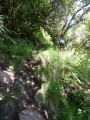
(1) Walk alongside it, keeping it on your left, and quickly start climbing the winding path. You’ll reach a viewpoint at the top station of the Monte Charge.

(2) Stay on the path and, heading steadily south-west, reach a junction of paths.

(3) Leave the path leading to La Vierge on your right and continue straight ahead. The slope begins to rise and soon becomes steep before ending at Les Échelles, which leads further on to the Caverne Mussard. Here, rejoin the GRR1.

(4) Turn right here, follow the crest of the caldera, and reach the point directly below the summit of the Trois Petits Bonhommes.

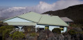
(5) Continue along theGR® to reach the Refuge de la Caverne Dufour at a leisurely pace (E).

Waypoints

  1. S : mi 0 - alt. 3,094 ft - Lodge Le p’tit blanc des O
  2. 1 : mi 0.69 - alt. 3,264 ft - Stage
  3. 2 : mi 1.44 - alt. 4,259 ft - Viewpoint
  4. 3 : mi 2.11 - alt. 4,531 ft - Carrefour de la Vierge
  5. 4 : mi 3.46 - alt. 7,028 ft - Ladders then GRR1
  6. 5 : mi 4.55 - alt. 7,907 ft - Directly below the summit of the Trois Petits Bonhommes
  7. E : mi 5.26 - alt. 8,130 ft - Refuge de la Caverne Dufour

Notes

There are no water sources along the route.
At the refuge, the water flow is very low and only a trickle of water runs; having a shower is virtually impossible (bring wet wipes).
Book accommodation in advance.

Always be cautious and plan ahead when you're outdoors. Visorando and the author of this route cannot be held responsible for any accidents occurring on this route.

The GR® and PR® markings are the intellectual property of the Fédération Française de Randonnée Pédestre.

Reviews and comments

4.8 / 5
Based on 3 reviews

Reliability of the description
4.7 / 5
Ease of following the route
4.7 / 5
Route interest
5 / 5
gattuso17
gattuso17
• Edited:

Overall rating : 5 / 5

Date of your route : Jan 03, 2020
Reliability of the description : ★★★★★ Very good
Ease of following the route : ★★★★★ Very good
Route interest : ★★★★★ Very good

Hike via Cap Anglais
Be warned: this is one of the steepest climbs on Réunion.
Walking poles are a great help.
The vegetation takes up a lot of space on the path at the start of the hike, particularly on the hairpin bends. In wet weather, your shoes may get wet.
The rocks are also quite slippery in wet weather.
The climb is quite long and requires a good level of fitness.
It took us 2 hours 45 minutes to complete the route, which was better than the time indicated on the sign.

After that, on the way back to the lodge, the slope is less steep. You can see the lodge from a distance, so don’t get discouraged by the last few kilometres of walking to reach it. A good night’s sleep awaits you there. ;-)

Machine-translated

Mysterdub
Mysterdub
• Edited:

Overall rating : 4.3 / 5

Date of your route : May 10, 2018
Reliability of the description : ★★★★☆ Good
Ease of following the route : ★★★★☆ Good
Route interest : ★★★★★ Very good

A particularly challenging hike. It climbs very steeply and you regularly have to use your hands to help yourself up. Some sections are particularly steep.
I usually complete hikes in less time than indicated. This time, it took me 8 hours, compared to the 6 hours stated.

Machine-translated

Gege23
Gege23

We did complete this stage, but we went via the Bellouve lodge and the forest of the same name. It’s a slightly longer stage, but perhaps a little less physically demanding. What’s more, the Bellouve forest is stunning and well worth a visit.

Even via the Bellouve lodge, the stage is very physically demanding.

Machine-translated

Surfou
Surfou

Overall rating : 5 / 5

Date of your route : Mar 26, 2017
Reliability of the description : ★★★★★ Very good
Ease of following the route : ★★★★★ Very good
Route interest : ★★★★★ Very good

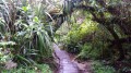
The climb is steep but shaded all the way to Cap Anglais. You do, however, need to be careful, as in places the path becomes narrow and is covered in leaves.

Machine-translated

Other walks in the area

For more walks, use our search engine .

The GPS track and description are the property of this route's author. Please do not copy them without permission.