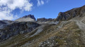
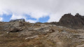
Moiry Dam – Arolla

From Zinal to Arolla, you need to take a bus to the Moiry dam, which drops you off at the same spot in 50 mins–1 hour (it goes all the way up to Vissoie, which makes the journey longer). It’s also possible to try and find accommodation in St-Luc or Vissoie.

This walk is part of a multi-day hike: Tour du Cervin

Details

n°103737884
Creation:
Last update:
Last review:
–
  • Walking
    Activity: Walking
  • ↔
    Distance: 8.58 mi
  • ◔
    Average duration: 8h 15 
  • ▲
    Difficulty: Very difficult

  • ⚐
    Back to start: No
  • ↗
    Ascent: + 4,970 ft
  • ↘
    Descent: - 5,679 ft

  • ▲
    Highest point: 9,573 ft
  • ▼
    Lowest point: 4,544 ft

Description of the walk

(S) From the bus stop at the Moiry dam, walk along the crest of the dam towards the west.

(1) Take a path heading south which climbs gently.

(2) Turn westwards towards the Col de Torrent. You’ll reach the Torrent mountain pasture.

(3) Continue westwards.

(4) Pass the Lac des Autannes on your left. Continue climbing to the Col de Torrent.

(5) Descend on the other side.

(6) Pass through Béplan and continue downhill, heading south then south-south-west. Arrive at the hamlet of Villa.

(7) Head towards Évolène (do not follow the road towards the bridge).

(8) Head down a path on the left. After a steep, winding section, the path continues gently downwards towards the road, which you reach at a roundabout. Arrive at the La Fauchère bus stop (E) (service to Arolla).

Waypoints

  1. S : mi 0 - alt. 5,282 ft - Bus stop at the dam - Lac de Moiry
  2. 1 : mi 0.44 - alt. 7,438 ft - Western end of the dam
  3. 2 : mi 1.16 - alt. 7,851 ft - Junction
  4. 3 : mi 1.84 - alt. 8,291 ft - Torrent mountain pasture
  5. 4 : mi 2.58 - alt. 8,816 ft - Lac des Autannes
  6. 5 : mi 3.4 - alt. 9,521 ft - Col de Torrent (2916 m)
  7. 6 : mi 4.72 - alt. 8,130 ft - Bèplan
  8. 7 : mi 7.31 - alt. 5,699 ft - Villa (Évolène)
  9. 8 : mi 7.48 - alt. 5,538 ft - Shortcut
  10. E : mi 8.58 - alt. 4,570 ft - La Fauchère bus stop (381)

Other walks in the area

For more walks, use our search engine .

The GPS track and description are the property of this route's author. Please do not copy them without permission.