Country:

 City:
City:


The entire walk is signposted either with a yellow line (PR®) or a double yellow/red line (GRP®). Follow the guide, and be careful, as there are three junctions mentioned in the description below where neither the signposting nor the path to take is very clearly visible.
Les Trois Termes car park, at the junction of the D177 and D244, north of Sénanque Abbey. A few shaded spaces.
(S/E) Look out for the “Trois Termes” signpost and head towards “La Haute Pouraque” (PR® yellow markings).
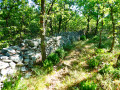
(1) At the “La Haute Pouraque” signpost, turn right onto the GRP®, heading towards the “Mur de la Peste”, a section of which can be seen on the right-hand side of the path a few hundred metres further on, well before the “Mur de la Peste” signpost.
(2) At the “Mur de la Peste” signpost, continue straight on towards “La Corneirette”, which is opposite the DFCI water tank, on the other side of the D177.
(3) At the “La Corneirette” signpost, cross the departmental road with care, and take the track towards “Vaulongue” for about a hundred metres, keeping a close eye out for the GRP® markings on the left-hand side before the first bend in this track.
(4) Please note: both the signposting and the path, which branches off to the left, are barely visible. Take this path.
(5) The same applies a few hundred metres further on: the GRP® trail’s fork to the right is barely visible. This applies to both the trail itself and the markings. Ignore the path that continues straight ahead, and turn right until you reach a new section of the Plague Wall.
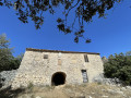
(6) Turn left and follow this GRP®-marked path, which runs alongside the Plague Wall for a considerable distance. Please note that the path sometimes runs on the left-hand side and sometimes on the right. Ignore the two wide tracks that the path crosses, and further on, join a wide track coming from the right. At the next junction, there is a hunting shelter, open to the public. This is the only place where you can take shelter in the event of bad weather.
(7) Turn right onto the wide, downhill track; reach the D4 road and follow it to the left for about 350 metres.
(8) At the “Vaulongue” signpost, leave the road and climb the stony path to the right, towards “La Fuste”, still following the GRP® markings. At the top, the path widens and becomes a forest track. Continue until you reach a sharp bend to the right.
(9) Be careful here too: don’t miss the small path branching off to the left, just before the path’s wide bend. Continue along the path, which also widens a little further on, until you reach a junction.
(10) At the “La Fuste” signpost, turn right towards the “Croix de la Fuste”, still following the GRP® markings.
(11) At the “Croix de la Fuste” signpost, turn right towards the “Col de Murs”, still following the GRP® markings.
(12) At the “Col de Murs” signpost, leave the GRP® trail and join the PR® (yellow line markings). Cross the D4 with care, then head more or less straight ahead towards “Mallet”.
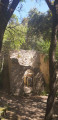
(13) Some inconsiderate people have seen fit to tag the walls of the old sheepfold at Jas du Griffon. Continue along the track to “Mallet”.
(14) At the “Mallet” signpost (note that it is not located where indicated on the IGN map background but precisely at (14) – perhaps it was previously situated there?), take the track to the right and follow it to the D2 road.
(15) Cross it carefully, and continue along the PR® marked path (yellow line) opposite. The path leads to a private property. Just before the property, take the PR® marked path (yellow line) which branches off to the right and leads to the Parking des Trois Termes car park (S/E).
 Visorando Member


 Difficult
  Easy
Easy