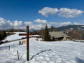
La Croix Cartier, starting from Saint-Nicolas-la-Chapelle

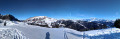
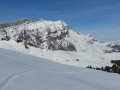
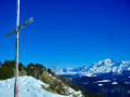
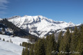
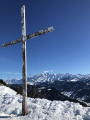
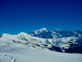
A hike to the Croix Cartier which involves some technical sections and offers magnificent views (in good weather), particularly of the Etale and Mont Blanc massifs. This hike requires a good sense of direction.

Details

216273
Creation:
Last update:
Last review:
  • Snowshoeing
    Activity: Snowshoeing
  • ↔
    Distance: 7.34 mi
  • ◔
    Duration according to the author: 6 hrs 
  • ▲
    Difficulty: Difficult

  • ⚐
    Back to start: Yes
  • ↗
    Ascent: + 1,798 ft
  • ↘
    Descent: - 1,811 ft

  • ▲
    Highest point: 6,014 ft
  • ▼
    Lowest point: 4,265 ft

Photos

Description of the walk

Access: At Flumet, head towards La Giettaz and turn left onto the D113 towards Saint-Nicolas-la-Chapelle. In the village, follow signs for Vallon de Chaucisse (to the right). Please note that the road is not immediately cleared of snow… Park in the small car park by the roadside which marks the start of the route to the Avenières mountain pasture (the road is too snow-covered to continue).

(S/E) Head north along the road leading up to La Chaussisse (at the first Fork in the road, ignore the road leading up to the left).

(1) At La Chaussisse, head straight ahead (north-east) towards the hamlet of Les Carrés, following the purple snowshoe markings.

(2) Join the Route des Carrés and follow it for 300 metres to the right (east).

(3) At the small pass at a place called Les Carrés, turn sharply left (wooden sign) and follow a forest track that winds its way uphill.

(4) At the junction, continue the ascent, letting the path to Paravis branch off to the north, and take a sharp left-hand bend. Just before the next sharp right-hand bend, the path narrows and becomes harder to follow if there are no tracks. You’ll reach the edge of the forest.

(5) Continue along the edge of the forest, heading north-west, until you reach the Croix Cartier.

(6) Head westwards and arrive at the foot of the cross.

(7) Head west, downhill, to reach the Col de Peloset across the mountain pasture.

(8) At the pass, follow the valley that opens up to the south-west and head for the 1600-metre mark.

(9) Continue down the mountain pasture track. After a few hairpin bends, you’ll reach the start of an avalanche couloir approximately 400m long (safety equipment compulsory).

(10) Follow the track east-south-east.

(11) At the end of the avalanche couloir, descend gently towards Chaucisse through the village, following – and occasionally cutting across – the hairpin bends of the mountain pasture road.

(1) At Chaucisse, turn right and follow the road for 2 km back to the starting point (S/E).

Waypoints

  1. S/E : mi 0 - alt. 4,327 ft - Stream under the Avenières
  2. 1 : mi 1.29 - alt. 4,321 ft - Chaucisse
  3. 2 : mi 1.84 - alt. 4,675 ft - Towards Les Carrés
  4. 3 : mi 2.05 - alt. 4,751 ft - Les Carrés
  5. 4 : mi 2.79 - alt. 5,256 ft - Junction with the path to Paravis
  6. 5 : mi 3.35 - alt. 5,705 ft - Final ascent
  7. 6 : mi 3.46 - alt. 5,971 ft - Croix Cartier
  8. 7 : mi 3.63 - alt. 5,948 ft - Below the Croix Cartier
  9. 8 : mi 4.25 - alt. 5,614 ft - Col de Peloset
  10. 9 : mi 4.52 - alt. 5,312 ft - Returning along the same route
  11. 10 : mi 4.79 - alt. 5,190 ft - Start of the avalanche couloir
  12. 11 : mi 5.12 - alt. 5,000 ft - End of the avalanche couloir
  13. S/E : mi 7.34 - alt. 4,327 ft - Stream under the Avenières

Notes

Significant avalanche risk between points (10) and (11). Safety equipment (avalanche transceiver, shovel, probe, survival blanket) compulsory.

A 1:25,000 map and compass are essential.

Worth a visit

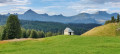
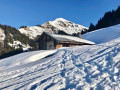
Pretty Savoyard chalets on the descent to Chaucisse.

Reviews and comments

4.4 / 5
Based on 3 reviews

Reliability of the description
4.3 / 5
Ease of following the route
4 / 5
Route interest
5 / 5
Zoltic
Zoltic

Overall rating : 4.7 / 5

Date of your route : Dec 20, 2021
Reliability of the description : ★★★★★ Very good
Ease of following the route : ★★★★☆ Good
Route interest : ★★★★★ Very good
Very busy route : No

A walk that’s already magnificent in summer, and simply stunning and very quiet in winter.

It’s well worth parking directly at Chaussice (marker 1) to save a good hour of uninteresting walking.

Signposting is very sparse and, in fresh snow, the route offers no other landmarks in places apart from the GPS track.

If you have 5–10 minutes to spare, you can take a detour via the Croix Stata (be careful, as the cliff face begins immediately afterwards).

The return journey, which is rather tedious in summer, can be speeded up considerably by cutting across the hairpin bends on the road. The long straight stretch cannot be avoided and is a genuine avalanche couloir (an avalanche had already come down when we passed through).

Machine-translated

tve64
tve64
• Edited:

Overall rating : 4.3 / 5

Date of your route : Feb 27, 2019
Reliability of the description : ★★★★☆ Good
Ease of following the route : ★★★★☆ Good
Route interest : ★★★★★ Very good

A lovely hike with splendid views.
We did it in the opposite direction, which had the advantage of passing through the avalanche-prone section – which faces due south – in the morning, thereby minimising the risk of large and dangerous wet snow slides in the area, which occur after prolonged exposure to the sun and during thaws.
It is nevertheless prudent to wait until these grassy slopes have been cleared of snow before undertaking the hike. The snow and mountain weather forecast generally indicates this. Once the slopes have been cleared, the risk in the area is significantly lower.

We were able to park at Chaucisse, which saves us from having to walk along a rather uninteresting stretch of road.
Following the guidebook, I would say that at point number 5, it is easier (though longer) to continue along the path and then reach the Cartier Cross via the ridge at the edge of the forest. The climb up the slope from point No. 5 to the cross is quite steep (there were no tracks indicating that any walkers had ascended directly to the cross via this route).

An alternative route is to head for the Stata Cross and then descend, keeping the Peloset chalets on your right as you follow the hairpin bends, before reaching point No. 10.

Machine-translated

gillou91
gillou91

Overall rating : 4.3 / 5

Date of your route : Dec 10, 2016
Reliability of the description : ★★★★☆ Good
Ease of following the route : ★★★★☆ Good
Route interest : ★★★★★ Very good

A superb hike. The weather was exceptionally fine that day. The views were absolutely stunning. We carried on to the Stata cross, about a 30-minute walk away. The snow was hard from around 1,700 metres, so there was no need for snowshoes or anything else. A lovely hike to enjoy in any season.

Machine-translated

Other walks in the area

For more walks, use our search engine .

The GPS track and description are the property of this route's author. Please do not copy them without permission.