


Refine your search for walks in Bettmerhorn Blick
Bettmerhorn Blick walks


 From Bettmeralp to Fiecheralp via the Bettmerhorn Bergstation
 Visorando Member
 4.75 mi
 +2,313 ft
 -1,483 ft
 4h 10
4h 10
 Difficult
 Departure from Betten (Valais)
A very beautiful alpine hike that will take you from the village of Bettmeralp to the Bettmerhorn viewpoint. You’ll enjoy a magnificent view of the Aletsch Glacier. The rest of the route, which is downhill, will take you to Fiescheralp.
Walks near Bettmerhorn Blick
The Eggishorn from the Bettmerhorn top station
 8.50 mi
+2,110 ft
-4,462 ft
5h 45
Difficult
Departure from Betten (Valais)
8.50 mi
+2,110 ft
-4,462 ft
5h 45
Difficult
Departure from Betten (Valais)
A very beautiful route starting from the upper Bettmerhorn station. After a panoramic viewpoint right at the start of the hike, you’ll make your way to the second summit, which offers the widest panorama of the Aletsch Glacier.
Route around Fiescheralp to see the Aletsch Glacier
13.28 mi
+5,810 ft
-5,007 ft
2 days
Difficult
Departure from Betten (Valais)
A stunning alpine hike taking you to the two most beautiful viewpoints over the Aletsch Glacier. In the evening, you’ll enjoy the tranquillity of these two villages, which also offer superb views of the Valais’ 4,000-metre peaks: the Dom, the Matterhorn and the Weisshorn
 Moosfluh – Riederfurka – Bettmeralp
 4.82 mi
+312 ft
-1,634 ft
3 hrs
4.82 mi
+312 ft
-1,634 ft
3 hrs
 Moderate
Departure from Riederalp (Valais)
Moderate
Departure from Riederalp (Valais)
A superb panoramic hike, with a remarkable view of the Aletsch Glacier. On arriving at Riederfurka, you will notice Villa Cassel.
Märjelenseestube - Bellwad via the Aletsch Panoramaweg
 5.76 mi
+1,004 ft
-3,652 ft
3h 30
Difficult
Departure from Fieschertal (Valais)
5.76 mi
+1,004 ft
-3,652 ft
3h 30
Difficult
Departure from Fieschertal (Valais)
This third stage will take you to the Fieschergletcher, which runs parallel to the Aletschgletcher. On the Aspi Titter suspension bridge, you will be impressed by the depth of the Weisswasser river gorges. This fairly technical end of the route ends in the beautiful village of Bellwad, which has preserved its traditional chalets.
Riederalp - Märjelenseestube via the Aletsch Panoramaweg
 7.85 mi
+2,569 ft
-1,138 ft
5h 50
Difficult
Departure from Riederalp (Valais)
7.85 mi
+2,569 ft
-1,138 ft
5h 50
Difficult
Departure from Riederalp (Valais)
This second stage passes through the Rieder Furka and Villa Cassel again. The trail then follows a moraine offering several views of the glacier. The climb to the Härdernagrat offers exceptional views of both the Aletsch Glacier and the Valais peaks rising to over 4,000 metres, including the Matterhorn. After HohBalm, the Aletsch Glacier remains your faithful companion before disappearing at the Märjelenseestube.
Belalp - Riederalp via the Aletsch Panoramaweg
 7.13 mi
+2,215 ft
-2,615 ft
5h 15
Difficult
Departure from Naters (Valais)
7.13 mi
+2,215 ft
-2,615 ft
5h 15
Difficult
Departure from Naters (Valais)
A superb route that quickly offers views of the Aletsch Glacier. You’ll descend towards the gorges of the River Massa (Massschlucht), which flows from the Aletsch Glacier. To cross to the other side of the canyon, you’ll take the Massa suspension bridge, which is 124 metres long and sits at a height of over 80 metres. After the pleasant Riederfurka Pass, you’ll descend to the peaceful, car-free village of Riederalp.
Aletsch Panorama Trail
 22.67 mi
+6,181 ft
-7,799 ft
4 days
Difficult
Departure from Naters (Valais)
22.67 mi
+6,181 ft
-7,799 ft
4 days
Difficult
Departure from Naters (Valais)
Three-day itinerary featuring the two largest glaciers in the Alps. Numerous viewpoints of the Alpine glaciers and three- and four-thousand-metre peaks in Valais, such as the Matterhorn, the Weisshorn and the Fletschhorn.
From Binn to Simplon Pass
 54.93 mi
+19,777 ft
-17,884 ft
7 days
Difficult
Departure from Binn (Valais)
54.93 mi
+19,777 ft
-17,884 ft
7 days
Difficult
Departure from Binn (Valais)
This hike is inspired by the Walser Tour and the Mineralien Tour. This magnificent route crosses numerous mountain pastures, where the dwellings are very varied: from wooden chalets to stone chalets. The hamlet of Salecchio Superiore consists of magnificent wooden chalets, several centuries old, all very well preserved. The chalet that houses the dormitories of the Rifugio "Zum Gora" dates back to the 17th century. In Italy, the route at the foot of the peaks bordering Switzerland, including Monte Leone, takes us through two regional parks: the Parco Naturale dell'Alpe Veglia and the Parco Naturale dell'Alpe Devero.
Binn - Binntal Hütte
 6.89 mi
+3,228 ft
-423 ft
6h 00
Difficult
Departure from Binn (Valais)
6.89 mi
+3,228 ft
-423 ft
6h 00
Difficult
Departure from Binn (Valais)
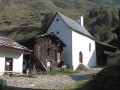
This stage is common to both the Walser Tour and the Valrando Mineral Tour. A few houses line this path in Freichi and then in Blatt. The Ofenhorn can be admired all the way to the Binntal Hütte. Although this is German-speaking territory, French is surprisingly the dominant language in this hut. The Binntal Hütte belongs to the Swiss Alpine Club: Delémont section.
Binn - Crampiolo
 8.06 mi
+3,960 ft
-2,782 ft
7h 10
Difficult
Departure from Binn (Valais)
8.06 mi
+3,960 ft
-2,782 ft
7h 10
Difficult
Departure from Binn (Valais)
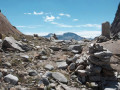
This stage is common to both the Mineralien Tour and the Walser Tour. The Geisspfadpass marks the border between Switzerland and Italy. In Binn, cross the small bridge over the Binna, follow the road to Fäld for about 1 km, and a sign on the right indicates the path to Geisspfadsee and Mässersee. This path joins the one coming from Fäld at the Mässerchäller chalet (1,879 m). Follow the signs for Maniboden. The climb to the Geisspfadpass is then very easy. The descent to Piano della Rossa is through large scree, with passages equipped with chains and ladders, but no particular difficulty. The descent to Crampiolo is very pleasant.Markings: White-Red-White]. Via Alpina Blue D3 and D2