Russy Forest, east of the D956

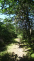
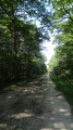
A forest walk along a shaded route with no technical difficulties. A peaceful walk through a quiet area, beneath a variety of tree species.

Details

n°10713997
Creation:
Last update:
Last review:
  • Walking
    Activity: Walking
  • ↔
    Distance: 7.47 mi
  • ◔
    Average duration: 3h 30 
  • ▲
    Difficulty: Moderate

  • ⚐
    Back to start: Yes
  • ↗
    Ascent: + 39 ft
  • ↘
    Descent: - 39 ft

  • ▲
    Highest point: 322 ft
  • ▼
    Lowest point: 282 ft

Photos

Description of the walk

Car park at the entrance to the Allée de Pezay.

(S/E) Cross the D923 and take the Allée des Laudières opposite, for approximately 450 m.

(1) Turn right onto the track before the green metal fence. Follow this track alongside the electric fence. At marker 95, turn left to reach the edge of the forest. (However, it is possible to continue straight on to marker 92 without leaving the track or the cover of the trees).

(2) Turn right and carry on along the edge of the woodland. You’ll reach the Allée de Clénord.

(3) Head straight ahead and continue along the edge of the forest.

(4) Turn right onto the path between plots 171 and 170. At the end, turn left onto the Allée de Clénord and follow it to the D923. Cross the road carefully and continue straight ahead for about 600 m.

(5) Turn left onto the path between plots 167 and 159. When you reach the crossroads, cross the Allée de Beauregard and take the path leading off to the right, just after the small bridge. Follow it as far as the Allée de Chailles at Mont-près-Chambord. Turn right, then, after about fifty metres, turn left between the woodland and the coppice.

(6) When you reach the Allée de Pezay, cross it and take, opposite, the shady path that crosses the perchis between plots 131 and 133. At the end, turn right onto the Allée de Clénord and continue to the Croix Pineau crossroads (signpost).

(7) Turn left at a 90-degree angle onto the Allée de Chailles in Mont-près-Chambord, heading towards the D765. When you reach the road, turn right onto the Allée du Camp and head for the car park (S/E).

Waypoints

  1. S/E : mi 0 - alt. 322 ft - Car park – D923 road
  2. 1 : mi 0.3 - alt. 322 ft - Metal fence
  3. 2 : mi 1.1 - alt. 305 ft - Crossroads
  4. 3 : mi 2.03 - alt. 292 ft - Allée de Clénord
  5. 4 : mi 2.67 - alt. 292 ft - Plots 171 and 170
  6. 5 : mi 3.73 - alt. 299 ft - Plots 167 and 159
  7. 6 : mi 4.92 - alt. 302 ft - Allée de Pezay
  8. 7 : mi 5.71 - alt. 308 ft - Croix Pineau
  9. S/E : mi 7.47 - alt. 322 ft - Car park – D923 road

Notes

A shelter near the Croix Pineau crossroads.

Depending on conditions, some sections may be muddy and slippery. Depending on the season, bring: gaiters, water bottle(s), cereal bars, a spare battery, mosquito repellent, a hat, rainwear, etc.

State-owned forests are hunting grounds. The hunting areas, days and times can be found at: https://www.onf.fr/chasse/les-calendrier....

Worth a visit

Nearby:
The Musée des Montils and the seven museums in Blois.
The châteaux of Blois, Beauregard and Villesavin.
The natural swimming pool at Mont-près-Chambord in summer.
Maison de la Loire in Saint-Dyé and the Chaussée Saint-Victor.
Other walks, geocaching.

Reviews and comments

3.7 / 5
Based on 2 reviews

Reliability of the description
4 / 5
Ease of following the route
3.5 / 5
Route interest
3.5 / 5
Louni
Louni
• Edited:

Hello
Looking at the map and comparing it with the description, I’ve spotted a mistake!
At point 6, it says to take the path opposite that runs between plots 147 and 133!
However, on the map it is clear that these plots are numbered 131 and 133.
Please could you check this?
Kind regards
jlp45

Machine-translated

mitch85
mitch85

Overall rating : 2.7 / 5

Date of your route : Oct 10, 2022
Reliability of the description : ★★★☆☆ Average
Ease of following the route : ★★☆☆☆ Disappointing
Route interest : ★★★☆☆ Average
Very busy route : No

A pleasant route to start with, running along the edge of the forest, but it becomes monotonous afterwards with long straights
Furthermore, it isn’t signposted, so it’s not always easy to spot the changes in direction

Machine-translated

bionat
bionat

Overall rating : 4.7 / 5

Date of your route : Aug 26, 2021
Reliability of the description : ★★★★★ Very good
Ease of following the route : ★★★★★ Very good
Route interest : ★★★★☆ Good
Very busy route : No

A pleasant, easy walk along lovely forest paths.
A quick note: the section via point 2 (between elevations 95 and 92) is of no particular interest (recycling centre, field edges, etc.), so you might as well follow the dotted line on the map.
You can shorten the route by going directly from marker 5 to marker 7; in this case, the route will be 9.44 km.
It’s a bit noisy near the D956 (a dual carriageway towards Romorantin); you can take a shortcut via a side lane.

Machine-translated

Other walks in the area

For more walks, use our search engine .

The GPS track and description are the property of this route's author. Please do not copy them without permission.