Russy Forest

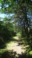
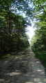
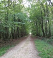
A shaded forest walk with no technical difficulties. Peace and quiet are guaranteed along most of the route, beneath the centuries-old oak trees.

Details

n°10712449
Creation:
Last update:
Last review:
  • Walking
    Activity: Walking
  • ↔
    Distance: 9.23 mi
  • ◔
    Average duration: 4h 20 
  • ▲
    Difficulty: Moderate

  • ⚐
    Back to start: Yes
  • ↗
    Ascent: + 56 ft
  • ↘
    Descent: - 56 ft

  • ▲
    Highest point: 322 ft
  • ▼
    Lowest point: 266 ft

Description of the walk

Park in the car park at the entrance to the Allée de Pezay.

(S/E) Cross the D923 and take the Allée des Laudières for a few hundred metres. You’ll reach the junction with a track just before the metal fence.

(1) Turn right onto it and follow this track alongside the electric fence. You’ll reach the white track of the Allée de Clénord.

(2) Leave it on your right and continue along the edge of the forest. At the end, go through the gate and rejoin the D923 road.

(3) Walk along it to the left for about ten metres, then turn left; continue to the sawmill and turn right onto the track, which becomes grassy in front of a small house. Further on, at the houses, turn right onto the tarmac road to rejoin the D923.

(4) Cross it carefully and take the almost straight bridle path opposite, continuing to the junction of the Allée de Chailles and Mont.

(5) Turn left onto it and follow it to the track at the edge of the forest.

(6) Turn right in front of the sawmill and stay on the path at the edge of the forest. Stay on this path until it joins theGR®31.

(7) Turn right onto it, head into the woods and join the D765.

(8) Turn right and follow the road carefully for about a hundred metres, then turn right onto the Allée de Clénord. At the first junction, turn left onto the Route Forestière du Parc des Éveux. At the end of this, turn left towards the D956. Before reaching it, turn right onto a narrow bridle path. At the end, turn left onto the Allée de Beauregard. Then turn right to reach the T-junction of the Allée de Chailles at Mont-près-Chambord. Turn left here and join the D956.

(9) Turn right onto Allée du Camp and, following a completely straight stretch of road, you’ll reach the car park on Allée de Pezay (S/E).

Waypoints

  1. S/E : mi 0 - alt. 322 ft - Car park at the start of the Allée de Pezay
  2. 1 : mi 0.29 - alt. 322 ft - Metal fence
  3. 2 : mi 1.93 - alt. 289 ft - Allée de Clénord junction
  4. 3 : mi 2.81 - alt. 299 ft - D923 junction
  5. 4 : mi 3.43 - alt. 299 ft - D923 junction
  6. 5 : mi 3.98 - alt. 302 ft - Junction at Allée de Chailles in Mont.
  7. 6 : mi 4.38 - alt. 312 ft - Edge of the woodland
  8. 7 : mi 5.56 - alt. 285 ft - GR31
  9. 8 : mi 6.37 - alt. 266 ft - D765 junction
  10. 9 : mi 8.43 - alt. 318 ft - D956 junction
  11. S/E : mi 9.23 - alt. 322 ft - Car park at the start of the Allée de Pezay

Notes

Bus shelter on the D923
This walk was mapped using OMS Randonnée Monde; therefore, some differences in the route may appear when viewed on an IGN Topo map.
Depending on the weather, some sections may be muddy and slippery.
Depending on the season, bring: gaiters, water bottles, cereal bars, a spare battery, mosquito repellent, a hat, rainwear...
State-owned forests are hunting grounds. The hunting areas, days and times can be found at: https://www.onf.fr/chasse/les-calendrier...

Worth a visit

Nearby
The Musée des Montils and the seven museums in Blois.
The châteaux of Blois, Beauregard and Villesavin.
The natural swimming pool at Mont-près-Chambord in summer.
Maison de la Loire in Saint-Dyé and the Chaussée Saint-Victor.
Other walks, geocaching.

Always be cautious and plan ahead when you're outdoors. Visorando and the author of this route cannot be held responsible for any accidents occurring on this route.

The GR® and PR® markings are the intellectual property of the Fédération Française de Randonnée Pédestre.

Reviews and comments

3.8 / 5
Based on 2 reviews

Reliability of the description
4 / 5
Ease of following the route
4 / 5
Route interest
3.5 / 5
noemie95
noemie95

Overall rating : 4.3 / 5

Date of your route : Aug 09, 2026
Reliability of the description : ★★★★☆ Good
Ease of following the route : ★★★★★ Very good
Route interest : ★★★★☆ Good
Very busy route : No

A pleasant walk, but you can hear a lot of traffic noise (due to its proximity to the main road). If you’re looking for a quieter walk, choose a different route.

I’d also recommend starting the walk from somewhere other than the spot indicated. The recommended car park is really small and often full.

Machine-translated

suzanne binder
suzanne binder

Overall rating : 3.3 / 5

Date of your route : Dec 06, 2021
Reliability of the description : ★★★★☆ Good
Ease of following the route : ★★★☆☆ Average
Route interest : ★★★☆☆ Average
Very busy route : No

In winter, it’s impossible to park in the designated car park – no doubt because of the hunting season. The only place to park is along the road, and it isn’t very big, especially when you’re with a group!
Otherwise, the route is good

Machine-translated

Other walks in the area

For more walks, use our search engine .

The GPS track and description are the property of this route's author. Please do not copy them without permission.