Amidst the vineyards and the River Beuvron around Mont-près-Chambord

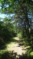
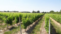
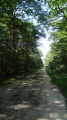
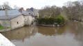
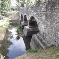
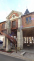
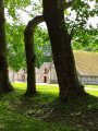
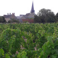
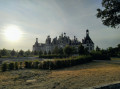
Situated at the crossroads between the châteaux of Chambord, Villesavin and Cheverny, the village of Mont-près-Chambord is renowned for its Cheverny and Cour Cheverny vineyards, which shape the local landscape.

Details

n°2242173
Creation:
Last update:
Last review:
  • Walking
    Activity: Walking
  • ↔
    Distance: 6.28 mi
  • ◔
    Average duration: 3h 00 
  • ▲
    Difficulty: Easy

  • ⚐
    Back to start: Yes
  • ↗
    Ascent: + 102 ft
  • ↘
    Descent: - 102 ft

  • ▲
    Highest point: 354 ft
  • ▼
    Lowest point: 240 ft

Photos

Description of the walk

The walk starts from the car park at the Grand Place, near the post office on the edge of Rue Nationale.

(S/E) From the Grand Place, cross the main road and head straight ahead into the street marked ‘No Entry’, then walk alongside the school to reach the sports hall, which you will go round by taking the compacted track heading south. Turn right where you meet Rue du Bellaugeon to reach Rue des Martinières, where you’ll head left. Ignore the first turn-off to the swimming pool on the left and the streets on the right.

(1) Turn left onto the next path, which is flanked by vegetation. This grassy path turns left and then runs alongside some vineyards. Turn right when you reach the Chemin des Près de la Fontaine, which cuts across. Keep to the right on the hard-surfaced track alongside the campsite.

(2) Turn right onto the cross street, Rue du Gué, then left after about 50 metres onto Rue du Vardet.

(3) At the Gaubodière crossroads, leave the tarmac and take the grassy track on the right. Cross Rue du Bournigal and continue straight ahead on the narrower grassy track. Pass the first junction, then turn left onto the cross-track to reach Route des Ponts d’Arian (D154).

(4) Turn right onto the Route des Ponts d’Arian, then keep right at the Fork in the road onto the narrower road, Rue de la Giraudière.

White-and-red markings (GR®3)

(5) In the hamlet, turn right at the crossroads onto Rue de Meneuil, following theGR®3signposting towards Cellette; then, in the hamlet of Le Clos Tricot, after the left-hand bend, turn left at the Fork in the road onto the grassy track. After about 200 metres, walking alongside the vineyards, take the first path on the right. Turn left where the path meets Rue du Gué, a cross-road. Pass through the hamlet of La Métairie, a dairy farm.

(6) After the dairy farm of La Métairie, take the first path on the right, then turn left onto Rue Bagueneau, a side street, until you reach the junction with the Route de Villesavin.

(7) Follow the Route de Villesavin to the right. Ignore the path on the left, then the street on the right, heading towards Clenord.

Nature Discovery Trail signposting

(8) At the next junction, turn left towards the hamlet of La Chancelée. Rue de la Chancelée bends sharply to the right.

(9) Keep left at the Fork in the road onto the gravelled track. This approaches the Beuvron, then runs alongside the strip of woodland before turning right. Cross the Villesavin road and continue straight ahead. Pass through the hamlet of Les Milleries, ignoring the various off-roads.

(10) Leave Rue des Milleries by turning right, following the sign for ‘Chemin Découverte Nature’. The path goes through a wood. Turn left at the junction, then right onto the gravelled track, the Chemin de la Taille.

End of signposting

(11) At the crossroads, continue straight ahead along Rue de la Robinière, then turn left at the junction with a side street. This leads onto Rue de la Martinière, which you took on the way there.

(1) Ignore the path on the right that you took on the way there; stay on Rue de la Martinière, then turn right onto Rue du Bellaugeon after the path leading to the swimming pool. Keep to the left at the Fork in the road to take the gravel track that goes round the sports hall. Walk alongside the school, cross Rue Nationale to reach the Grand Place de la Poste (S/E).


Waypoints

  1. S/E : mi 0 - alt. 341 ft - Car park at the Grand Place near the post office
  2. 1 : mi 0.48 - alt. 318 ft - Junction of the circular loop
  3. 2 : mi 0.95 - alt. 348 ft - Turn right onto the side street, Rue du Gué
  4. 3 : mi 1.22 - alt. 351 ft - La Gaubodière
  5. 4 : mi 1.67 - alt. 308 ft - On the right: Route des Ponts d’Arian
  6. 5 : mi 1.99 - alt. 299 ft - Turn right at the junction onto Rue de Meneuil
  7. 6 : mi 2.87 - alt. 272 ft - The hamlet of La Dairy Farm
  8. 7 : mi 3.24 - alt. 269 ft - On the right: Route de Villesavin
  9. 8 : mi 3.61 - alt. 282 ft - Turn left towards the hamlet of “La Chancelée”
  10. 9 : mi 3.83 - alt. 272 ft - Turn left at the fork in the road onto the compacted track
  11. 10 : mi 4.96 - alt. 295 ft - Nature Discovery Trail
  12. 11 : mi 5.42 - alt. 305 ft - Opposite, Rue de la Robinière
  13. S/E : mi 6.28 - alt. 341 ft - Car park at the Grand Place near the post office

Notes

The numerous junctions require constant vigilance during the walk: be sure to follow the red-and-white markings on theGR®3, then follow the ‘Chemin découverte nature’ signs on the nature trail.

Worth a visit

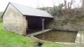
The Mont-Prés-Chambord natural swimming area is a place of interest. On either side of the lake, two regeneration zones are planted with vegetation that helps maintain the biological balance of the environment.

Nearby is the Château de Chambord

Always be cautious and plan ahead when you're outdoors. Visorando and the author of this route cannot be held responsible for any accidents occurring on this route.

The GR® and PR® markings are the intellectual property of the Fédération Française de Randonnée Pédestre.

Reviews and comments

4.3 / 5
Based on 2 reviews

Reliability of the description
5 / 5
Ease of following the route
5 / 5
Route interest
3 / 5
Vinifera
Vinifera

Overall rating : 4 / 5

Date of your route : Aug 23, 2024
Reliability of the description : ★★★★★ Very good
Ease of following the route : ★★★★★ Very good
Route interest : ★★☆☆☆ Disappointing
Very busy route : No

Hello!
A route that’s mostly on the road… Disappointing for us, but surely very interesting for a cyclist on a hybrid bike!
Not much shade.
The last bit was a bit better, in our opinion.

Machine-translated

Jean-Louis Pinault
Jean-Louis Pinault

Thank you for your encouragement,
Have a lovely evening,
Jean-Louis

Machine-translated

Rando GPS
Rando GPS

Overall rating : 4.7 / 5

Date of your route : Jul 28, 2019
Reliability of the description : ★★★★★ Very good
Ease of following the route : ★★★★★ Very good
Route interest : ★★★★☆ Good

A lovely walk, but there were lots of mosquitoes. Fortunately, we’d planned everything. Some street names weren’t mentioned in the description, but there was no chance of getting lost.
If you want to see wildlife in the summer, don’t do this walk in the afternoon. Go either late in the evening or early in the morning.

Machine-translated

Other walks in the area

For more walks, use our search engine .

The GPS track and description are the property of this route's author. Please do not copy them without permission.