Country:
 City:


The walk starts at the car park on Rue de la Poste, about a hundred metres past the town hall on Chaussée Saint-Victor, as you approach Rue de la Loire.
(S/E) With your back to the town hall, walk along Rue de la Poste for about fifty metres, then turn right at the junction onto Rue de la Loire. This road joins Rue de l’Église.
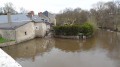
(1) At the Fork in the road, take the left-hand branch, which becomes Chemin de Rudebiles. Turn left onto the grassy path that runs alongside the Ruisseau les Mées. Keep the stream on your right until you approach the Pont Isolé. The path then turns left, offering a lovely view of the gardens beneath the bridge, before veering away from the bridge until you reach a junction.
(2) Turn right onto Allée de Bellevue, then right again onto Rue des Dinandiers, which leads to a housing estate. Head left until you reach a cross-path at the edge of a small wood. The path widens before joining Chemin de la Borde, which makes a wide bend to the right before running alongside Château de la Borde
(3) As you leave the small wood, leave the tarmac and take a path on the left. This path becomes tarmac again before joining Rue Miraton. Continue straight on along Rue du Vieux Macè. Turn right onto Rue Médicis, then immediately left into the cul-de-sac. This leads onto a path heading north-east which crosses Rue Desouches.
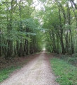
(4) Turn right at the junction with Rue de la Loire, passing the town hall of Saint-Denis-sur-Loire on your left. Pass Place du Onze Novembre, then turn onto Rue du Lierre, which bends sharply to the left. This becomes Rue du Bois at the edge of a forest, crosses Rue de la Croix, then becomes Rue des Grèves.
(5) At the junction, turn right onto Rue du Tertre, which joins Rue du Perce Neige before entering the forest. It curves sharply to the right and then leads onto the Levée de Blois à Ménars as it approaches the Loire. Head along the Levée de la Loire, a wide, well-marked path used by the “La Loire à vélo” route. Pass the end of the Pont Isolé, then a rest area, and finally a lake on your right.
(6) At the junction, leave the wooded strip on the right and head left onto the Chemin de Banlieue, which joins the Levée de la Loire at the cemetery.
(7) Leave the Levée de la Loire just before a stretch of water, taking a path on the right. Turn left at the junction, then right towards the Chaussée Saint-Victor. Take the first path on the left which crosses the Parc des Mées; turn right onto the winding path leading to the Rue du Coteau after crossing the Mées via a footbridge, ending with a flight of steps.
(8) Turn right onto Rue du Coteau, which you’ll leave just before the bend to take a path that you’ll follow until you reach Rue du Montprofond.
(9) Continue straight ahead along the winding, downhill path which joins Rue de la Serpentinette; turn left onto this street. It soon becomes Rue de la Poste, which leads back to the starting point (S/E).



 Visorando Member



 Easy