Botanical walk at Bonascre

A short family walk based on the botanical walk offered by the Bonascre resort.

Details

58861718
Creation:
Last update:
Last review:
  • Walking
    Activity: Walking
  • ↔
    Distance: 4.23 mi
  • ◔
    Average duration: 2h 35 
  • ▲
    Difficulty: Easy

  • ⚐
    Back to start: Yes
  • ↗
    Ascent: + 738 ft
  • ↘
    Descent: - 732 ft

  • ▲
    Highest point: 5,213 ft
  • ▼
    Lowest point: 4,485 ft

Photos

Description of the walk

Meet at the ESF (École du Ski Français) building.

(S/E) Head up towards the large rock with a picnic table and follow the path that takes you to the end of the hairpin bend in the road. This is where the trail really begins.
Follow the wooden signs pointing to the botanical trail.
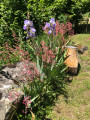
There are also information boards along the walk explaining the local flora and the surrounding peaks. The forest track climbs steadily until it reaches the Ruisseau des Estagnols. Here you’ll find some cool shade.

(1) The track turns into a footpath and climbs more steeply… hang in there, you’re not far now!
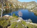
The climb continues until you reach the top, beneath the chairlift facilities of the Campels ski area. It’s the ideal spot for a break, a picnic and a swim, especially with children.

(2) For the return journey, take the hairpin bend to the right onto a wide forest track which serves as a ski run in winter (Les 3 Jasses), rising slightly at the start until you reach an altitude of 1588 metres.

(3) It then descends all the way back.

(4) Turn right to reach the car park (S/E).
(See alternative route in the practical information section).

Waypoints

  1. S/E : mi 0 - alt. 4,508 ft - ESF building - Ax-Bonascre
  2. 1 : mi 1.69 - alt. 4,760 ft - Junction with the Ruisseau des Estagnols
  3. 2 : mi 2.14 - alt. 5,115 ft - Domaine des Campels
  4. 3 : mi 2.38 - alt. 5,213 ft - Highest point on the return journey
  5. 4 : mi 3.85 - alt. 4,662 ft - Return option
  6. S/E : mi 4.23 - alt. 4,508 ft - ESF building - Ax-Bonascre

Notes

- A refreshing spot for a swim halfway along the route.
- There is little shade despite the forest track along the route.
- The start and end of the track are closed off by a cattle wire and a Canadian gate as this is a grazing area for livestock. Please remember to close the gates!

Alternative route: as a final option, you can take the path on the left, which leads back towards the centre of the resort, rather than the one on the right, which descends and takes you back to the starting point.

Worth a visit

Reviews and comments

4.4 / 5
Based on 3 reviews

Reliability of the description
4.3 / 5
Ease of following the route
5 / 5
Route interest
4 / 5
User 13915164

Overall rating : 4.7 / 5

Date of your route : Jul 17, 2026
Reliability of the description : ★★★★★ Very good
Ease of following the route : ★★★★★ Very good
Route interest : ★★★★☆ Good
Very busy route : No

A pleasant, easy walk. A perfect way to warm up.

Machine-translated

balbuzar
balbuzar

Overall rating : 4.7 / 5

Date of your route : Aug 05, 2025
Reliability of the description : ★★★★★ Very good
Ease of following the route : ★★★★★ Very good
Route interest : ★★★★☆ Good
Very busy route : No

Easy, fairly wide trail to follow. Very nice shaded spot by the river for a picnic break (not really suitable for groups, but we were alone). Pretty views, information boards on the first part of the trail (trees, etc.).

Machine-translated

ChantalNR&M
ChantalNR&M

Overall rating : 4 / 5

Date of your route : Aug 20, 2025
Reliability of the description : ★★★☆☆ Average
Ease of following the route : ★★★★★ Very good
Route interest : ★★★★☆ Good
Very busy route : No

A pleasant short walk.

Machine-translated

Other walks in the area

For more walks, use our search engine .

The GPS track and description are the property of this route's author. Please do not copy them without permission.