Country:

 City:
City:


The walk starts at Auvers-sur-Oise railway station.
(S) From the station, turn left onto the D928 (Rue du Général de Gaulle). Follow this road to the first junction, located near the Maison de Van Gogh, also known as the Auberge Ravoux.
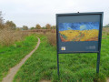
(1) Turn right at this junction. Then head right up the famous steps of Auvers-sur-Oise, which inspired Van Gogh. Next, turn left onto Rue Daubigny. Carry on straight ahead at the first junction, passing in front of Daubigny’s studio. At the studio, ignore a path branching off to the right and carry on straight ahead. About 800 metres further on, ignore another path coming from the left and carry straight on along the Côte de la Thibaude.
(2) Then turn left onto the first path which runs alongside a stream called the Ravine des Vallées and winds through the Bois le Roi. Carry straight on at a junction situated roughly halfway to the next road. Just before this road, reach a field and follow its edge on the right.
(3) When you reach the Chemin de l’Isle, turn right. At the first junction, carry straight on. At the second, by a cross, carry straight on again along a track. This track crosses fields before gradually descending into a woodland. Towards the end of the descent, ignore a path branching off to the left, then cut across the D151 (Rue Georges Duhamel).
(4) Take the next track on the left to begin a long stretch along the old railway line between Marines and Valmondois. Continue straight on at every junction until you reach the D151. Cross it and rejoin the old railway line on the opposite side. Here too, continue straight on at every junction until you reach the D79, which you must cross to continue following the route of the old railway line on the opposite side. This leads to a path serving a number of houses.
(5) At the end of this track, turn right onto the D64 (Rue de La Falaise). Ignore the first track on the left. Continue right onto Rue Pierre Pilon.
(6) At the junction by the church and the farm (with its dovecote), carry on straight ahead, then keep left at the next two junctions. Carry on straight ahead at the third junction onto the D64.
(7) Take the first track on the left. Then carry on straight ahead along a track that turns into a dirt track. Cross a stream and ignore aPR® sign on the right as you walk past a campsite. At the next junction, turn right onto a dirt track, then take the first path on the right which climbs slightly.
Then pass a faint path coming from the right to reach a track. Follow it to the left. This track leads to some houses.
(8) Opposite, follow the very faint path leading to the Trou à Morts. A GPS is strongly recommended for this. The path is short and leads to this burial site.
(9) Turn back along the same route to the previous junction.
(8) Turn left onto the track. Very soon after, at the first junction, turn right and then keep right again onto a track.
Carry on straight ahead at the next three junctions.
(10) At the fourth junction, turn left down the hill towards Jouy-le-Comte. When you reach Rue des Maillets, turn right and you’ll arrive at Jouy-le-Comte Church.
(11) Visit the church, then return to the previous junction via the same route.
(10) Continue left along the track, which turns into a path; follow this to its end. Keep left at the end of the path. Then ignore the turn-off to the right leading to a care home, as well as another path on the right 500 metres further on. At the next junction, turn left onto Rue Guichard towards L’Isle-Adam/Parmain station.
(12) Carry straight on at the crossroads by the station to cross the railway line. Then cross two branches of the River Oise, the last of which you’ll cross via a very beautiful stone bridge.
(13) At the entrance to the second island, continue straight on.
(14) At the crossroads, carry on straight ahead along the Grande Rue. Stay on the same road until you reach the Church of Saint-Martin in L’Isle-Adam.
(15) Turn round after crossing the first bridge and walk across the small island.
(13) Before the second bridge, turn left onto the path that runs alongside the second branch of the Oise. Then cross one of the branches via a footbridge to reach the Quai de l’Oise. Follow this along to the right. Keep to the right at the first junction and stay on the same path until it turns 90° eastwards and leaves the banks of the Oise. Then take the first path (Rue Saint-Lazare) coming from the right.
(16) At the end of the road, turn right onto the D922 for a few metres, then take the first path on the left. Immediately turn right to stay on the same path, which begins a gentle climb. You’ll reach the first houses.
(17) At the first houses, at Pré Fleuri, take the first track on the left. Turn right at the first junction and carry on straight ahead until the end of the track.
(18) Turn left and walk along the Coteau de l’Étang, occasionally enjoying views of the Marais de Stors Nature Reserve. Ignore the two paths coming from the left and continue along the hillside. At the third junction, turn left, ignoring a path on the right leading to the old quarries. Shortly after this junction, turn right onto Route Capitaine and you’ll reach the Porte Noire.
(19) At this point, head left onto the first track. 200 m further on, take the first path on the left again. At the next two junctions, go straight on and turn sharply right at the third. Ignore another small path coming from the left. Continue straight on at the next junction with the Sentier aux Verdiers.
(20) At the Carrefour Vicaire, take the second path on the right onto the Route du Bois Franc. At the Carrefour du Chêne au Loup, carry on straight ahead to stay on the same path. At the end of the path, cross the N184 via a bridge to reach the Carrefour de la Porte Baillet.
(21) Turn left onto Route Glaiseuse, which climbs quite steeply in places. At the next two junctions, carry on straight ahead until you reach the junction at Poteau de la Tour. From there, carry on straight ahead onto Route Pierreuse and stay on this road until the third junction.
(22) Turn left and head down towards Nerville-la-Forêt. Keep right at the first two junctions and carry on straight ahead at the third to pass south of Nerville-la-Forêt. Then keep left at every junction until you reach a road. Turn left onto it.
(23) At the next junction, carry straight on along Rue Marcel Harlay and stay on this street until it ends.
(24) This is where the least pleasant part of the route begins. This section is disused but not off-limits, as indicated by the GR® markings. You’ll need to weave your way under fallen trees, step over tall grass and battle your way through stinging nettles: long trousers are strongly recommended for this section. At the end of the disused track, turn left and stay on the same path until you reach the next departmental road.
(25) Follow it to the right, taking great care. Ignore the access and exit roads to the A16 and head straight on at both junctions.
(26) Shortly after the second junction, turn left onto the first track and follow it to Le Blanc Val.
(27) Take advantage of this covered walkway to have a break, then return to the previous road.
(26) Follow it to the left and pass under the railway line.
(28) Turn sharply left onto the D78. At the next junction, turn right and then continue straight on at every junction until you reach Presles station (E).


 Visorando Member
 Moderate
 Association / Club / Walk leader
 Easy
Easy 
 Difficult