The ‘8’ route in Auvers-sur-Oise

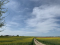
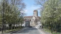
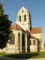
A short stroll after your meal, taking in the cemetery and the church.

Details

n°69880415
Creation:
Last update:
Last review:
  • Walking
    Activity: Walking
  • ↔
    Distance: 2.91 mi
  • ◔
    Average duration: 1h 30 
  • ▲
    Difficulty: Easy

  • ⚐
    Back to start: Yes
  • ↗
    Ascent: + 223 ft
  • ↘
    Descent: - 223 ft

  • ▲
    Highest point: 230 ft
  • ▼
    Lowest point: 82 ft

Description of the walk

Start from the car park on Rue Marcel Martin.

(S/E) Leave the car park, turn left and walk to Rue de Cordeville.

(1) Turn left, cross Rue Rajon and continue straight on to Chemin de la Cavée.

(2) Continue straight ahead along the path and turn left at the four-way crossroads. Pass the two Forks in the road leading to the cemetery to reach a third junction with Chemin des Vallées.

(3) Carry on straight ahead and, at the bottom, turn right onto Rue Daubigny and continue until you reach a Fork in the road.

(4) Carry on straight ahead and turn right at the end of the street to reach Les Lézardières.

(5) Turn right and head towards the junction with Chemin des Vallées.

(3) Carry on straight ahead until you reach the church.

(6) Turn right, cross the junction and head straight ahead. Then turn left to return to the car park (S/E). 

Waypoints

  1. S/E : mi 0 - alt. 89 ft - Car park, Rue Marcel Martin
  2. 1 : mi 0.44 - alt. 89 ft - Rue de Cordeville
  3. 2 : mi 0.59 - alt. 105 ft - Chemin de la Cavée
  4. 3 : mi 1.13 - alt. 203 ft - Chemin des Vallées (four-way junction)
  5. 4 : mi 1.66 - alt. 115 ft - Fork
  6. 5 : mi 2.04 - alt. 197 ft - Les Lézardières
  7. 6 : mi 2.75 - alt. 141 ft - Crossroads - Église Notre-Dame-de-l'Assomption (Auvers-sur-Oise)
  8. S/E : mi 2.91 - alt. 89 ft - Car park, Rue Marcel Martin

Notes

No water point

Worth a visit

Reviews and comments

4.7 / 5
Based on 2 reviews

Reliability of the description
5 / 5
Ease of following the route
4.5 / 5
Route interest
4.5 / 5
souchez rando
souchez rando

Thank you for your feedback

Machine-translated

User 4599720

Overall rating : 5 / 5

Date of your route : Sep 20, 2026
Reliability of the description : ★★★★★ Very good
Ease of following the route : ★★★★★ Very good
Route interest : ★★★★★ Very good
Very busy route : No

A lovely route through the countryside and town. Car park near a small open-air café on the banks of the Oise.

Machine-translated

souchez rando
souchez rando

thank you for your feedback. We wish you all the best on your future hikes

Machine-translated

GCl
GCl

Overall rating : 4.3 / 5

Date of your route : Aug 11, 2025
Reliability of the description : ★★★★★ Very good
Ease of following the route : ★★★★☆ Good
Route interest : ★★★★☆ Good
Very busy route : No

Pleasant hike.
The description is accurate.
Sometimes the street names aren't very helpful because there aren't any signs indicating the name in question.
But with the map, it's easy enough to find your way around.
A short hike that makes you want to come back to Auvers.

Machine-translated

Other walks in the area

For more walks, use our search engine .

The GPS track and description are the property of this route's author. Please do not copy them without permission.