Croix de Justin and Pic de Beauvoisin via Die

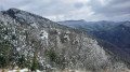
A lovely, easy walk with views of the Vercors and the Trois Becs. Much of the route, at the start and on the way back, is quite shaded. There’s hardly any tarmac – just 200 metres at the start and finish!

Details

71128877
Creation:
Last update:
Last review:
  • Walking
    Activity: Walking
  • ↔
    Distance: 7.98 mi
  • ◔
    Average duration: 5h 55 
  • ▲
    Difficulty: Moderate

  • ⚐
    Back to start: Yes
  • ↗
    Ascent: + 2,612 ft
  • ↘
    Descent: - 2,615 ft

  • ▲
    Highest point: 3,425 ft
  • ▼
    Lowest point: 1,237 ft

Photos

Description of the walk

Get to Die via the D93. Coming from Pontaix, turn right after the first roundabout and follow the signs for ‘cimetière’. Park in the large car park in front of the cemetery. 

(S/E) Return along the road you came on, following the Drôme downstream, and cross the small bridge over the river.

(1) Just after the bridge, follow the signs for “Croix de Justin”: these signs will be visible for much of the route, so it’s impossible to get lost. Walk past a few greenhouses until you reach a fork in the path. 

(2) Take the track on the left for about 200 m, then turn right to begin a climb of about 5 km: don’t worry, it’s a steady climb all the way with no sudden steep sections. Follow the small, very well-maintained path as it climbs gently: at this point, you’ll be passing through woodland, with not much of a view.

(3) Leave the return path opposite. Navigate the hairpin bend to the right. Continue on virtually level ground, take a hairpin bend to the left, then carry on until you come out onto a good, fairly wide forest track.

(4) Follow it straight ahead for about a hundred metres, then take a shortcut to the right before rejoining it shortly afterwards. Continue to follow the sign for “Croix de Justin” and reach a junction located at a bend to the left. 

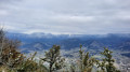
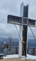
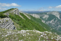
(5) Go straight on to reach the Croix de Justin: enjoy the magnificent view over the Vercors, Die and the surrounding area. There’s even a bench where you can have a bite to eat.

(6) Retrace your steps back to the bend.

(5) Carry on straight ahead, then turn left a good hundred metres further on.

(7) Take a forest track on the left, heading towards the Pic de Beauvoisin, which is clearly signposted throughout. Make sure you keep heading south-east. 

(8) Keep left at this junction, and follow a few hairpin bends before reaching the Col de Beauvoisin, where the climb is almost over.

(9) Take the small path leading down to the left towards Pic de Beauvoisin. 

(10) Head back down via the forest track on the right. 

(11) Don’t miss the small path on the right where the forest track ends: don’t worry, a signpost indicates the direction of Die. Continue along this main path until you rejoin the route you took on the way there at the junction you passed earlier.

(3) Head down the opposite way, following the route in the opposite direction to the way there, to return to the cemetery car park (S/E). 

Waypoints

  1. S/E : mi 0 - alt. 1,273 ft - Cemetery car park - Drôme
  2. 1 : mi 0.19 - alt. 1,237 ft - Pont Neuf
  3. 2 : mi 0.43 - alt. 1,453 ft - Turn left
  4. 3 : mi 1.68 - alt. 2,372 ft - Épingle, junction of the circular loop
  5. 4 : mi 2.66 - alt. 3,015 ft - Forest track
  6. 5 : mi 2.92 - alt. 3,173 ft - The Croix de Justin junction
  7. 6 : mi 3.07 - alt. 3,209 ft - Justin’s Cross
  8. 7 : mi 3.43 - alt. 3,205 ft - Turn left at the fork
  9. 8 : mi 4.12 - alt. 3,264 ft - Junction, turn left
  10. 9 : mi 4.49 - alt. 3,084 ft - Col de Beauvoisin
  11. 10 : mi 4.81 - alt. 2,690 ft - Foot of the Pic de Beauvoisin
  12. 11 : mi 5.34 - alt. 2,910 ft - Path on the right
  13. S/E : mi 7.98 - alt. 1,276 ft - Cemetery car park - Drôme

Notes

The entire route is very well signposted – thank you for marking it out.

(10) Personally, we didn’t climb to the summit, though it’s likely you can get closer to it. You can also head back down via the ‘40 hairpin bends’ path: we avoided it as it was too dangerous for my liking on wet ground.

Reviews and comments

4.7 / 5
Based on 2 reviews

Reliability of the description
4.5 / 5
Ease of following the route
5 / 5
Route interest
4.5 / 5
User 4066901

Overall rating : 4.7 / 5

Date of your route : Aug 16, 2025
Reliability of the description : ★★★★☆ Good
Ease of following the route : ★★★★★ Very good
Route interest : ★★★★★ Very good
Very busy route : No

A very beautiful hike that can be done starting from Die train station (so no car needed). Well shaded, very beautiful scenery. The directions are very good, but be careful, there is an error at point 10.

It says:
(10) Go back down the forest path on the right.

This should be corrected to:
(10) Go back up the forest path on the left.

You can clearly see on the altitude chart that the path goes uphill between (10) and (11) and that you need to turn left on the map. And when you're there, there's no doubt that the instructions are wrong.

Machine-translated

alexport
alexport

Overall rating : 4.7 / 5

Date of your route : Jun 20, 2025
Reliability of the description : ★★★★★ Very good
Ease of following the route : ★★★★★ Very good
Route interest : ★★★★☆ Good
Very busy route : No

Route completed on 19/6/25 in intense
heat; fortunately, much of the route is shaded.
Stunning views

Machine-translated

Other walks in the area

For more walks, use our search engine .

The GPS track and description are the property of this route's author. Please do not copy them without permission.