Serre de l’Adret and Col de Borne from Chamaloc

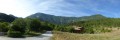
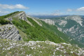
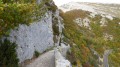
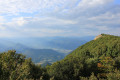
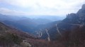
An easy walk starting from Chamaloc with views of the Glandasse, the But de l’Aiglette and the But Saint-Genix.
Vultures are often seen soaring above the route.

Details

71630885
Creation:
Last update:
Last review:
  • Walking
    Activity: Walking
  • ↔
    Distance: 3.90 mi
  • ◔
    Average duration: 2h 05 
  • ▲
    Difficulty: Easy

  • ⚐
    Back to start: Yes
  • ↗
    Ascent: + 377 ft
  • ↘
    Descent: - 446 ft

  • ▲
    Highest point: 2,041 ft
  • ▼
    Lowest point: 1,667 ft

Description of the walk

Starting point in the Bailly district of Chamaloc. To reach the starting point from Die, follow the D518 towards the Col du Rousset. Drive for about 7 km and park at the side of the road at the entrance to the village, just past the bridge on the right.

(S/E) Return to the bridge and cross it. Pass the sheepfold on your left and continue along the path at the bottom of the valley until you reach a three-way junction.

(1) At the signpost marked ‘L’Auche’, take the path leading uphill to the right, which then enters the Saint-Genix State Forest.

(2) At the three-way junction, follow the track to the left until you reach the top of the ridge, at the signpost marked “Serre de l’Adret”.

(3) To your right, you’ll see Marignac-en-Diois. Continuestraight on, downhill, until you reach the Col de la Borne.

(4) Take the path leading down to the left and continue through the forest. Follow this path along the hillside until you come to a stream.

(5) Take the track on the left, which leads to a ford (you can cross via a makeshift bridge made of a few beams), just before a footbridge signposted ‘Parking de Baise’.

(6) Leave the footbridge on your right and follow the track which runs alongside the river on the right bank until you reach the junction with the Auche.

(1) Carry on straight ahead, following the path in the opposite direction back to Chamaloc (S/E).

Waypoints

  1. S/E : mi 0 - alt. 1,824 ft - Bailly district in Chamaloc
  2. 1 : mi 0.56 - alt. 1,709 ft - The Auche. Junction of the circular loop
  3. 2 : mi 0.95 - alt. 1,890 ft - Saint-Genix State Forest
  4. 3 : mi 1.82 - alt. 2,041 ft - Serre de l’Adret
  5. 4 : mi 2.16 - alt. 1,962 ft - Col de la Borne (591m)
  6. 5 : mi 2.83 - alt. 1,729 ft - Stream
  7. 6 : mi 3 - alt. 1,667 ft - Ford
  8. S/E : mi 3.9 - alt. 1,772 ft - Bailly district in Chamaloc

Reviews and comments

4.5 / 5
Based on 2 reviews

Reliability of the description
4.5 / 5
Ease of following the route
4.5 / 5
Route interest
4.5 / 5
danileo04
danileo04

Overall rating : 5 / 5

Date of your route : May 28, 2025
Reliability of the description : ★★★★★ Very good
Ease of following the route : ★★★★★ Very good
Route interest : ★★★★★ Very good
Very busy route : No

A lovely discovery of a forest in the southern Vercors. A small, ‘peaceful’ village, but the vultures weren’t there (too windy). Daniel.

Machine-translated

Christophe MONDON
Christophe MONDON

Overall rating : 4 / 5

Date of your route : Apr 21, 2025
Reliability of the description : ★★★★☆ Good
Ease of following the route : ★★★★☆ Good
Route interest : ★★★★☆ Good
Very busy route : No

A lovely circular walk, suitable for everyone, including children aged 8 and over, in my opinion.
There are no particular hazards; the track or path presents no major difficulties, and shaded sections alternate with sunny ones.
In short, a lovely walk that ends alongside a stream, providing some welcome refreshment!!

Machine-translated

Other walks in the area

For more walks, use our search engine .

The GPS track and description are the property of this route's author. Please do not copy them without permission.