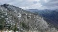
Clos Saint-Hubert hut from Marignac-en-Diois

A short walk around Montagne de Baise, at the foot of But Saint-Genix. Please note that this route is not signposted along its entire length.

Details

n°34211231
Creation:
Last update:
Last review:
  • Walking
    Activity: Walking
  • ↔
    Distance: 4.65 mi
  • ◔
    Average duration: 3h 15 
  • ▲
    Difficulty: Moderate

  • ⚐
    Back to start: Yes
  • ↗
    Ascent: + 1,240 ft
  • ↘
    Descent: - 1,240 ft

  • ▲
    Highest point: 3,271 ft
  • ▼
    Lowest point: 2,031 ft

Description of the walk

Park in the car park at Marignac-en-Diois Town Hall.

(S/E) Take the road leading uphill and walk through the village, ignoring Rue de l’Aiglette on your right – you’ll take this on the way back. Follow a track and then a footpath.

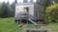
(1) Turn left towards the Cabane Rouge. You’ll come to a forest track; follow it uphill to the hut, keeping in the same direction.

(2) Continue along the track towards the Cabane du Clos Saint-Hubert. When you reach a three-way junction, stay on the track as it rounds the bend and carry on to the next three-way junction.

(3) Ignore the track branching off to the right and carry on straight ahead until you reach a fork.

(4) At the signpost, leave the track and turn right towards Cabane du Clos Saint-Hubert. When you reach the hut, take the path that climbs to the left towards Col de la Chau. A few dozen metres further on, at the signpost, take the path that descends to the right towards Les Chambards – Les Combes, until you rejoin a track.

(5) Turn right onto it, heading due south until you reach a fork.

(6) At the signpost, at the edge of the track, leave the path to Les Chambards and Les Combes on your left and continue along the track for a few metres. In a wide right-hand bend, take the path opposite that leads downhill: be careful, as this path is not very visible. At the first junction, turn sharply left: be careful, as this section follows a forestry track that is not maintained. Keep to the ridge, continuing straight ahead.

(7) Pass the hairpin bend on the plateau and head down until you come to a path. Take this to the left towards Les Genets.

(8) Turn right towards Marignac-en-Diois and go round the back of the care home, continuing straight on at the junction. Then join the Route des Voutes via the Chemin du Replat.

(9) Turn right onto this path to reach the village centre. When you reach the temple, turn left to return to the car park (S/E).

Waypoints

  1. S/E : mi 0 - alt. 2,031 ft - Marignac-en-Diois Town Hall
  2. 1 : mi 0.32 - alt. 2,198 ft - Junction
  3. 2 : mi 0.71 - alt. 2,398 ft - Cabane Rouge
  4. 3 : mi 1.45 - alt. 2,789 ft - Three-way junction
  5. 4 : mi 2.3 - alt. 3,241 ft - Signpost
  6. 5 : mi 2.6 - alt. 2,943 ft - Trail junction
  7. 6 : mi 3.13 - alt. 2,710 ft - Signpost
  8. 7 : mi 3.75 - alt. 2,297 ft - Lacet du Replat
  9. 8 : mi 4.08 - alt. 2,080 ft - Les Genets
  10. 9 : mi 4.33 - alt. 2,034 ft - Route des Voutes
  11. S/E : mi 4.65 - alt. 2,031 ft - Marie de Marignac-en-Diois

Reviews and comments

3.8 / 5
Based on 2 reviews

Reliability of the description
4.5 / 5
Ease of following the route
4 / 5
Route interest
3 / 5
cornet22
cornet22

Overall rating : 3.3 / 5

Date of your route : Apr 08, 2026
Reliability of the description : ★★★★☆ Good
Ease of following the route : ★★★★☆ Good
Route interest : ★★☆☆☆ Disappointing
Very busy route : No

The walk was estimated to take 3 hours and 15 minutes, but we completed it in 2 hours and 30 minutes without rushing (7.5 km). It mainly consists of forest paths under the pine trees. It lacks interest and scenic views. A walk to ‘warm up’.

Machine-translated

vincent.liefooghe
vincent.liefooghe

Overall rating : 4.3 / 5

Date of your route : Mar 25, 2025
Reliability of the description : ★★★★★ Very good
Ease of following the route : ★★★★☆ Good
Route interest : ★★★★☆ Good
Very busy route : No

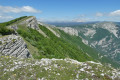
A fairly easy walk, with a steady climb offering views of the But St Genix, then the But de l’Aiglette and the Glandasse massif (peaks still covered in snow at the end of March 2025).

We got a bit lost between points 7 and 8 – logging had obliterated the trail – but thanks to GPS tracking we quickly got back on the right track.

A lovely walk to get back into the swing of things, completed in 2 hours 40 minutes without rushing too much, including a snack break at the Clos St Hubert hut.

Machine-translated

Other walks in the area

For more walks, use our search engine .

The GPS track and description are the property of this route's author. Please do not copy them without permission.