Criel de Renage via La Roche and Le Garin

Criel is the heart of Renage’s agricultural activities. This circular walk follows the various paths that once allowed the inhabitants of Criel or Renage to reach the factories in the Val de Fure on foot: forges, cutlery workshops and silk mills.

Details

n°6103498
Creation:
Last update:
Last review:
  • Walking
    Activity: Walking
  • ↔
    Distance: 2.70 mi
  • ◔
    Average duration: 1h 35 
  • ▲
    Difficulty: Moderate

  • ⚐
    Back to start: Yes
  • ↗
    Ascent: + 361 ft
  • ↘
    Descent: - 341 ft

  • ▲
    Highest point: 1,220 ft
  • ▼
    Lowest point: 912 ft

Photos

Description of the walk

Renage church car park.

(S/E) Walk between the church and the cemetery, cross the town hall car park and the community hall car park to reach Boulevard du Docteur Valois. Turn left and head east towards Chemin Montessuy.

(1) At the right-hand bend, leave the tarmac road and head towards Chemin Montessuy, continuing to the next junction. Turn left to head down towards the Pont de la Guillonnière bridge over the River Fure. Cross the bridge; a flight of steps leads to the start of the Sentier de la Roche.

(2) Take the Sentier de la Roche, which can be very wet and slippery if it has rained. Pass the Chemin du Crocodile on your right and, when you reach the road from Renage to Criel (Rue Alexandre Raphaël), carry on to the right. Follow this stretch of road for 800 metres, until you reach the junction with the Chemin du Marais Fleury (tarmacked).

(3) Turn left, pass an old bread oven and then the school in Criel to reach the next junction with the Chemin de la Sûre.

(4) Turn left onto Chemin de la Sûre, then, after 200 metres, turn right onto Chemin des Écureuils; head downhill, turning right, and you’ll rejoin the tarmac at the end of Chemin du Garin.

(5) Turn sharply left to head down towards the Fure. As you walk down the path, you can see the water intake for the Socamel hydroelectric power station on your right.

Cross the River Fure, with the water intake for the Revex hydroelectric power station on your left, at the foot of Alivet Castle and the ruins of the 12th-century blast furnace. Pass under the arch of the blast furnace and join the Descente d’Alivet, then head up to the right.

About forty metres after the sharp bend to the right, turn almost right round and take the Chemin des Taillandiers, which climbs gently up the hillside to your left. At the end of this path, cross the Renage road towards Grenoble. Turn left and continue until you reach the entrance to the Impasse des Cités on your left.

Cross the road and, opposite, take the path alongside the tennis courts, then turn right at the end of the path into a car park. Walk to Rue du Verdon, continue for 100 metres, then turn left onto Rue des Écoles. Ignore Avenue de la Piscine on your right and walk to the end of the primary school. Turn right, then left to return to the church car park (S/E).


Waypoints

  1. S/E : mi 0 - alt. 1,060 ft - Car park at the - Église Saint-Pierre (Renage)
  2. 1 : mi 0.33 - alt. 1,030 ft - Entrance to the Chemin Montessuy
  3. 2 : mi 0.5 - alt. 938 ft - Start of the La Roche trail - Fure (rivière)
  4. 3 : mi 0.99 - alt. 1,191 ft - Chemin du Marais Fleury
  5. 4 : mi 1.3 - alt. 1,214 ft - Chemin de la Sûre
  6. 5 : mi 1.68 - alt. 1,076 ft - Chemin du Garin - Fure (rivière)
  7. S/E : mi 2.7 - alt. 1,060 ft - Car park at the - Église Saint-Pierre (Renage)

Notes

Take care for a few dozen metres at the start of Chemin de La Roche (2), which is very often damp and slippery.
Hiking on our trails is an outdoor activity and carries certain risks: you may slip and fall, or find yourself in the path of a mountain bike or a falling branch… Please be careful. Warning: global warming is affecting the vegetation. Trees have been weakened and may uproot unexpectedly: do not venture into the undergrowth in windy or stormy weather. Walking with poles is recommended. Keep an eye on your children and stay on the path. Enjoy your walk.

Worth a visit

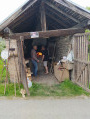
On the Route du Marais Fleury, there is an old oven where the residents of Criel used to bake their bread.

The school in Criel was established to spare the young people of Criel the need to walk all the way to the school in Renage. It is now used for other activities.

Reviews and comments

4.3 / 5
Based on 2 reviews

Reliability of the description
5 / 5
Ease of following the route
4 / 5
Route interest
4 / 5
Claude PERRIOLAT
Claude PERRIOLAT

Thank you for pointing that out: I shall correct the description.
Kind regards.

Machine-translated

romanche
romanche

Overall rating : 4.3 / 5

Date of your route : Jan 19, 2025
Reliability of the description : ★★★★★ Very good
Ease of following the route : ★★★★☆ Good
Route interest : ★★★★☆ Good
Very busy route : No

A very interesting walk to get back into the swing of things after the festive season. A lovely little route, very well described. We only had a bit of a doubt at point 5. As we hadn’t ‘found the tarmac at the end of Chemin du Garin’, and misled by a Yellow Cross on the descent to the left, we only realised our mistake 200 metres further on. It wasn’t a big deal. We simply turned back! Thank you in any case for this lovely route

Machine-translated

DAVID  jean luc
DAVID jean luc

Overall rating : 4.3 / 5

Date of your route : Nov 07, 2024
Reliability of the description : ★★★★★ Very good
Ease of following the route : ★★★★☆ Good
Route interest : ★★★★☆ Good
Very busy route : No

An interesting walk with some good climbs and descents; a bit tricky due to the fallen leaves (risk of slipping), but very enjoyable on a sunny day.

Machine-translated

Other walks in the area

For more walks, use our search engine .

The GPS track and description are the property of this route's author. Please do not copy them without permission.