Beaucroissant via the Fontaine Noire

A lovely route, though steep in places, following two of the traditional paths up from Renage to Beaucroissant and its Champ de Foire.
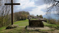
Several 360° panoramic views of the Vercors, Belledonne, the Chartreuse and the Bièvre plain.

Details

n°6156970
Creation:
Last update:
Last review:
  • Walking
    Activity: Walking
  • ↔
    Distance: 2.12 mi
  • ◔
    Average duration: 1h 20 
  • ▲
    Difficulty: Easy

  • ⚐
    Back to start: Yes
  • ↗
    Ascent: + 410 ft
  • ↘
    Descent: - 410 ft

  • ▲
    Highest point: 1,470 ft
  • ▼
    Lowest point: 1,060 ft

Description of the walk

Park in the car park at Renage Church.

(Out and back) Opposite the church, take the Montée de la Rua. Turn left, then right, and follow the steep tarmac road until you reach the edge of the woodland, where the path becomes stony.
At the top of the slope, continue straight ahead on the tarmac road until you reach the junction of the Chemins du Mollard and the Chemins de la Croze.

(1) At the junction, head straight ahead up the tarmac road that runs along the crest of the hill.
To the left, the road overlooks the “Champ de Foire”, where the renowned Beaucroissant fairs take place, attracting tens of thousands of visitors every year. To the right, there are views of the Vercors, Belledonne, the Chartreuse, the Voironnais and the Bièvre plain to the west.
At the end of the road, turn right onto the road from Beaucroissant to Rives and continue for about a hundred metres.

(2) Take the entrance to the Chemin de la Fontaine Noire, which winds down through parks and fields towards Renage.

(3) At the bottom of the Chemin de la Fontaine Noire, turn right into a housing estate with views of the Vercors and the Chartreuse. At the end, head down to the left and then to the right to join the Rue de la République (D45).

(4) Turn right to reach the church car park (S/E).

Waypoints

  1. S/E : mi 0 - alt. 1,060 ft - Car park at - Église Saint-Pierre (Renage)
  2. 1 : mi 0.68 - alt. 1,440 ft - Junction of the Chemins du Mollard and Chemins de la Croze
  3. 2 : mi 1.15 - alt. 1,427 ft - Entrance to the Chemin de la Fontaine Noire
  4. 3 : mi 1.57 - alt. 1,168 ft - Bottom of the Chemin de la Fontaine Noire
  5. 4 : mi 1.89 - alt. 1,076 ft - Arrival on Rue de la République
  6. S/E : mi 2.12 - alt. 1,060 ft - Car park at - Église Saint-Pierre (Renage)

Notes

The descent towards Renage, via the Chemin de la Fontaine Noire, can be muddy after rainy days.

Hiking on our trails is an outdoor activity and carries certain risks: you may slip and fall, or find yourself in the path of a mountain bike or a falling branch… Please be careful. Warning: global warming is affecting the vegetation. Trees are weakened and may uproot unexpectedly: do not venture into the undergrowth in windy or stormy weather. Walking with poles is recommended. Keep an eye on your children and stay on the path. Enjoy your walk.

Worth a visit

Reviews and comments

4.7 / 5
Based on 1 review

Reliability of the description
5 / 5
Ease of following the route
5 / 5
Route interest
4 / 5
opale
opale
• Edited:

Overall rating : 4.7 / 5

Date of your route : Oct 08, 2023
Reliability of the description : ★★★★★ Very good
Ease of following the route : ★★★★★ Very good
Route interest : ★★★★☆ Good
Very busy route : No

A lovely little route we did whilst we were in the area.
The climb is steep but not long, and the view from the top is well worth it.
The descent along the Chemin de Fontaine Noire was a bit damp, despite the very dry weather we’ve had over the last few days.
A lovely little ‘after-lunch’ walk.

Machine-translated

Other walks in the area

For more walks, use our search engine .

The GPS track and description are the property of this route's author. Please do not copy them without permission.