Colle di Nanaz and Colle di Fontana Fredda

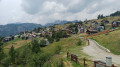
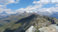
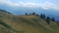
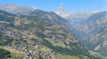
A stunning hike starting from Chamois. This route offers magnificent panoramic views. As you climb, the view of the Gran Paradiso massif becomes increasingly expansive. On arrival at the Col de Nannaz, you’ll be richly rewarded with a spectacular panorama stretching from the Breithorn to the Liskamm. Later, as you approach the Sanctuaire de la Clavalité, the Matterhorn will come into view.
The village of Chamois is the only car-free village in Italy. It is accessible only on foot, by bike or by cable car.

Details

n°35613399
Creation:
Last update:
Last review:
  • Walking
    Activity: Walking
  • ↔
    Distance: 8.98 mi
  • ◔
    Average duration: 7h 00 
  • ▲
    Difficulty: Difficult

  • ⚐
    Back to start: Yes
  • ↗
    Ascent: + 3,284 ft
  • ↘
    Descent: - 3,278 ft

  • ▲
    Highest point: 9,101 ft
  • ▼
    Lowest point: 5,915 ft

Photos

Description of the walk

From the Aosta–Turin motorway (A5), take the Châtillon exit. Take the SR46 towards Valtournenche / Breuil Cervinia. Stop at the cable car car park in the hamlet of Buisson. Take the Buisson–Chamois cable car.
The start and finish of this hike are on the village square between the Buisson-Chamois cable car station and the town hall.

(S/E) From the town hall, take the Chamois–La Magdeleine track, cross the village and head towards the Torrente Chamois.

(1) Cross the stream and take the track on the left. Follow the stream upstream. Pass another bridge on your left, near the ruins of a mill. Cross the stream at the junction with the Piste de Forsus Cort. Continue uphill to the fork leading to the Foresus barn.

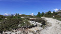
(2) Leave the Foresus track and note a sign just above the water collection hut. Heading south, follow the sign for Colle di Nannaz. Continue along a pleasant path, passing close to a shallow lake before reaching Alpe Cleva Bella.

(3) Stay on path No. 3A and begin the climb towards Colle di Nannaz. Make your way up in a series of terraces through magnificent scenery. As you go, admire the waterfalls that line this path. Turn round to take in the view of the Gran Paradiso massif. Continue the ascent until you reach the junction with the Alta Via No. 1.

(4) Follow the sign for Colle di Nannaz, turning right. Walk alongside a small lake before tackling this final stretch. As you approach the pass, the magnificent peaks between the Breithorn and the Liskamm gradually come into view.

(5) Take a break to enjoy the view. Return to the junction of the Alta Via No. 1 and Trail No. 3A

(4) Stay on the Alta Via No. 1 until you reach the junction with a path on the left.

(6) Leave the AV1 on your right, which leads to the Col des Fontaines, and turn left onto a path that is barely visible at first. After about a hundred metres, the path is clearly marked on the ground. Stay at a nearly constant altitude below the Falinère ridge, then above the lake of the same name, and descend towards Path No. 3B.

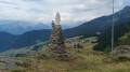
(7) Heading west, pass beneath the summit of La Falinère and reach the Santuario di Clavalité. Just before this sanctuary, to your surprise, the Matterhorn suddenly comes into view.

(8) Continue towards the clearly visible upper station of the chairlift (Falinère).

(9) With the Matterhorn still accompanying you along the way, carry on to Colle di Fontana Fredda.

(10) Begin the descent along a wide track leading to a small chalet just below the top station of the second section (Lago Lod – Teppa).

(11) Follow the track which descends directly to Lago Di Lod.

(12) Continue to the top station of the chairlift (Corgnolaz – Lago di Lod). Turn left onto the footpath and continue the descent until you reach a track at Assetaz.

(13) Cross the track and walk to the entrance to the village of Chamois.

(14) Walk down through the narrow streets of Chamois to reach the town hall square (A/D).
Waypoints

  1. S/E : mi 0 - alt. 5,961 ft - Chamois Town Hall
  2. 1 : mi 0.26 - alt. 5,935 ft - Mill bridge over the Torrente Chamois
  3. 2 : mi 1.42 - alt. 6,801 ft - Alpe Foresus
  4. 3 : mi 2.4 - alt. 7,352 ft - Alpe Cleva Bella
  5. 4 : mi 3.83 - alt. 8,688 ft - Alta Via No. 1 towards Col de Nannaz
  6. 5 : mi 4.36 - alt. 9,101 ft - Colle di Nannaz
  7. 6 : mi 5.08 - alt. 8,720 ft - Path on the left
  8. 7 : mi 5.65 - alt. 8,432 ft - Falinère Trail
  9. 8 : mi 6.36 - alt. 8,251 ft - Clavalité Sanctuary
  10. 9 : mi 6.47 - alt. 8,173 ft - Upper station of the cable car
  11. 10 : mi 6.66 - alt. 8,107 ft - Colle di Fontana Fredda
  12. 11 : mi 7.61 - alt. 7,359 ft - Chalet
  13. 12 : mi 8.31 - alt. 6,627 ft - Lago di Lod
  14. 13 : mi 8.5 - alt. 6,447 ft - Assetaz – Crossing the track
  15. 14 : mi 8.8 - alt. 6,093 ft - Road leading to the village
  16. S/E : mi 8.98 - alt. 5,945 ft - Chamois Town Hall

Notes

  • Cable car car park at Buisson: €3 per day. (2023)
  • Buisson-Chamois cable car: €5.50 (return) (2023)
  • Hotel: Maison Cly

Hike undertaken by the author on 26 June 2023.

Worth a visit

  • Chamois.
  • Col de Nannaz.
  • Becca di Nannaz.
  • Becca Trecaré.
  • Petit and Grand Tournalin.
  • Punta Falinère.
  • Col des Fontaines.
  • Cheneil.
  • Colle di Fontana Fredda.

Reviews and comments

5 / 5
Based on 1 review

Reliability of the description
5 / 5
Ease of following the route
5 / 5
Route interest
5 / 5
henrigole
henrigole

Thank you for your feedback and additional information. The village of Chamois is a rare gem, both in summer and winter. I'm going back there tomorrow for the eighth time.

Machine-translated

Randocaz
Randocaz

Overall rating : 5 / 5

Date of your route : Jul 17, 2025
Reliability of the description : ★★★★★ Very good
Ease of following the route : ★★★★★ Very good
Route interest : ★★★★★ Very good
Very busy route : No

Thank you for sharing!
What a fantastic hike.
Magnificent landscapes. Wherever you look, you are surrounded by magnificent peaks.
Even the village is worth exploring, very pretty, like a picture postcard of the mountains.
A must-see for anyone hiking in this region.
Two additional pieces of information for those who are lucky enough to follow this fantastic route.
At point 6, it's worth climbing up to the Col des Fontaines. You'll be rewarded with a panorama including Lake Cignana, which is rarely seen.
The detour is not very long.
And for those who find the hike a little long, you can take the chairlifts on the way down to save your knees. There are three separate sections available at points 9, 11 (the most useful as the slope is steep) and 12. They're not cheap (€7 per section, payable at the lake), but your knees are priceless! Please note that they close at 4.30pm.

Machine-translated

Other walks in the area

For more walks, use our search engine .

The GPS track and description are the property of this route's author. Please do not copy them without permission.