


Refine your search for walks in Col ou Coll de les Basses (1796m)
Col ou Coll de les Basses (1796m) walks


 Circular Pla Guillem via Coll des Basses – Cabane des Cums – Coll del vent
 Visorando Member
 10.31 mi
 +2,589 ft
 -2,589 ft
 7h 00
 Moderate
 Departure from Prats-de-Mollo-la-Preste (Pyrénées-Orientales)
A very pleasant circular route on well-marked paths. However, a good sense of direction is still required, as there are different markings to follow.Warning: the Pla Guillem area is very hazardous in foggy conditions and it is often very cold there. The GPX track is essential: the weather changes very quickly.*This hike can be classified as difficult. The 7-hour duration indicated by the software is fairly accurate. Not all the paths are easy to walk on.The scenery is very beautiful. The Cums hut and the Pla Guillem refuge offer places to rest.This hike should be avoided during heatwaves and in heavy snow.Please note the restricted access to the car park at La Togne towards Coll de les Basses: see practical information.
Le Pla Guillem from the Cabane Pastorale des Forquets
 11.38 mi
+2,556 ft
-2,530 ft
7h 30
 Difficult
Departure from Prats-de-Mollo-la-Preste (Pyrénées-Orientales)
A fairly long hike, mostly on open terrain. Plenty of 360° views.Passes by watering holes, mountain passes, stone-paved paths, stone huts and a refuge.Trails at the start and finish of this beautiful hike.Please note: Nature Reserve. Specific regulations apply.Avoid this hike during heatwaves and when there is heavy snow.Classified as difficult as a basic sense of direction is required.Warning: the Pla Guillem area is very hazardous in foggy conditions and it is often very cold there. The GPX track is essential: the weather changes very quickly.Outside the summer season, when the barrier is raised at the Forquets car park: you can start at (1). This saves 3 km on the return journey.
Les Queroses - Coll de Bise - La Parcigoule
 9.43 mi
+3,402 ft
-3,396 ft
7h 20
Difficult
Departure from Prats-de-Mollo-la-Preste (Pyrénées-Orientales)
From Perpignan, head towards Le Boulou, Céret, Amèlies-les-Bains, Prats de Mollo via the D115. Then head towards La Preste via the D115a. Then turn right towards Parcigoule. Continue to the end of the tarmac road and park as soon as possible after the farm, without obstructing the passage. See practical information (¹).A sense of direction is necessary. The signposting is good in thefirst part.Plan for a simple return trip after heavy rain. See the practical information section (²).
Pic des Sept Hommes and Pic Roja
 13.10 mi
+3,688 ft
-3,675 ft
9h 15
Difficult
Departure from Prats-de-Mollo-la-Preste (Pyrénées-Orientales)
The ascent of the Pic des Sept Homes and the Puig Roja is a very beautiful hike behind the famous Canigou, from which you’ll have a breathtaking view, as well as of the entire surrounding area.
The route is a round trip, with just a circular loop around the Puig de la Collada Verda, passing to the west via the Collada de Roques Blanques (Little White Rocks Pass) on the way out and via the south-east of the Puig de la Collada Verda (Little Green Pass) on the way back, offering more varied landscapes and vegetation.
There are two fairly steep sections; it’s best to be in good physical shape (stamina and strong knees!) for the ascent and descent. Otherwise, the rest of the route is very accessible.
Please note that, apart from a short section at the start and on the return leg, the bulk of the walk is well above 2,000 metres, so it’s exposed!
Please note the access to the Coll de les Basses: practical information.
From Collada de Roques Blanques to Pla Guillem via the ridges
 10.51 mi
+3,228 ft
-3,268 ft
7h 40
Difficult
Departure from Prats-de-Mollo-la-Preste (Pyrénées-Orientales)
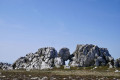
Most of the walk is out in the open, with some very beautiful scenery. First, a steep climb to Puig de Collada Verda (marker 2403) and a geodesic marker. This is followed by a route along the ridge and a passage to Collada del Vents. Then watch out for the rocky Cingle dels Pelegrins, where there is no fence or protection. Keep away from them by following the path marked on the ground. A large cairn marks the end of the ridge. A return trip to Pla Guillem (signpost) allows you to enjoy the scenery.
Classified as difficult due to the length and number of ascents and descents throughout the hike and a dangerous zone (15) at (17).
Walks near Col ou Coll de les Basses (1796m)
From the Refuge des Conques to the Refuge de Mariailles
 9.37 mi
+2,628 ft
-2,352 ft
6h 35
Difficult
Departure from Prats-de-Mollo-la-Preste (Pyrénées-Orientales)
First stage of the: Loop from the Refuge des Conques to the Refuge de Mariailles
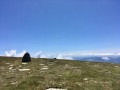
Mountain hike with beautiful scenery, particularly from Coll de Bise to Collada de la Roqueta.
Classified as difficult: exposed, steep slopes in places. See practical information.
Allow 6 hours of sustained walking.
From the Las Conques mountain hut to the Cavale lodge
 9.38 mi
+2,831 ft
-2,897 ft
6h 45
Difficult
Departure from Prats-de-Mollo-la-Preste (Pyrénées-Orientales)
Fourth stage of the 8-day clockwise Tour du Canigou.
A fairly short stage, with excellent views as it follows the ridge.
It is possible to climb Roc Colom from the (4).
In the event of strong winds, you must stay on the path to the right, with the Esquerdes de Rotjà on your left.
Sant Guillem to Prats-de-Mollo via Serre Vernet - Comella - Lloses - Miracle
9.45 mi
+1,775 ft
-3,609 ft
5h 55
Moderate
Departure from Le Tech (Pyrénées-Orientales)
Thissecond stage, almost entirely in the forest, is therefore possible in summer, setting off early.Discovery hike along marked paths, little or not used, requiring a sense of direction and the GPX track. Beautiful places to stop and enjoy the scenery.
Refuge Sant Guillem - Chemin d'els Troncassers - Puig Sarraïns - La Llau
 9.33 mi
+1,847 ft
-3,104 ft
5h 55
Moderate
Departure from Le Tech (Pyrénées-Orientales)
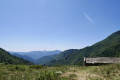
Second day of: Two days of discovery at the Sant Guillem Refuge, from the Sant Guillem Refuge.Between (8) and (12), a GPX track is strongly recommended or a very good sense of direction, despite the signposting and cairns being in very good condition. Observed at the end of July 2023.Coll de Serre Vernet via a magnificent balcony path in very good condition. The same applies to Puig dels Sarraïns.Return to the refuge via a beautiful path, then pleasant tracks through the woods.After a break at the refuge, return to the car park at La Llau via the usual route.
Prats-de-Mollo to Sant Guillem via Puig Fabra - Les Sarraïns - Serre Vernet
9.38 mi
+4,183 ft
-2,326 ft
7h 55
Difficult
Departure from Prats-de-Mollo-la-Preste (Pyrénées-Orientales)
Thisfirst stage, almost entirely in the forest, is therefore possible in summer, if you set off early. A challenging hike with 1,275 metres of elevation gain on marked trails that are rarely used, requiring a good sense of direction and the GPX track.There are some beautiful spots to stop and enjoy the scenery. The highest point (altitude 1,830 m) at Puig dels Sarraïns is a perfect place to stop for lunch, for example.
Refuge de Mariailles - Refuge des Cortalets
 10.14 mi
+3,497 ft
-2,090 ft
7h 45
Difficult
Departure from Casteil (Pyrénées-Orientales)
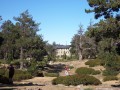
This stage is the first part of a two-day circular around the Canigou Massif. This first stage takes you around the peak to the west, from the Mariailles Refuge to the Cortalets Refuge, via the Bonne Aigue Refuge. It's a good warm-up before the next day's climb.
Mariailles - Cortalets
8.05 mi
+3,871 ft
-2,349 ft
7h 05
Difficult
Departure from Casteil (Pyrénées-Orientales)
The fourth stage features the ascent of Canigou as its highlight.Please take note of the following warnings regarding this route:''Info 2023: The route linking the Pic du Canigó and passing via the chimney is no longer signposted. The Conflent Canigó Tourist Office is unable to provide information on its accessibility. It is strongly advised to follow the Barbet ridges (PR®®8) or the GR®10 if you are coming from the Mariailles refuge to reach the Cortalets refuge.Furthermore, please note: as the ascent of the peak constitutes high-mountain hiking, it is important to be prepared, well-informed and properly equipped.”See also this link
From the Refuge de Mariailles to the Refuge des Cortalets
 9.65 mi
+3,451 ft
-1,939 ft
7h 25
Difficult
Departure from Casteil (Pyrénées-Orientales)
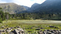
Sixth stage of the 8-day clockwise Tour du Canigou.A fairly long, undulating stage.The path is mostly on a ridge.The day ends with a difficult climb from the Bonne Aigue refuge.
⚠️ Renovation work at the Cortalets Refuge in 2026, 2027 and 2028. The Cortalets Refuge is closed for renovation work.
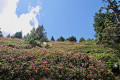
The Pic des Sept Hommes as seen from the Mariailles Refuge
 10.47 mi
+3,317 ft
-5,161 ft
7h 40
Difficult
Departure from Casteil (Pyrénées-Orientales)
A second challenging day’s hiking in the mountains to the Pic dels Set Homes or Pic des Sept Hommes.
Set off early as the ascent from Pla Guillem is in open country. This walk passes through a sensitive area subject to specific regulations.
From the Mariailles refuge to the Conques refuge
 10.00 mi
+2,490 ft
-2,785 ft
6h 45
Difficult
Departure from Casteil (Pyrénées-Orientales)
Second stage of the: Loop from the Refuge des Conques to the Refuge de Mariailles
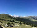
Mountain hike with a permanent view of Pla Guillem at Porteilla des Avets
Classified as difficult: open terrain, paths sometimes with old or no markings, steep slopes in places. See practical information.
Allow 6 hours of sustained walking.