Pic des Sept Hommes and Pic Roja

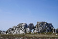
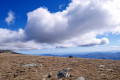
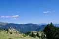
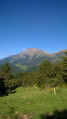
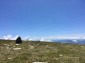
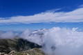
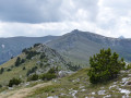
The ascent of the Pic des Sept Homes and the Puig Roja is a very beautiful hike behind the famous Canigou, from which you’ll have a breathtaking view, as well as of the entire surrounding area.

The route is a round trip, with just a circular loop around the Puig de la Collada Verda, passing to the west via the Collada de Roques Blanques (Little White Rocks Pass) on the way out and via the south-east of the Puig de la Collada Verda (Little Green Pass) on the way back, offering more varied landscapes and vegetation.

There are two fairly steep sections; it’s best to be in good physical shape (stamina and strong knees!) for the ascent and descent. Otherwise, the rest of the route is very accessible.

Please note that, apart from a short section at the start and on the return leg, the bulk of the walk is well above 2,000 metres, so it’s exposed!

Please note the access to the Coll de les Basses: practical information.

Details

n°39085071
Creation:
Last update:
Last review:
  • Walking
    Activity: Walking
  • ↔
    Distance: 13.10 mi
  • ◔
    Average duration: 9h 15 
  • ▲
    Difficulty: Difficult

  • ⚐
    Back to start: Yes
  • ↗
    Ascent: + 3,688 ft
  • ↘
    Descent: - 3,675 ft

  • ▲
    Highest point: 8,934 ft
  • ▼
    Lowest point: 5,856 ft

Photos

Description of the walk

Access to Pla de les Basses isn’t always possible. The gate at the Cabane Pastorale des Forquets is closed during the summer months.
If access is possible, you can park without any problems just before the barrier that prohibits all non-essential traffic.

(S/E) From there, follow the track due west until you reach the Coll de Bise path, which joins the track further down.

(1) Turn right and follow the path to the Col de Bise.

(2) Take the path on the left, marked in yellow. Continue to the Coll de les Molles, with the hut on your right.

(3) Cross the track several times until you reach the Collada de Roques Blanques.

(4) Turn right onto the track (Cami Ramader (transhumance path) from Campmagre to Pla Guillem),GRP® Tour du Canigou, heading towards Pla Guillem. You can take a breather; it’s fairly flat for quite a while.
Reach the Collada del Vent (a small pass named after the wind, which certainly lives up to its name).

(5) Keep left on the Cami Ramader de Campmagre al Pla Guillem,GRP®, continuing in the same direction.
At Pla Guillem, there are several more or less visible tracks, but you can already see the Pic des Sept Hommes straight ahead. If you’d like to take a break, have a look around or, if necessary, there’s a hut and the Pla Guillem Refuge on the left. Please respect the site, which has been restored very recently. Thank you.

(6) You’ll come to a crossroads with standing stones (vertical). Continue in the same north-easterly direction. You’ll reach the Coll dels Bocacers.

(7) Start of the ascent to the peak; the track is a little difficult to follow but, overall, it’s a very steep climb!
You’ll reach the ridge of the Serra (mountain) dels Set Homes.

(8) First panoramic view of the Canigou massif and its famous ‘chimney’ on one side, and the Esquerdes de Rotja, the Costabone and, in the distance, the Pic de la Dona.
The rest of the route isn’t particularly strenuous. Once again, simply follow the signposts and the trail to Puig Roja.

(9) The highest point of this walk. Breathtaking views of the Canigou, as well as the Puig dels Tres Vents (Peak of the Three Winds) and the Puig del Roc Negre (Peak of the Black Rock). If you want an even better view, carry on a little further to the two small peaks which serve as vantage points offering a breathtaking vista.
- Head back towards Pla Guillem, at the Collada del Vent.

(5) Turn left. There are signposts and an old picnic area with a stone table and benches. Head due south along a narrow, sloping path that runs along the hillside. Stay on the well-marked path to avoid slipping. After the Collade de les Voltes (winding pass), the path turns south-west, descends steeply and arrives below the Coll de les Molles hut.

(10) Continue along the hillside, heading due east. Look out for the remaining yellow markings (wooden posts). The path then descends slightly

(11) Keep well to the right, heading south-east, and continue along the hillside until you reach the Coll de Bise.

(2) A well-deserved and enjoyable return journey, following the route taken on the way out in the opposite direction until you reach (S/E).

Waypoints

  1. S/E : mi 0 - alt. 5,856 ft - Outside the summer season - Col ou Coll de les Basses (1796m)
  2. 1 : mi 0.76 - alt. 6,125 ft - Junction. Yellow markings
  3. 2 : mi 0.89 - alt. 6,316 ft - Junction of the first circular loop - Col ou Coll de Bise (1923m)
  4. 3 : mi 1.64 - alt. 6,854 ft - Coll de les Molles
  5. 4 : mi 2.2 - alt. 7,379 ft - GRP - Col Rochers Blancs ou Collada de Roques Blanques (2252m)
  6. 5 : mi 3.7 - alt. 7,316 ft - Junction of the second circular loop - Col du coup de vent ou Collada del Vent (2229m)
  7. 6 : mi 4.51 - alt. 7,530 ft - Pla Guillem crossroads
  8. 7 : mi 5.23 - alt. 7,507 ft - Coll dels Bocacers
  9. 8 : mi 6.13 - alt. 8,665 ft - Pic des Sept Hommes
  10. 9 : mi 6.93 - alt. 8,934 ft - Pic Roja
  11. 10 : mi 11.52 - alt. 6,699 ft - Below the shepherd’s hut
  12. 11 : mi 11.88 - alt. 6,522 ft - Yellow markings. On the slope
  13. S/E : mi 13.1 - alt. 5,860 ft - Outside the summer season - Col ou Coll de les Basses (1796m)

Notes

The start is at Pla des Basses, which is only accessible by a vehicle with a bit of ground clearance as the final few kilometres are on a track. Please note that during the summer months, access is restricted and the track is closed by a barrier; check with the Pratas-de-Mollo Tourist Office in advance. Start the walk before the barrier at the Cabane des Forquets (car park). This adds 5 km return and 250 m of ascent and descent.
- Follow the track and, at a right-hand bend after 1.3 km (where there is a spring), head up to the left (north), following the yellow markings towards the Coll de Bise, passing a clearly visible drinking trough, and rejoin the track at (1).

The walk takes place in a pastoral area, a Nature Reserve, where there are cows, calves, sheep and mountain dogs, between (3) and (4). Sometimes the shepherds are there tending their animals, but sometimes they are not. I have often crossed paths with herds and encountered patous there, without any problems as long as you take care not to frighten the animals. So do not approach them, especially if you have a dog or if there are calves around!

There aren’t many water sources on the way there. Below the (1) (watering hole), you’ll have to wait until you reach the south-eastern flank of the Pic de la Collada Verda (10), but by then it’s quite late in the day. So make sure you plan your supplies carefully!

The area is a good spot for spotting vultures.

Worth a visit

The start is in the village of Prats de Mollo la Preste; do allow plenty of time in your schedule to visit this magnificent village, which is one of the most beautiful in France
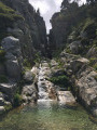
At the (10) (on both the outward and return journeys), there is a charming stone shepherd’s hut built against some enormous boulders. As with the previous point, if it’s unoccupied and there are no animals grazing nearby, you can go and have a look. However, it’s locked and reserved for the shepherds who stay there during the summer season!

Between (4) and (6), you may come across walkers, as the route follows the Tour du Canigou and, in part, the HRP.

Reviews and comments

5 / 5
Based on 1 review

Reliability of the description
5 / 5
Ease of following the route
5 / 5
Route interest
5 / 5
randoludo11
randoludo11

Overall rating : 5 / 5

Date of your route : Oct 06, 2023
Reliability of the description : ★★★★★ Very good
Ease of following the route : ★★★★★ Very good
Route interest : ★★★★★ Very good
Very busy route : No

Hello,
It’s lovely to see a hike in the Vallespir.
Thanks to those who aren’t familiar with the area.
Best wishes from a fellow mountaineer.
--
Ludo⛺
http://randoludo.blog4ever.com
http://matraversee.blog4ever.com

Machine-translated

Other walks in the area

For more walks, use our search engine .

The GPS track and description are the property of this route's author. Please do not copy them without permission.