Refine your search for walks in Col du vallon (2463m)
Col du vallon (2463m) walks


 The peaks of La Mayt and Chabrières
 Visorando Member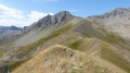
 9.34 mi
 +3,153 ft
 -3,156 ft
 7h 05
7h 05
 Difficult
 Departure from Vars (Hautes-Alpes)
Overlooking the ski areas of Vars and Risoul, enjoy a 360-degree panorama of the Ubaye, the Queyras and the Ecrins. This panorama is helpfully described at the summit of Chabrières, where there is an orientation table.
Walks near Col du vallon (2463m)
Basse Rua - Maljasset
10.62 mi
+4,688 ft
-4,186 ft
9h 00
 Very difficult
Departure from Vars (Hautes-Alpes)
Very difficult
Departure from Vars (Hautes-Alpes)
There is a long crossing before the Col des Houerts, which takes you into the Ubaye Valley.
In the cool shade of the larch trees at Les Orres
 Tourist office
 2.96 mi
+246 ft
-2,123 ft
1h 35
2.96 mi
+246 ft
-2,123 ft
1h 35
 Easy
Departure from Les Orres (Hautes-Alpes)
Easy
Departure from Les Orres (Hautes-Alpes)
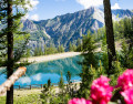
A long, cool downhill walk through the larch forest, passing through Grand-Clos, where the water reservoir transforms into a mirror-like lake.
This walk is a downhill route from the top of the Pic Vert chairlift to the 1650 resort (L’Épervière car park).
Ceillac - Basse Rua
8.29 mi
+4,613 ft
-4,219 ft
7h 50
Difficult
Departure from Ceillac (Hautes-Alpes)
Passing by Pic d'Escreins, make the connection between the Cristillan valley and the Val d'Escreins.
Ceillac - Maljasset
 8.18 mi
+3,694 ft
-2,799 ft
7h 00
Difficult
Departure from Ceillac (Hautes-Alpes)
8.18 mi
+3,694 ft
-2,799 ft
7h 00
Difficult
Departure from Ceillac (Hautes-Alpes)
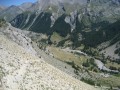
A stage of the Queyras Alpine crossing to reach the Haute Ubaye Valley, including a section via Lake Sainte-Anne and the Col Girardin.
Ceillac - Saint Véran
 7.82 mi
+4,321 ft
-3,045 ft
7h 20
7.82 mi
+4,321 ft
-3,045 ft
7h 20
 Moderate
Departure from Ceillac (Hautes-Alpes)
Moderate
Departure from Ceillac (Hautes-Alpes)
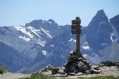
The third stage is entirely on theGR®58, heading towards the rising sun.
Ceillac - Le Cros
6.30 mi
+3,386 ft
-2,585 ft
5h 50
Difficult
Departure from Ceillac (Hautes-Alpes)
This is the fourth and final stage of this journey between Queyras (05) and Ubaye (04). Passing through the Col des Estronques brings you back to the starting point in the hamlet of Cros.
From Ceillac to Fouillouse
 13.37 mi
+4,452 ft
-4,216 ft
10h 00
Difficult
Departure from Ceillac (Hautes-Alpes)
13.37 mi
+4,452 ft
-4,216 ft
10h 00
Difficult
Departure from Ceillac (Hautes-Alpes)
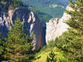
This fifteenth stage crosses the Escreins massif (not to be confused with the Écrins massif) and, via the Ubaye valley, enters the Chambeyron valley. From the Refuge de la Cime, the route—off the GR®5—crosses the Torrent du Mélezet valley and climbs up the Pré Girardin valley via the ski runs; then, on the plateau, it skirts the rocky ridge overlooking Lac Miroir, reaches the lake and rejoins the GR®5. The route climbs up the valley between the shoulder of the Pic des Heuvières and the Crête de Coste Belle, passing the small pass of Sainte-Anne and then the lake of the same name before reaching the Col Girardin. It descends towards a basin, where the Torrent des Séchoirs has its source, and follows it. Clinging to the side of a steep slope, it joins the D25 road in the upper Ubaye valley and continues downstream, alternating between the road and paths close to the river. It leaves the D25 for the Fouillouse road, passes the vertiginous Pont du Châtelet, a tunnel and, via a path, reaches the hamlet of Fouillouse.
Trek around Chambeyron Mountain Range (1) Fouillouse - Refuge du Chambeyron
 3.88 mi
+2,470 ft
-36 ft
3h 55
Moderate
Departure from Saint-Paul-sur-Ubaye (Alpes-de-Haute-Provence)
3.88 mi
+2,470 ft
-36 ft
3h 55
Moderate
Departure from Saint-Paul-sur-Ubaye (Alpes-de-Haute-Provence)
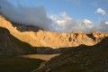
First stage around the Chambeyron Mountain Range which, after a steady climb, takes you to the shelter with the same name. You'll end up in a breath-taking setting, at the foot of Brec de Chambeyron.
Trek around Chambeyron Mountain Range
 36.21 mi
+13,120 ft
-13,783 ft
5 days
Difficult
Departure from Saint-Paul-sur-Ubaye (Alpes-de-Haute-Provence)
36.21 mi
+13,120 ft
-13,783 ft
5 days
Difficult
Departure from Saint-Paul-sur-Ubaye (Alpes-de-Haute-Provence)
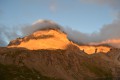
Reaching over 3000 metres in altitude, Aiguilles de Chambeyron and Brec de Chambeyron form an impressive mountain range halfway between Queyras and the Moncantour. This hike offers a trek with no techincal difficulty, with passes over 2700 m in altitude and a summit of over 3000 m. Set in an outstanding landscape and for the most part within a high mountain setting.