


Refine your search for walks in Col du Mollard
Col du Mollard walks


 Trek around Mont Outheran starting from Désert d'Entremont
 Visorando Member
 8.01 mi
 +1,873 ft
 -1,873 ft
 6 hrs
6 hrs
 Moderate
 Departure from Entremont-le-Vieux (Savoie)
A beautiful hike to be done with or without snowshoes.
 Circuit of Mont Outheran, via the Col du Mollard, Col du Planet and Col du Grapillon
7.70 mi
+1,719 ft
-1,690 ft
3 hrs
Moderate
Departure from Entremont-le-Vieux (Savoie)
A mountain bike tour of Mont Outheran via the Col du Mollard, Col du Planet and Col du Grapillon, allowing you to explore its different sides with relatively limited elevation changes as the route never descends very far down.
Walks near Col du Mollard
 Col de La Valette – Clavans via Lac des Quirlies
8.94 mi
+1,939 ft
-4,895 ft
5h 50
 Difficult
Departure from Besse (Isère) (Isère)
Difficult
Departure from Besse (Isère) (Isère)
Return to the Romanche by heading down the Ferrand valley.
A return trip – though optional – to the Quirlies glacial lake would be a shame to miss.
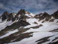
From Grange Bernard to the Refuge de Terre Rouge
 Association / Club / Walk leader
 5.14 mi
+1,896 ft
-33 ft
4h 00
Moderate
Departure from Valmeinier (Savoie)
5.14 mi
+1,896 ft
-33 ft
4h 00
Moderate
Departure from Valmeinier (Savoie)
First stage of the Petit tour du Mont Thabor hike
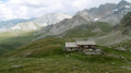
Valmeinier 1800 – Refuge du Thabor
 9.69 mi
+5,079 ft
-2,690 ft
10 hrs
9.69 mi
+5,079 ft
-2,690 ft
10 hrs
 Very difficult
Departure from Valmeinier (Savoie)
Very difficult
Departure from Valmeinier (Savoie)
The route begins on theGRP® Tour du Mont Thabor trail, starting from the Petite Station in Valmeinier 1800. You’ll pass the Col des Marches, Lake Bissorte, the Refuge des Marches, Lake des Batailléres, the pass of the same name, Lake Long and Lake Rond before arriving at the Refuge du Thabor.
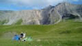
Montpascal – Valbuche
 8.10 mi
+4,413 ft
-1,834 ft
5 hrs
Very difficult
Departure from Pontamafrey-Montpascal (Savoie)
8.10 mi
+4,413 ft
-1,834 ft
5 hrs
Very difficult
Departure from Pontamafrey-Montpascal (Savoie)
First day of a two-day hike in the Maurienne with a bivouac.
Hike completed in 2016 with a break at the Col de la Baisse, another above the Chalet des Brunes and a final one at the Chalet du Tovet.
Note: The route shown is based on my GPS watch, which I never paused, which explains the circular patterns in certain places.
From the Terre Rouge Refuge to the Mont Thabor Refuge
8.39 mi
+3,740 ft
-2,651 ft
7h 05
Difficult
Departure from Valmeinier (Savoie)
Second stage of the short Mont Thabor circuit hike
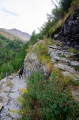
Refuge de Terre Rouge - Le Prec
 8.76 mi
+2,165 ft
-3,848 ft
5h 55
Difficult
Departure from Valmeinier (Savoie)
8.76 mi
+2,165 ft
-3,848 ft
5h 55
Difficult
Departure from Valmeinier (Savoie)
This is the last stage of this three-day route, with one last beautiful climb. A final alpine pass, a few lakes, and the return via the Fenêtre du Prec to round off this lovely Tour du Thabor.
Valbuche – Montpascal
5.98 mi
+2,096 ft
-4,669 ft
5 hrs
Very difficult
Departure from Saint-Jean-de-Belleville (Savoie)
The second day of a two-day hike in the Maurienne region, including a bivouac.
La Grave – Goléon Mountain Hut
4.72 mi
+3,271 ft
-108 ft
5h 00
Difficult
Departure from La Grave (Hautes-Alpes)
The idea behind this three-day self-supported trek is to link the Goléon massif to the Grandes Rousses massif via the ridges to the north of the Plateau d’Emparis.
It’s a wild hike requiring not only good physical fitness but also the ability to read maps and the terrain.
Thefirst day is just a warm-up.
From Goléon to Les Grandes Rousses: La Grave / Clavans
86.50 mi
+29,537 ft
-26,375 ft
3 days
Very difficult
Departure from La Grave (Hautes-Alpes)
From the Goléon massif to the Grandes Rousses massif, via the ridges between Emparis and Arves.A multi-day hike, with a bivouac, along the ridges between Emparis and Arves.
La Grave - Alpe de Villar-d'Arêne mountain hut
 6.87 mi
+2,618 ft
-669 ft
5h 25
Difficult
Departure from La Grave (Hautes-Alpes)
6.87 mi
+2,618 ft
-669 ft
5h 25
Difficult
Departure from La Grave (Hautes-Alpes)
After a rest day in La Grave, set off on this8th stage, which presents no technical difficulties and involves no significant elevation gain. A route that circles La Meije, initially following the Romanche torrent. You will pass close to Villar d'Arène. Thesecond section, starting from Pont d'Arsine, is slightly more challenging and much wilder, taking in the Pas d'Anna Falque and the Plan d'Alpe before reaching the Refuge de l'Alpe de Villar-d'Arêne, which offers breathtaking views of the surrounding mountains.