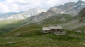
From the Terre Rouge Refuge to the Mont Thabor Refuge

Second stage of the short Mont Thabor circuit hike

This walk is part of a multi-day hike: A short walk around Mont Thabor

Details

30729413
Creation:
Last update:
Last review:
  • Walking
    Activity: Walking
  • ↔
    Distance: 8.39 mi
  • ◔
    Average duration: 7h 05 
  • ▲
    Difficulty: Difficult

  • ⚐
    Back to start: No
  • ↗
    Ascent: + 3,740 ft
  • ↘
    Descent: - 2,651 ft

  • ▲
    Highest point: 10,427 ft
  • ▼
    Lowest point: 7,113 ft

Description of the walk

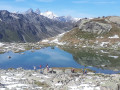
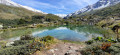
(S) From the Terre Rouge Refuge, continue south-east, skirting Lake Caspi, until you reach the Pierre du Déjeuner.

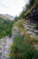
(1) Continue towards Mont Thabor. At the foot of the massif, take a path that climbs up a scree slope which is somewhat unstable but, above all, very steep. Reach the Col de la Chapelle.

(2) Go round the Pointe des Angelières and rejoin theGR®57below the summit of Mont Thabor.

(3) Turn left onto it to reach the summit and its chapel, which can serve as a refuge.

(4) Follow the same path back in the opposite direction to theGR® junction.

(3) Begin the descent and walk past the three crosses before reaching the Col des Méandes.

(5) Take the left-hand branch of theGR®57. Begin a steep descent to reach Lac du Peyron.

(6) Take a wide right-hand bend and begin a short climb to reach the Col de la Vallée Étroite, a major junction ofthe GR® andGRP® routes.
This is where theGR®5, linking Modane to the Vallée Étroite, joins the route; theGR®57heads off to the right towards the Vallée Étroite, whilst theGRP® Tour du Mont Thabor heads off to the left towards the Refuge de la Vallée Étroite.

(7) Turn left to reach the Refuge du Mont Thabor (E), where you will spend the night.

Waypoints

  1. S : mi 0 - alt. 7,113 ft - Refuge de Terre Rouge
  2. 1 : mi 2.12 - alt. 8,474 ft - Pierre du Déjeuner
  3. 2 : mi 3.25 - alt. 9,547 ft - Col de la Chapelle
  4. 3 : mi 3.69 - alt. 10,052 ft - GR57 junction
  5. 4 : mi 3.98 - alt. 10,417 ft - Mont Thabor
  6. 5 : mi 5.09 - alt. 8,934 ft - Col des Méandes
  7. 6 : mi 6.15 - alt. 8,038 ft - Lac du Peyron
  8. 7 : mi 7.91 - alt. 7,979 ft - Col de la Vallée Etroite
  9. E : mi 8.39 - alt. 8,202 ft - Refuge du Mont Thabor

Always be cautious and plan ahead when you're outdoors. Visorando and the author of this route cannot be held responsible for any accidents occurring on this route.

The GR® and PR® markings are the intellectual property of the Fédération Française de Randonnée Pédestre.

Other walks in the area

For more walks, use our search engine .

The GPS track and description are the property of this route's author. Please do not copy them without permission.