


Refine your search for walks in col de Valbelle
col de Valbelle walks


 Circular route around Les Florins: between the past and the present
 Visorando Member
 8.13 mi
 +3,041 ft
 -3,038 ft
 6h 25
6h 25
 Difficult
 Departure from Saint-André-d'Embrun (Hautes-Alpes)
At the start, part of the path has been converted into a forest track or a road. The remote pass has become a ski run. You’ll see more marmots than signposts there. Above all, your eyes will be fixed on the Écrins range. Descend via the old path which leads back to Le Florins and its waterfall. An unusual hike.
Moderators’ note . For changes on the ground, see the notices
Please note: following the bad weather in December 2023, the hamlet of Les Florins has been partially damaged and is inaccessible. The path after the (9) may be impassable or dangerous.
Walks near col de Valbelle
Basse Rua - Maljasset
10.62 mi
+4,688 ft
-4,186 ft
9h 00
 Very difficult
Departure from Vars (Hautes-Alpes)
Very difficult
Departure from Vars (Hautes-Alpes)
There is a long crossing before the Col des Houerts, which takes you into the Ubaye Valley.
In the cool shade of the larch trees at Les Orres
 Tourist office
 2.96 mi
+246 ft
-2,123 ft
1h 35
2.96 mi
+246 ft
-2,123 ft
1h 35
 Easy
Departure from Les Orres (Hautes-Alpes)
Easy
Departure from Les Orres (Hautes-Alpes)
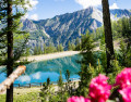
A long, cool downhill walk through the larch forest, passing through Grand-Clos, where the water reservoir transforms into a mirror-like lake.
This walk is a downhill route from the top of the Pic Vert chairlift to the 1650 resort (L’Épervière car park).
Ceillac - Maljasset
 8.18 mi
+3,694 ft
-2,799 ft
7h 00
Difficult
Departure from Ceillac (Hautes-Alpes)
8.18 mi
+3,694 ft
-2,799 ft
7h 00
Difficult
Departure from Ceillac (Hautes-Alpes)
A stage of the Queyras Alpine crossing to reach the Haute Ubaye Valley, including a section via Lake Sainte-Anne and the Col Girardin.
Ceillac - Basse Rua
8.29 mi
+4,613 ft
-4,219 ft
7h 50
Difficult
Departure from Ceillac (Hautes-Alpes)
Passing by Pic d'Escreins, make the connection between the Cristillan valley and the Val d'Escreins.
Ceillac - Saint Véran
 7.82 mi
+4,321 ft
-3,045 ft
7h 20
7.82 mi
+4,321 ft
-3,045 ft
7h 20
 Moderate
Departure from Ceillac (Hautes-Alpes)
Moderate
Departure from Ceillac (Hautes-Alpes)
The third stage is entirely on theGR®58, heading towards the rising sun.
Ceillac – Saint-Véran
 8.54 mi
+4,252 ft
-2,986 ft
7h 40
Difficult
Departure from Ceillac (Hautes-Alpes)
8.54 mi
+4,252 ft
-2,986 ft
7h 40
Difficult
Departure from Ceillac (Hautes-Alpes)
A good warm-up for thisfirst stage. Thefirst pass is the Col des Estronques, followed by a round trip to the nearby summit of the Tête de la Jacquette, where an exceptional panorama awaits you, taking in the Pics de la Font Sancte, the Aiguille de Chambeyron, the Bric de Rubren, the Peouvou and, to the north, the Grand Glaiza and the Rochebrune.
Ceillac - Le Cros
6.30 mi
+3,386 ft
-2,585 ft
5h 50
Difficult
Departure from Ceillac (Hautes-Alpes)
This is the fourth and final stage of this journey between Queyras (05) and Ubaye (04). Passing through the Col des Estronques brings you back to the starting point in the hamlet of Cros.
Route around Le Ponteil
 4.23 mi
+1,791 ft
-1,729 ft
3h 30
Moderate
Departure from Champcella (Hautes-Alpes)
4.23 mi
+1,791 ft
-1,729 ft
3h 30
Moderate
Departure from Champcella (Hautes-Alpes)
A route starting from Le Ponteil that goes round the large, unnamed peak near the Tramouillon hut.
Alpage de la Selle - Moussière
4.92 mi
+358 ft
-1,581 ft
2h 35
Moderate
Departure from Saint-Crépin (Hautes-Alpes)
This pleasant second day begins with a climb to the Col de Moussière before passing by the very pleasant Lac du Lauzet, then taking the long forest track back to the Moussière car park.
From Ceillac to Fouillouse
 13.37 mi
+4,452 ft
-4,216 ft
10h 00
Difficult
Departure from Ceillac (Hautes-Alpes)
13.37 mi
+4,452 ft
-4,216 ft
10h 00
Difficult
Departure from Ceillac (Hautes-Alpes)
This fifteenth stage crosses the Escreins massif (not to be confused with the Écrins massif) and, via the Ubaye valley, enters the Chambeyron valley. From the Refuge de la Cime, the route—off the GR®5—crosses the Torrent du Mélezet valley and climbs up the Pré Girardin valley via the ski runs; then, on the plateau, it skirts the rocky ridge overlooking Lac Miroir, reaches the lake and rejoins the GR®5. The route climbs up the valley between the shoulder of the Pic des Heuvières and the Crête de Coste Belle, passing the small pass of Sainte-Anne and then the lake of the same name before reaching the Col Girardin. It descends towards a basin, where the Torrent des Séchoirs has its source, and follows it. Clinging to the side of a steep slope, it joins the D25 road in the upper Ubaye valley and continues downstream, alternating between the road and paths close to the river. It leaves the D25 for the Fouillouse road, passes the vertiginous Pont du Châtelet, a tunnel and, via a path, reaches the hamlet of Fouillouse.