Circular route around Les Florins: between the past and the present

At the start, part of the path has been converted into a forest track or a road. The remote pass has become a ski run. You’ll see more marmots than signposts there. Above all, your eyes will be fixed on the Écrins range. Descend via the old path which leads back to Le Florins and its waterfall. An unusual hike.
Moderators’ note . For changes on the ground, see the notices
Please note: following the bad weather in December 2023, the hamlet of Les Florins has been partially damaged and is inaccessible. The path after the (9) may be impassable or dangerous.

Details

n°3639017
Creation:
Last update:
Last review:
  • Walking
    Activity: Walking
  • ↔
    Distance: 8.13 mi
  • ◔
    Average duration: 6h 25 
  • ▲
    Difficulty: Difficult

  • ⚐
    Back to start: Yes
  • ↗
    Ascent: + 3,041 ft
  • ↘
    Descent: - 3,038 ft

  • ▲
    Highest point: 7,822 ft
  • ▼
    Lowest point: 5,187 ft

Photos

Description of the walk

To reach the starting point, take the small tarmac road at Saint-André d’Embrun towards the Col de la Coche. 3 km before the pass, on the left, park near the wooden sign pointing to Les Florins.

(S/E) Start the walk by staying on the tarmac road towards the Col de la Coche.

(1) At the first hairpin bend, leave the road and continue straight on along the forest track. This track follows the Torrent de Palps without actually joining it. Do not take the paths that veer off to the right and climb steeply, nor those that join the torrent. Further on, cross the Torrent de Partenq, where you can see the water flowing over large rocks on the right.

(2) About 400 m after crossing the torrent, at the junction of the forest tracks, take the one on the right which climbs steeply. This track splits into several paths.
If you take the middle one, it will soon end at a path running perpendicular to it. Turn left (east). If you take the one on the right (less steep), leave it at the first junction to take the path on the left. This forest track will soon come to an end. Further along, you’ll come across the small, disused path that used to exist. It’s easy to follow if you pay attention and leads to a track suitable for vehicles.

(3) Continue to the left towards the Cabane de Valbelle. Walk past it and carry on to thefirstchairlift (Clos Chardon).

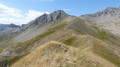
(4) At the foot of the chairlift, turn your back on it and head in the opposite direction (north). Take the slope (ski run) between the restaurant – which is only open in winter – and the Razis chairlift. You can make out a snowcat track leading north-north-east up to the Col de Valbelle, from where you can see the Écrins mountain range.

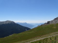
(5) Turn left, then at the Fork in the road a few metres further on, take the path on the right, which you’ll see winding its way up. The destination is the Belvédère de l’Homme de Pierre for its views. These are the buildings with antennas.

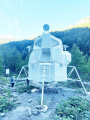
(6) Leave this path, which descends towards Risoul, and turn left to climb up to the Belvédère de l’Homme de Pierre. This is the group of buildings with telecoms masts on the promontory.

(7) On the side opposite the Écrins, you can see Lac de Serre-Ponçon. Directly below the ridge, head towards the barn (Cabane de Chérine) which you can make out to the south-east.

(8) At this point, follow the drovers' road on the right which descends towards Les Florins and passes through the gap. The path then descends towards the stream, crosses it, and follows it along the bank.

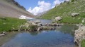
(9) Once you reach Les Florins, walk upstream along the small stream until you come to a magnificent waterfall overlooking the abandoned hamlet.

(10) Turn back and head down towards the hamlet.

(9) Walk past the renovated chapel, cross the Torrent de Palps, and head up the wide path on the right which leads back to the road, where your car is parked (S/E).

Waypoints

  1. S/E : mi 0 - alt. 5,187 ft - Parking next to the ‘Les Florins’ sign
  2. 1 : mi 0.14 - alt. 5,289 ft - Turn off at the hairpin bend, straight on along the forest track
  3. 2 : mi 1.05 - alt. 6,129 ft - Forest track on the right
  4. 3 : mi 1.45 - alt. 6,699 ft - Road suitable for vehicles, on the left
  5. 4 : mi 2.53 - alt. 7,165 ft - Clos Chardon chairlift
  6. 5 : mi 3.13 - alt. 7,805 ft - col de Valbelle
  7. 6 : mi 4.14 - alt. 7,484 ft - Junction: turn left after the - Col de chérine
  8. 7 : mi 5.16 - alt. 7,766 ft - Belvédère de l'Homme de Pierre
  9. 8 : mi 5.82 - alt. 7,293 ft - Cabane de Chérine
  10. 9 : mi 7.37 - alt. 5,338 ft - Les Florins
  11. 10 : mi 7.51 - alt. 5,456 ft - Waterfall
  12. S/E : mi 8.13 - alt. 5,190 ft - Parking next to the ‘Les Florins’ sign

Notes

Bring water: there may be water at the Cabane de Valbelle (8), but it is sometimes dry.
Good walking shoes.
Trousers or gaiters are preferable, as the old, disused path leading uphill may sometimes have stinging nettles.

Worth a visit

Les Florins is a magnificent, remote and abandoned hamlet; life there was simply too hard. We’ll follow the two paths that once connected its inhabitants to the rest of the world.

This walk brings together the old village, abandoned because life was too harsh, and the new mountain economy. A track suitable for mountain biking and a ski resort.
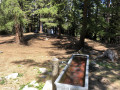
Les Florins is well worth a stop. If you can enter the restored chapel, a notice board recounts the history of this hamlet.
The small road over the Col de la Coche did not exist at that time. This is why the hamlet was more closely linked to Réallon and Vars, for which it became a summer grazing area for cows.

Reviews and comments

3.8 / 5
Based on 2 reviews

Reliability of the description
3.5 / 5
Ease of following the route
3.5 / 5
Route interest
4.5 / 5
JPC07
JPC07

Overall rating : 3.3 / 5

Date of your route : Aug 04, 2022
Reliability of the description : ★★★☆☆ Average
Ease of following the route : ★★★☆☆ Average
Route interest : ★★★★☆ Good
Very busy route : No

Please note: the condition of the paths has changed significantly since the author first mapped out this walk. First of all: if you have no mobile signal, don’t set off. From the start to point 3, the route is completely impassable: paths rutted by forestry vehicles, no signposts, tall grass, stones – everything you’d expect. On the other hand, from point 3 to 8, there are some very beautiful views, especially if you stick to the ridge path between points 5 and 7. However, from point 8 onwards, the path is very difficult to find and if you stray off it even slightly, you’ll soon find yourself above impassable rocky outcrops. Personally, I’d recommend doing it the other way round: the FLORINS is a stunningly wild area, and there’s no trouble at all finding the path up to 8. If you’re really keen to do a circular route, from point 3, head back via the FONT FROIDE track. Personally, if I were to go back, I’d just do a return trip (in the opposite direction) from 1 to 5, taking the direct shortcut from 6 to 8 on the way back. Seen in that light, it’s a lovely hike!

Machine-translated

patembrun
patembrun

Overall rating : 4.3 / 5

Date of your route : May 09, 2021
Reliability of the description : ★★★★☆ Good
Ease of following the route : ★★★★☆ Good
Route interest : ★★★★★ Very good
Very busy route : No

A brilliant hike. We climbed up to Valbelle through the snow along the track, then followed the Risoul ridge to have a picnic at the Chérine hut. A pleasant descent down to Les Florins.
Just one point: from Les Florins to the Valbelle hut, it’s much easier to follow the Piste de Fontfroide to reach the track.

Machine-translated

Other walks in the area

For more walks, use our search engine .

The GPS track and description are the property of this route's author. Please do not copy them without permission.