The Riaille circular path starting from Ceillac

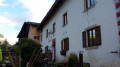
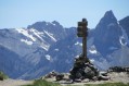
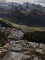
More of a stroll than a hike, this route takes you through the Bois de Jalavez and the alpine hamlet of La Riaille, finishing by following the left bank of the Mélezet stream.

Details

n°12670312
Creation:
Last update:
Last review:
  • Walking
    Activity: Walking
  • ↔
    Distance: 7.21 mi
  • ◔
    Average duration: 4h 35 
  • ▲
    Difficulty: Moderate

  • ⚐
    Back to start: Yes
  • ↗
    Ascent: + 1,450 ft
  • ↘
    Descent: - 1,407 ft

  • ▲
    Highest point: 6,450 ft
  • ▼
    Lowest point: 5,348 ft

Description of the walk

Park in the large car park by the roadside near the Salle des Fêtes in Ceillac.

(S/E) Continue along the street until you reach the market square. Carry on without crossing the Ruisseau du Cristillan. Head for the bridge crossing the stream, then continue to the right, following the stream, and you’ll soon come to a path junction. Begin a steep climb by taking the path to the right, signposted ‘Sentier Balcon’. A series of tight hairpin bends will take you to a flat area. Leave the path to the right to enjoy a bird’s-eye view of Ceillac.

(1) Return to the path and turn right onto it, continuing the gentle climb via a series of hairpin bends. You will then reach the designated paragliding launch site.

(2) Cross the launch area and continue along the path to reach the junction with the forest track.

(3) Turn right onto the track, passing the barrier blocking this track to motor vehicles. You’ll then come to several junctions; ignore them and stay on this wide, pleasant track. Continue, alternating between short ascents and descents, until you reach another barrier and then the tarmac road leading to Chaurionde.

(4) Turn left onto this road, then turn left off it a few metres further on to head uphill to the hamlet of La Riaille and its chapel.

(5) Follow the same route as on the way out and return to the road junction.

(4) Leave the road here and take the yellow-marked path to the left through the meadows; there is a sign indicating these meadows. Cross the Mélezet stream via a footbridge made of wooden logs. Continue straight ahead into the woods; keep right at the next junction, always following the signs for Ceillac. You’ll reach a track opposite the Chalet de la Cime du Mélezet.

(6) Take the track straight ahead; do not cross the stream here, but continue alongside it at a slight distance. Follow a short series of hairpin bends to reach the left bank of the stream, arriving opposite the Waterfall de la Pisse.

(7) Cross the torrent at the waterfall and then continue along theGR®5, marked in red and white, which takes you past the wooden sculptures on the ‘Chemin des Contes et Légendes’ (Path of Tales and Legends). Follow the almost level path to reach the junction with theGRP® ‘Tour de la Font Sancte’ trail.

(8) Turn right, cross the Mélezet via the bridge to return to the Salle des Fêtes car park (S/E).


Waypoints

  1. S/E : mi 0 - alt. 5,348 ft - Salle des Fêtes car park
  2. 1 : mi 0.42 - alt. 5,571 ft - Viewpoint over Ceillac
  3. 2 : mi 0.79 - alt. 6,004 ft - Paragliding area
  4. 3 : mi 0.95 - alt. 6,089 ft - Forest track
  5. 4 : mi 3.56 - alt. 6,201 ft - Return junction
  6. 5 : mi 3.8 - alt. 6,394 ft - La Riaille
  7. 6 : mi 4.74 - alt. 5,935 ft - Summit of the Mélezet - Refuge de la Cime du Melezet
  8. 7 : mi 5.54 - alt. 5,568 ft - Cascade de la Pisse (Ceillac)
  9. 8 : mi 7.06 - alt. 5,404 ft - GRP junction
  10. S/E : mi 7.21 - alt. 5,381 ft - Salle des Fêtes car park

Notes

No water points along the route.

Worth a visit

Always be cautious and plan ahead when you're outdoors. Visorando and the author of this route cannot be held responsible for any accidents occurring on this route.

The GR® and PR® markings are the intellectual property of the Fédération Française de Randonnée Pédestre.

Reviews and comments

5 / 5
Based on 2 reviews

Reliability of the description
5 / 5
Ease of following the route
5 / 5
Route interest
5 / 5
VCANET
VCANET

Overall rating : 5 / 5

Date of your route : Oct 25, 2026
Reliability of the description : ★★★★★ Very good
Ease of following the route : ★★★★★ Very good
Route interest : ★★★★★ Very good
Very busy route : No

A lovely walk amongst the larch trees in their autumn colours.
With our feet in 5 cm of snow above 1,800 m.

Machine-translated

User 5826626

Overall rating : 5 / 5

Date of your route : Aug 23, 2025
Reliability of the description : Not used / Not applicable
Ease of following the route : ★★★★★ Very good
Route interest : ★★★★★ Very good
Very busy route : Yes

A beautiful, easy hike. But there's no point in going all the way to La Raille, which is just a car park on a paved road. A small path branches off to the right at the start of the road. Cross the small stream and follow it to the right to rejoin the trail.

Machine-translated

petitlapin70
petitlapin70

The walk was cancelled due to heavy snow.

Machine-translated

Other walks in the area

For more walks, use our search engine .

The GPS track and description are the property of this route's author. Please do not copy them without permission.