


Refine your search for walks in Cogny (Rhône)
Cogny (Rhône) walks


 A long, solitary escape west of Cogny
 Visorando Member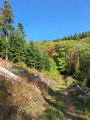
 16.74 mi
 +3,314 ft
 -3,320 ft
 10 hrs
 Very difficult
 Departure from Cogny (Rhône) (Rhône)
This day hike is intended for experienced walkers. Its appeal lies in the long kilometres of solitude, where hikers can find themselves while awakening their senses by listening to the various sounds of nature and enjoying the magnificent landscapes where the ridge line oscillates from "very high" to "walker's height".
This hike is difficult due to its length and elevation gain. In total, slopes greater than 7% stretch over 11 kilometres. In addition, orientation is complicated fromthe 11th tothe 13th kilometre as there are many crossroads. The psychological impact should not be overlooked, as you will almost always take the uphill paths at the crossroads. For this very difficult hike, be sure to take all the necessary precautions.
Loop between Ville-sur-Jarnioux and Jarnioux
 5.21 mi
+643 ft
-636 ft
2h 55
5.21 mi
+643 ft
-636 ft
2h 55
 Easy
Departure from Ville-sur-Jarnioux (Rhône)
Easy
Departure from Ville-sur-Jarnioux (Rhône)
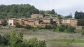
From Ville-sur-Jarnioux, take the Voie du Tacot to Jarnioux and return via small paths. This is an easy walk with beautiful views of both villages.
Viewpoints from Crêt de Charnat and Saint-Bonnet Chapel
 8.72 mi
+1,752 ft
-1,736 ft
5h 30
8.72 mi
+1,752 ft
-1,736 ft
5h 30
 Moderate
Departure from Montmelas-Saint-Sorlin (Rhône)
Moderate
Departure from Montmelas-Saint-Sorlin (Rhône)
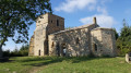
A peaceful route starting from Montmelas-Saint-Sorlin via Crêt de Charnat, Crêt Neron, Col de Saint-Bonnet and Chapelle Saint-Bonnet. Beautiful views of the Saône valley and the Alps.
Between the Châtoux and the Joncin mountain passes
 5.17 mi
+709 ft
-715 ft
3h 00
Moderate
Departure from Ville-sur-Jarnioux (Rhône)
5.17 mi
+709 ft
-715 ft
3h 00
Moderate
Departure from Ville-sur-Jarnioux (Rhône)
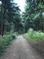
A scenic walk between the mountain passes of Col du Châtoux and Col du Joncin.
A loop hike from col du Chatoux in the Haut Beaujolais region
 9.05 mi
+1,129 ft
-1,129 ft
5h 10
Moderate
Departure from Sainte-Paule (Rhône)
9.05 mi
+1,129 ft
-1,129 ft
5h 10
Moderate
Departure from Sainte-Paule (Rhône)
From Col du chatoux (or col du Chêne), this hike goes through woods along the ridge line offering wonderful views:
-over the Saône and eastern Beaujolais valleys
- over Azergues Valley to the west.
From the Col to the Chapel of Saint-Bonnet
 1.77 mi
+249 ft
-259 ft
1h 00
Easy
Departure from Montmelas-Saint-Sorlin (Rhône)
1.77 mi
+249 ft
-259 ft
1h 00
Easy
Departure from Montmelas-Saint-Sorlin (Rhône)
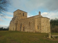
A lovely walk through the woods to the Chapel of Saint-Bonnet and its magnificent viewpoint.
Crêt Néron from the Croix du Ban
 4.83 mi
+965 ft
-965 ft
3h 05
Easy
Departure from Blacé (Rhône)
4.83 mi
+965 ft
-965 ft
3h 05
Easy
Departure from Blacé (Rhône)
A short, easy hike through vineyards and forests with beautiful views of the Saône valley. View to the west from the ridge.
Medieval walk in the Beaujolais region
 4.87 mi
+633 ft
-646 ft
2h 45
Easy
Departure from Oingt (Rhône)
4.87 mi
+633 ft
-646 ft
2h 45
Easy
Departure from Oingt (Rhône)
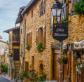
This loop takes you on a journey of discovery through an original and unique area, shaped by yellow ochre limestone, before you stroll through the medieval village of Oingt, listed as one of the "Most Beautiful Villages in France", with its golden stone houses welcoming artists and craftsmen. The village enjoys an exceptional view over the Azergues valley.
Circuit le Sallerin / le Sovarin de la commune de Blacé
 Local authority12.55 mi
+2,306 ft
-2,287 ft
7h 45
Local authority12.55 mi
+2,306 ft
-2,287 ft
7h 45
 Difficult
Departure from Blacé (Rhône)
Difficult
Departure from Blacé (Rhône)
Surplombant la vallée de la Saône, le sentier traverse les vignes du Beaujolais et passe par le bas du vallon de Rochefolle pour rejoindre l'acrobranche de Blacé, en traversant le ruisseau le Sallerin / le Sovarin et traverse une forêt de feuillus et de résineux. Une pause à la Chapelle de Saint-Bonnet révélera la beauté du panorama sur le Val de Saône et le Beaujolais.
Les Têtiéres route in the commune of Blacé
 9.98 mi
+1,873 ft
-1,857 ft
6h 15
Moderate
Departure from Blacé (Rhône)
9.98 mi
+1,873 ft
-1,857 ft
6h 15
Moderate
Departure from Blacé (Rhône)
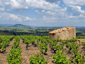
Overlooking the Saône valley, the trail crosses the Beaujolais vineyards and climbs the Col du Failly through a forest of deciduous and coniferous trees. A break at the Chapelle de Saint-Bonnet chapel will reveal the beauty of the panorama over the Saône Valley and the Beaujolais region.
Les Béragnons route in the commune of Blacé
 6.25 mi
+312 ft
-312 ft
3h 10
Moderate
Departure from Blacé (Rhône)
6.25 mi
+312 ft
-312 ft
3h 10
Moderate
Departure from Blacé (Rhône)
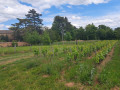
A 10 km circular that winds through the vineyards of Blacé and along the old Voie du Tacot road, passing through the village of Saint-Julien and near the Claude Bernard Museum.
Le grand circuit de Blacé
15.59 mi
+2,073 ft
-2,057 ft
9h 00
Difficult
Departure from Blacé (Rhône)
Randonnez sur ce sentier de 25 km et partez à la découverte du patrimoine blacéen, sa viticulture, ses panoramas, ses vieilles demeures. Ce circuit est une synthèse des trois autres circuits de la commune de Blacé et reprend en partie ces derniers (la Madone 5 km, les Béragnons 10 km et les Têtières 16 km).
Route de la Madone in the commune of Blacé
 3.58 mi
+545 ft
-548 ft
2h 05
Easy
Departure from Blacé (Rhône)
3.58 mi
+545 ft
-548 ft
2h 05
Easy
Departure from Blacé (Rhône)
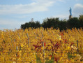
In the commune of Blacé, discover this 5 km trail, the Madone, built to protect the harvests, and enjoy the orientation table offering a panoramic view of the Monts du Lyonnais on the border with Burgundy and, on a clear day, Mont Blanc.
Les Pierres Dorées via Ville-sur-Jarnioux and Saint-Clair
 7.01 mi
+961 ft
-935 ft
4h 05
Moderate
Departure from Theizé (Rhône)
7.01 mi
+961 ft
-935 ft
4h 05
Moderate
Departure from Theizé (Rhône)
This loop takes the Chemin du Tacot and returns via a pretty ridge sheltered by old box trees.
Golden stones and country lanes from Sainte-Paule
 8.43 mi
+1,316 ft
-1,299 ft
5h 00
Moderate
Departure from Sainte-Paule (Rhône)
8.43 mi
+1,316 ft
-1,299 ft
5h 00
Moderate
Departure from Sainte-Paule (Rhône)
Through the rolling countryside, the walk follows the red-and-yellow or yellow signposts and takes us through Oingt, a pretty medieval village with golden-hued stone buildings, a Romanesque church and numerous craft shops. The walk mainly follows paths, tracks and quiet country lanes, apart from the D116, which you’ll need to walk alongside and then cross after the descent from the Col du Chêne. The walk ends with a steep climb… so save a bit of energy for the end.
Cadoles and geo-heritage in Pommiers
 4.57 mi
+486 ft
-495 ft
2h 30
Easy
Departure from Pommiers (Rhône) (Rhône)
4.57 mi
+486 ft
-495 ft
2h 30
Easy
Departure from Pommiers (Rhône) (Rhône)
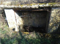
This route allows you to discover the geology and heritage of the south-western part of the village.
Ancient paths, wooded areas, cadoles (vineyard huts) built by our ancestors, but you will also discover a little-known part of the local industry of the past: clay extraction for tiles and bricks, lime kilns, hemp retting, and of course viticulture, all set against a backdrop of beautiful landscapes.
This route is the subject of the Pommiers 2022 geo-event, not to be missed.
More walks in Cogny (Rhône)
Select a point of interest below: