Country:
 City:


Park in the car park in front of the town hall, Place Bochin
(S/E) Leave the car park with your back to the town hall and turn right into Rue Châteaubriant. Continue along its extension into Rue de Bonne Fontaine. When this road joins the D14, cross carefully and turn left into Rue du Maine.
(1) At the junction, turn right onto Rue Saint-Martin and follow it for a good kilometre.
After the hamlet of La Cormerie, turn left towards Les Hautes Cours, then head for Les Basses Cours and finally La Cosnardière.
(2) Take the path on the right and follow it to Le Planty. Turn left, cross Avenue de Normandie very carefully – follow it for 20 metres to the left – then turn right onto a small street which very quickly becomes a path. This path goes round a property. Ignore a road on the left and, at the Fork in the road, continue straight ahead on the left.
(3) At a very sharp left-hand bend, take the path on the right. Continue for 20 metres along the road. Turn onto the path on the left. You will reach the hamlet of Saint Guillaume.
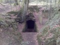
(4) Off the route, the steps on the left lead up to the rock for a view of the old quarry.
Carry on to the end of the road and turn right. When you reach the hamlet of La Clémençais, turn left and, 30 metres further on, ignore a road on the left.
(5) Before reaching Le Val, at a sharp left-hand bend, carry on straight ahead along the path (not shown on maps but very well marked).
Reach the road leading to La Bodinière (on the right). Follow it to the left and ignore a road on the right. Pass through the hamlet of Marche and continue due west to the bridge.
(6) Just before the bridge, take the steps on the right leading to the Voie Verte (the former railway line linking Fougères to Pontorson). Head left, due south.
Follow the Voie Verte, crossing a first road leading to La Basse Plesse, then a second one serving Loriais.
Carry on across the bridge that spans a road. At the bottom, on the left, you can see the sign marking the entrance to Louvigné-du-Désert
Carry on along the Voie Verte. Ignore a footbridge on the left.
(7) Turn left and go up the steps. Continue straight on along Rue du Floret. At the end of the street, turn right into Rue de Saint-Brice. Follow it as it bends to the left.
Turn right into Rue Michel and follow it to the left.
Turn right to walk past the church forecourt, cross Rue Lariboisière and continue slightly to the left along Rue du Maréchal Leclerc.
You’ll come back to the town hall car park. (S/E)

 Visorando Member

 Easy