The Ty-Mat route in Inzinzac-Lochrist

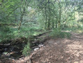
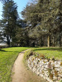
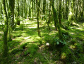
Passing through woodland, wetlands and streams, this nature walk will take you into the heart of the Trémelin Forest. A revitalising stroll amongst centuries-old trees, perfect for discovering the local flora and fauna. With all your senses alert, keep an eye out for an unexpected encounter: round a bend in the path, you might be lucky enough to spot a roe deer, a squirrel or a badger, or to find traces of their presence.

Details

n°58110419
Creation:
Last update:
Last review:
  • Walking
    Activity: Walking
  • ↔
    Distance: 2.56 mi
  • ◔
    Average duration: 1h 15 
  • ▲
    Difficulty: Easy

  • ⚐
    Back to start: Yes
  • ↗
    Ascent: + 108 ft
  • ↘
    Descent: - 102 ft

  • ▲
    Highest point: 210 ft
  • ▼
    Lowest point: 82 ft

Photos

Description of the walk

Parking is available at the start of the walk: car park to the north of the Ty-Mat pond (west of the Kerollin stream). Access via the Route de Trémelin from Inzinzac to Penquesten (second car park on the right coming from Inzinzac, first on the left coming from Penquesten).

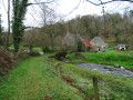
(S/E) As you leave the car park, on the road side, turn right (100 m). Turn onto the path on the right after the red bridge. This path runs alongside the Kerollin Mill stream.

(1) Go through the gate on the right and continue along the path on the right between the woods and the wetland. At the public bench, enjoy the view over the valley, then carry on straight ahead along the path as it climbs and keep to the left. Turn right (twice), then straight ahead through the forest (twice). Turn right to follow the sunken path between fields on one side and woodland on the other, until you reach the access road to the Domaine du Ty Mat. Admire the beautiful trees at the entrance to this private estate.

(2) Carry on straight ahead to re-enter the woodland. Take the path slightly to the left and carry on straight ahead, ignoring the first path on the right. At the junction with the wide lane leading down to the road, turn right to continue along the path through the woods. Follow the yellow markings on the path as it turns left, then right, and descends to the road. At the road, take care and turn right towards Ty Flute, then follow the footpath running alongside the D23 (500 m). You’ll arrive at the exit from Ty Flute.

(3) Turn right onto the bridge crossing the Kerollin Mill stream. Follow the wooden walkway spanning the wetland, then continue along the path which climbs up to join the woodland on the right. Carry on straight ahead, then turn right onto the path that runs below the Kerollin stream. Enjoy the tranquil atmosphere of the forest and, depending on the time of year, the soothing or lively sound of the stream. You’ll reach the junction where the walking trail and the mountain bike trail split.

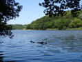
(4) Carry on straight ahead along the sunken path leading to the wetland and turn right to continue alongside the pond, then the stream, ignoring the paths on the left, until you reach the Ty Mat car park (S/E).

Waypoints

  1. S/E : mi 0 - alt. 135 ft - Car park to the north of the Ty-Mat pond
  2. 1 : mi 0.08 - alt. 128 ft - The stream at the Kerollin or Kersalo mill
  3. 2 : mi 0.76 - alt. 180 ft - Ty Mat Estate
  4. 3 : mi 1.34 - alt. 89 ft - Ty Flute
  5. 4 : mi 1.96 - alt. 125 ft - Junction as you approach the mill
  6. S/E : mi 2.56 - alt. 135 ft - Car park to the north of the Ty-Mat pond

Notes

This route is included in the Morbihan Departmental Plan for Walking and Hiking Routes and is accredited by the French Hiking Federation. You can follow the yellow ‘Circuit du Ty-Mat’ signposts. There is an information board with a map and details of local heritage features at the start.

This route is recommended by Lorient Agglomération
It is also recommended by pierre56: “A lovely walk through varied landscapes: woods, streams, ponds and wetlands. All on an easy, short route.”

Worth a visit

-Kerollin or Kersalo Mill Stream: a right-bank tributary of the Blavet, 9.5 km of watercourse from Calan.
-Ty Mat Estate: former seigneury ( 17th century),19th-century castle and manor house, privately owned.
-Wetland: plays a fundamental role in the water cycle (storing rainwater in winter, natural filtration via silt and plants). Hygrophilous flora (adapted to wetland environments) and poplar plantations.
-Trémelin Forest: 700 ha of deciduous and coniferous trees managed by the National Forestry Office (sustainable and responsible timber harvesting); great diversity of mosses and lichens. Forest exploited in the19th century (production of charcoal for the ironworks).
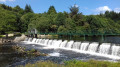
-Ty Mat Dam and Pond: site of the former mill belonging to the Ty Mat manor. Dam built by the Germans to supply the Lorient arsenal (1943–2000); plans for demolition and ecological restoration

Reviews and comments

5 / 5
Based on 1 review

Reliability of the description
5 / 5
Ease of following the route
5 / 5
Route interest
5 / 5
User 24890852

Overall rating : 5 / 5

Date of your route : Aug 18, 2025
Reliability of the description : ★★★★★ Very good
Ease of following the route : ★★★★★ Very good
Route interest : ★★★★★ Very good
Very busy route : No

We went early in the morning. It was very pleasant, wooded and full of trees.

Machine-translated

Other walks in the area

For more walks, use our search engine .

The GPS track and description are the property of this route's author. Please do not copy them without permission.