Country:

 City:


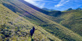
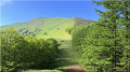
The walk starts from the Col d’Auzarai (or Hauzay, depending on the map), in the heart of the Hayra Forest: parking available.
(S/E) Take the track heading south-west along a tarmac section of approximately 300 m.
(1) At the three-way junction, ignore the track to the right and head towards the Harriondoko Kaskoa massif. Pass the Acheri Borda hunters’ hut and continue to a small cultivated area.
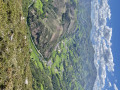
(2) Turn left to climb the highest point of Harriondoko Kaskoa (842 m), a small, steep peak overlooking the Aldudes Valley.
(3) Return to the junction.
(2) Resume the route to the left to go round this mountain to the north via a forest track, following the slope whilst passing a farm on the right and going through a gate marking a junction of paths.
(4) Turn left to follow the clear path along the mountainside until you reach a stream (Ahunztarreko), where you’ll join another track leading to the Bihurrietabuztanenea farm, situated at the bottom of the Nive des Aldudes valley.
(5) Take this small track – which has been tarmacked since 2024 – to the left, then the path that climbs through the scree towards the Col d’Urtarai. Here, the border does not follow the ridge line or any particular terrain but runs straight from Lindus toIchterbegui, a few kilometres further west. The dirt track has also changed here since 2023; it is now tarmacked over a large section.
(6) Shortly after the pass, you’ll cross the border, which is difficult to identify: however, you can try to spot Border Cross No. 151, which is supposed to be situated on a rock by the side of the path. You’ll need to search a little (depending on the season and the height of the ferns) for the precious engraved stone, which is often hidden amongst the vegetation.
(7) Then follow the road as it winds along the southern flank of the Col de Burdincurutcheta until you reach the pass itself.
(8) Turn right to begin the ascent of Lindus, which is off the beaten track but perfectly obvious . This rounded border peak (1,221 m – the highest point of the walk) is best known for its very well-preserved redoubt and lies on the Pyrenean watershed.
(9) Descend back to the Col de Burdincurutcheta (1,091 m).
(8) Head right, north-west, parallel to the track, and climb the nearby Urtarai (1,152 m).
(10) Descend along the northern ridge; further down, rejoin the more or less well-marked path, which is signposted with red markings.
(11) Pass the Rocher d’Hortzorrotz (1,025 m), which you may wish to climb. Return to the track and follow it along the wooded ridge to the Col d’Auzarai (S/E).
 Visorando Member
 Very difficult

 Difficult
 Association / Club / Walk leader
 Tourist office
 Easy