


Refine your search for walks in Lindus (1219 m)
Lindus (1219 m) walks


 The Harriondoko ridges, Lindus and Xaxperro in a loop from Urepel
 Visorando Member
 14.13 mi
 +3,294 ft
 -3,264 ft
 9h 20
9h 20
 Very difficult
 Departure from Urepel (Pyrénées-Atlantiques)
This loop is a superb hike in Lower Navarre, taking you in turn to the peaks of Lindus, Xaxperro and Sorotepo. This ridge route between France and Spain offers total immersion in the open, wild landscapes of the Basque Country. Throughout the route, panoramic views of the Baigorri valley, the surrounding Basque peaks and, on a clear day, the High Pyrenees follow one after another. A complete itinerary, between high-altitude pastures, airy ridges and a pastoral atmosphere, ideal for hikers in search of tranquillity and wide open spaces.
Walks near Lindus (1219 m)
Roncesvalles - Esteribar
 20.74 mi
+1,480 ft
-3,114 ft
10h 50
20.74 mi
+1,480 ft
-3,114 ft
10h 50
 Difficult
Departure from Orreaga/Roncesvalles (Navarre)
Difficult
Departure from Orreaga/Roncesvalles (Navarre)
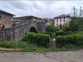
The forty-seventh stage of the Camino de Santiago. A long stage but less gruelling than the previous day’s, despite a somewhat arduous descent towards Zubiri. Along this route, you’ll alternate between landscapes of beech and pine forests and charming little villages with typical Navarran architecture. From this stage onwards, the signposting on the Camino de Santiago in Spain consists of yellow arrows—either painted on the ground, on building facades, on rocks or on trees—or specific European signage featuring a stylised yellow scallop shell on a blue background. This logo may also take the form of bronze scallop shells nailed to walls or set into the ground in the major towns along the route, indicating the direction towards Santiago de Compostela.
From Saint Jean-Pied-de-Port to Bidarray
13.73 mi
+1,749 ft
-2,041 ft
7h 50
Difficult
Departure from Saint-Jean-Pied-de-Port (Pyrénées-Atlantiques)
A beautiful stage in the Pyrenean foothills along country lanes.
From Saint-Jean-Pied-de-Port to Roncesvalles
 15.48 mi
+4,380 ft
-1,795 ft
10h 55
Difficult
Departure from Saint-Jean-Pied-de-Port (Pyrénées-Atlantiques)
15.48 mi
+4,380 ft
-1,795 ft
10h 55
Difficult
Departure from Saint-Jean-Pied-de-Port (Pyrénées-Atlantiques)
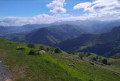
The forty-sixth stage of the Camino de Santiago. A physically demanding stage, featuring the ascent of the Pyrenees, splendid views of the surrounding Basque Country if the weather permits, free-roaming herds, a sense of being high up, and the excitement of crossing into Spain.
After a long, steep descent, you arrive at the Monastery of Roncesvalles. Given the altitude of the finish point and the cool temperatures, I preferred the monastery dormitory to camping. From Saint-Jean-Pied-de-Port, a whole new journey begins. The landscapes are no longer the same, nor are the pilgrims. From here on, there are ten times as many people on the paths. Very few French people and lots of Koreans, Australians, Americans, Filipinos and, of course, Spaniards. From here on, you have to speak Spanish or English or use Google Translate. But you always manage to make yourself understood and get by. That’s the magic of the Camino de Santiago.