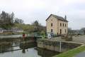
Mayenne towpath and counter-towpath route starting from Ménil

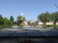
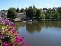
A lovely walk along the River Mayenne, ideal for enjoying the coolness of the river on sunny days! Please note that this is one of the only sections of the river where you can walk along both banks. You can also enjoy beautiful views of the Château de la Haute Roche and the Château de la Porte.

Details

216769
Creation:
Last update:
Last review:
  • Walking
    Activity: Walking
  • ↔
    Distance: 8.50 mi
  • ◔
    Average duration: 4h 00 
  • ▲
    Difficulty: Moderate

  • ⚐
    Back to start: Yes
  • ↗
    Ascent: + 121 ft
  • ↘
    Descent: - 121 ft

  • ▲
    Highest point: 200 ft
  • ▼
    Lowest point: 75 ft
  • ⚐ Country: France
  • ⚐ City: Ménil (53200)
  • ⚑
    Start/End: N 47.7749° / W 0.67322°
  • ❏
    IGN map(s): Ref. 1520SB
  • Hour-by-hour weather

Photos

Description of the walk

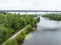
(S/E) From the Ménil campsite on Rue du Port, take the Mayenne towpath heading north. Follow it for about 6 km until you reach a viaduct spanning the Mayenne. Pass under the viaduct.

(1) Immediately after passing under the viaduct, turn left onto the tarmac road. Follow this road for 100 metres as it curves to the right, then take a path on the left which joins the cycle path running alongside the N162. Once you reach the cycle path, turn left and continue along it, crossing the river.

(2) After 350 metres, turn 180° to head back down towards the Mayenne towpath, 200 metres further on. When you reach the river, turn left onto the towpath and follow it for 4 km. You will then arrive about fifty metres upstream of the Bavouze Dam and Lock.

(3) Follow the path branching off to the left, which joins a small tarmac road. At the junction, turn right and continue.

(4) The road curves to the left towards the hamlet known as ‘Le Tertre’, whilst a grassy track heads straight on; follow this track.

(5) Pass the hamlet of Grande Valette and carry on straight ahead along this path until you reach a junction with a small tarmac road.

(6) At the junction, turn right and pass through the hamlets of La Lubinière and then La Petite Valette. You will then reach a junction (with a wayside cross on the left and a sign for “Bac de Ménil” opposite).

(7) Turn right and continue straight on, passing through the hamlet of Le Gué to reach the Ménil ferry.

(8) Ring the bell to signal your presence so you can cross the River Mayenne using the ferry (see the timetables and telephone number listed in the ‘Practical Information’ section).

You will then cross the Mayenne to reach the Ménil campsite / Rue du Port (S/E).

Waypoints

  1. S/E : mi 0 - alt. 79 ft - Ménil Campsite / Rue du Port
  2. 1 : mi 3.69 - alt. 89 ft - Viaduct over the Mayenne
  3. 2 : mi 4.02 - alt. 95 ft - A 180° turn to head back down towards the Mayenne
  4. 3 : mi 6.55 - alt. 89 ft - Bavouze Dam / Lock
  5. 4 : mi 7.02 - alt. 95 ft - Path opposite
  6. 5 : mi 7.36 - alt. 118 ft - Grande Vallette
  7. 6 : mi 7.62 - alt. 200 ft - Turn right at the junction
  8. 7 : mi 7.98 - alt. 141 ft - La Petite Valette (calvary/Ménil ferry sign)
  9. 8 : mi 8.44 - alt. 75 ft - Ferry landing stage
  10. S/E : mi 8.5 - alt. 79 ft - Ménil Campsite / Rue du Port

Notes

Parking spaces are available on Rue Saint-Martin or Rue du Vigneau (small car park) in the immediate vicinity of the starting point on Rue du Port.

Please note that this walk is only possible during the periods when the ferry and the Ménil campsite are open, from mid-April to mid-September:
- In April, May, June and September, reception is open from 09:00 to 12:00 and from 14:00 to 18:00.
- In July and August, Tuesday to Friday from 9.00 am to 12.30 pm and from 2.00 pm to 7.30 pm. Saturday to Monday from 9.00 am to 12.30 pm and from 1.30 pm to 7.30 pm (2016 opening hours are for guidance only; please check with the campsite).

For further information, call 02 43 70 24 54.

Please note that there is a charge for the ferry crossing (2016 price for information only: €1.50 per person).

Reviews and comments

4.8 / 5
Based on 3 reviews

Reliability of the description
4.7 / 5
Ease of following the route
5 / 5
Route interest
4.7 / 5
User 3770802

Overall rating : 5 / 5

Date of your route : Aug 02, 2026
Reliability of the description : ★★★★★ Very good
Ease of following the route : ★★★★★ Very good
Route interest : ★★★★★ Very good
Very busy route : Yes

A very pleasant walk, with no difficulty at all

Machine-translated

mvaban
mvaban

Overall rating : 5 / 5

Date of your route : Jun 26, 2023
Reliability of the description : ★★★★★ Very good
Ease of following the route : ★★★★★ Very good
Route interest : ★★★★★ Very good
Very busy route : No

Crossed the ford without any difficulty
An easy hike apart from the distance
A relaxed atmosphere

Machine-translated

PATNIC
PATNIC

Overall rating : 4.3 / 5

Date of your route : May 23, 2022
Reliability of the description : ★★★★☆ Good
Ease of following the route : ★★★★★ Very good
Route interest : ★★★★☆ Good
Very busy route : Yes

A lovely walking route following the River Mayenne, including a ferry crossing

Machine-translated

Other walks in the area

For more walks, use our search engine .

The GPS track and description are the property of this route's author. Please do not copy them without permission.