Country:
 City:
City:


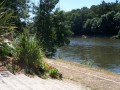
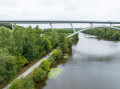
(S/E) From Azé Town Hall, head to the banks of the River Mayenne via Rue du Port (to the east of the town hall). At the river’s edge, follow the towpath alongside the river for about 500 metres. Pass under the viaduct and continue for about twenty metres. A path branches off to the right.
(1) Take this path; at the first T-junction, turn left, then right at the second junction. Continue along this path for about 400 m. You will then come out onto a small tarmac road. Turn left and walk just under 50 m. You’ll come to a gate; take the path on the right, lined with a wooden fence that crosses a stream, to reach the allotments. Continue straight on to reach the banks of the Mayenne.
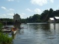
(2) Turn right to walk alongside the river, pass under the Pont de l’Europe and emerge at Parc Saint-Fiacre (motorhome parking area). Carry on along the River Mayenne to reach Quai du Docteur Lefèvre (next to the hospital). Continue straight on to the old bridge, cross it and carry on straight towards Quai de Coubertin (swimming pool car park and marina). Carry on straight to the far end of the car park (harbour master’s office)
(3) Turn slightly to the left, leaving the harbour master’s office on your right, and take the towpath that runs alongside the river. Continue for just over 900 metres, then, after the football pitches and just before the campsite, turn right. Walk up between the football pitches and the campsite for just over 250 m until you reach the Route de Laval. Cross at the pedestrian crossing, then turn left and carry on to the roundabout. There, take Avenue René Cassin (towards Angers / Nantes) on the right and carry on straight ahead until you reach a second roundabout.
(4) Turn left and carry on straight ahead for about 400 metres. You will then reach a junction; go straight on (signposted ‘VC108 des Sauveloup’ on the left) and continue for about 800 metres. You will then arrive at a place called Petit Sauveloup. From there, carry on along the road, which takes a 90° bend to the left and crosses a railway line. Once you have crossed the railway line, turn right and continue along the road for about 500 metres. Then follow the road as it bends 90° to the right and crosses the railway line again. Once you have crossed the railway line, continue along this road, heading south and ignoring a road on the right, for approximately 1.2 km. You will then come out onto a main road (D28, Route de Sablé-sur-Sarthe)
(5) Turn left, continue for about 100 m, then cross the D28 (caution: this is a very busy road with cars travelling at high speed) and take a small grassy track just before the house on the right-hand side of the road. Follow the track for about 600 m. You will come out onto a small tarmac road (with a ‘no through road’ sign opposite).
(6) Turn right and follow the tarmac road for about 800 metres. You will then reach a small crossroads; turn right. After about a hundred metres, take the small stony track (signs prohibiting motor vehicles on the right) which continues along the road. Follow this track for about 450 m and, at the second junction with another track, turn left onto the Chemin du Midi. This crosses the housing estates for about 600 m before joining a tarmac road (Route de Châtelain).
(7) Turn right, then left at the first junction, then right again after 30 metres at the next junction to join Rue de la Grande Fontaine. Continue along this street until you reach the junction with Rue de la Claverie, veer slightly to the right and take the path opposite that runs alongside the trees. Follow this path for about 80 m until you come out onto Rue de Saint-Aventin. Turn right and carry on straight ahead until you reach the roundabout. After the roundabout, continue for just over 50 m and cross over the ring road. There, a greenway branches off to the left (at the pedestrian crossing over a speed bump)
(8) Turn left onto the cycle path and carry on straight ahead. After passing under the road through a small tunnel, you’ll come to a three-way junction on the left. At this three-way junction, take the right-hand lane and head down to the River Mayenne. Once you reach the banks of the River Mayenne, turn left and follow the river for just over 500 metres to return to the starting point of the walk (E).

 Visorando Member
 Easy
Easy 
 Tourist office