Country:
 City:


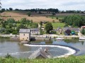
The start point is at the car park on Place de l’Église in Fromentières.
(S/E) From the church square, head west along Rue du Pont Manceau (D591), continue straight on, leave the village and, after the sign marking the end of the built-up area of Fromentières, proceed to the next junction (white signpost indicating “Montaumer” and “Le Rocher”).
(1) Turn left onto this track. After about 600 metres, the road takes a 90° bend to the left and a gravel track branches off to the right.
(2) Take the gravel track branching off to the right and continue until you reach a T-junction with a small road. Turn right, pass through Bourgneuf and reach a three-way junction with the RN162 on your left.
(3) Turn right, carry on straight ahead until the first junction and turn left onto the D591. Join the N162 and cross it (Caution: this is a very busy road and vehicles travel at high speed).
(4) Take the first right immediately after crossing the road (signs for “Saint-Germain de l’Hommel” and “Neuville”). Carry on straight ahead, then turn left at the third junction towards the hamlet of La Petite Touche. The road curves to the right and leads onto a tree-lined track.
(5) Turn onto this path, go round a 90° bend to the left, then turn right onto the third small track which leads back down towards the river (not shown on the map). After this tree-lined track, you’ll come out onto a small tarmac road. Continue to the right and follow this road uphill. Pass through the village of Saint-Germain-de-l’Hommel to reach the junction with the N162.
(6) Cross this road (Caution: very busy road and vehicles travel at high speed) and take the road opposite, slightly to the left (D605, towards Ruillé-Froid-Fonds). At the hamlet known as La Picarderie (white sign), the road curves to the left and a gravel track, lined with trees on the left-hand side, branches off to the right.
(7) Turn right onto the gravel track, pass the hamlet of Les Noës and join a small tarmac road. Follow it to the left and, at the next junction, turn right. The road passes a house and a grassy track branches off to the left; take this track. You’ll reach a small tarmac road at the hamlet known as Le Pâtis; join this road and continue to the next junction.
(8) Turn left, reach a three-way junction by a large oak tree and continue to the right. At the D591, turn left onto the route you took at the start to reach the village and the church at Fromentières (S/E).

 Tourist office


 Visorando Member
 Easy